TopoQuest Logo
Do you find TopoQuest useful?
Help keep TopoQuest running and adding new maps/features by donating!
Bitcoin:  19c7KJd3qBynnjoSw5npx9KScwjBe4ifkT
Litecoin:  LXs6TkuXGGXo1vDsWCkWVdjQX94eUKd6ui
Home View Maps Find Maps Find Places Resources & Links


Merrifield, Minnesota Topographic Map

USGS Map Title: Merrifield, MN
USGS Map MRC: 46094D2
DRG (GeoTIFF) Download: o46094d2.tif


Neighboring USGS Topographic Map Quads:


  Nisswa, MN  
46094E3
 

  Pelican Lake, MN  
46094E2
 

  Trommald, MN  
46094E1
 

  Gull Lake, MN  
46094D3
 

  Merrifield, MN  
46094D2
 

  Riverton, MN  
46094D1
 

  Baxter, MN  
46094C3
 

  Brainerd, MN  
46094C2
 

  South Long Lake, MN  
46094C1


Map MRC Location:

N47°
W95°
N47°
W94°
H8 H7 H6 H5 H4 H3 H2 H1
G8 G7 G6 G5 G4 G3 G2 G1
F8 F7 F6 F5 F4 F3 F2 F1
E8 E7 E6 E5 E4 E3 E2 E1
D8 D7 D6 D5 D4 D3 D2 D1
C8 C7 C6 C5 C4 C3 C2 C1
B8 B7 B6 B5 B4 B3 B2 B1
A8 A7 A6 A5 A4 A3 A2 A1
N46°
W95°
N46°
W94°

Merrifield, MN USGS 1:24K Topographic Map Preview:
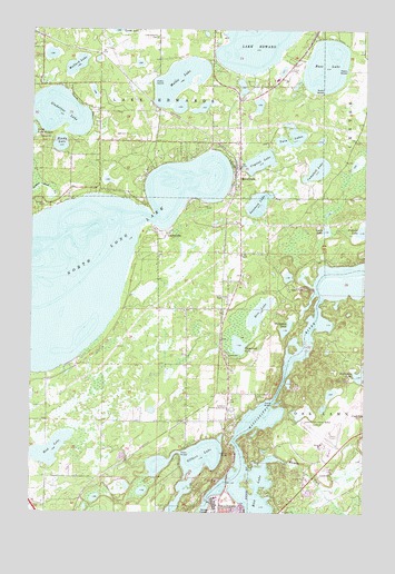
Merrifield, MN USGS Topographic Map
Click on map above to begin viewing in our Map Viewer.

This topographic map contains these locations and features:
Feature Name Type Latitude Longitude GNIS ID View Map
Bass LakeLakeN46.4907°W94.1404°639686View Map
Brainerd DamDamN46.3783°W94.1853°1776830View Map
Brainerd Lakes Regional AirportAirportN46.3932°W94.1406°660084View Map
Campbell LakeLakeN46.4640°W94.1433°640852View Map
Community Church of the NazareneChurchN46.4828°W94.1664°2071468View Map
Crystal LakeLakeN46.4658°W94.1651°642533View Map
Evergreen Memorial GardensCemeteryN46.4019°W94.1750°643471View Map
Gilbert LakeLakeN46.3871°W94.1902°644128View Map
Gladstone LakeLakeN46.4783°W94.2401°644164View Map
Green LakeLakeN46.4479°W94.1397°644413View Map
Hart's RV ParkLocaleN46.4986°W94.1439°2071464View Map
Horseshoe LakeLakeN46.4228°W94.1543°645228View Map
Lake Edward CemeteryCemeteryN46.4980°W94.2039°646342View Map
Lazy Acre's Trailer CourtPopulated PlaceN46.3867°W94.1389°2071618View Map
LegionvillePopulated PlaceN46.4472°W94.1994°646585View Map
Mallard LakeLakeN46.4907°W94.2339°647405View Map
Memorial ParkParkN46.3792°W94.1764°2071651View Map
MerrifieldLocaleN46.4639°W94.1736°2071469View Map
MerrifieldPopulated PlaceN46.4650°W94.1728°647778View Map
Merrifield Census Designated PlaceCensusN46.4674°W94.1746°2628687View Map
Merrifield Post OfficePost OfficeN46.4631°W94.1717°2071465View Map
Mollie LakeLakeN46.4870°W94.1954°648018View Map
Moody LakeLakeN46.4703°W94.2397°648052View Map
Mud LakeLakeN46.3912°W94.2425°648361View Map
North Long LakeLakeN46.4384°W94.2414°648668View Map
North Memorial Air CareBuildingN46.3925°W94.1385°2721344View Map
Pickerel LakeLakeN46.4480°W94.1258°649377View Map
Rice LakeLakeN46.4271°W94.1643°650004View Map
Rice LakeLakeN46.3799°W94.1652°650037View Map
Rice LakeReservoirN46.3810°W94.1799°1776831View Map
Sorensen LakeLakeN46.4549°W94.1654°652259View Map
Stewart C Mills Senior FieldParkN46.3778°W94.1728°2071626View Map
Sullivan's Resort and CampgroundLocaleN46.4722°W94.2256°2071612View Map
Supreme Mobile CourtPopulated PlaceN46.4306°W94.1778°2071619View Map
Tamarack LakeLakeN46.4184°W94.1722°653008View Map
Twin LakesLakeN46.4704°W94.1533°653445View Map
Unorganized Territory of First AssessmentCivilN46.4182°W94.2427°2070596View Map
Unorganized Territory of West Crow Wing (historical)CensusN46.4122°W94.2361°665960View Map
Whiteley CreekStreamN46.3889°W94.1558°654106View Map

Note: Coordinates in the location and feature list above are referenced to NAD83 datum.


Copyright (C) 2008-2025 Ryan Niemi / Sunset Dynamics ... All Rights Reserved