TopoQuest Logo
Do you find TopoQuest useful?
Help keep TopoQuest running and adding new maps/features by donating!
Bitcoin:  19c7KJd3qBynnjoSw5npx9KScwjBe4ifkT
Litecoin:  LXs6TkuXGGXo1vDsWCkWVdjQX94eUKd6ui
Home View Maps Find Maps Find Places Resources & Links


Pelican Lake, Minnesota Topographic Map

USGS Map Title: Pelican Lake, MN
USGS Map MRC: 46094E2
DRG (GeoTIFF) Download: o46094e2.tif


Neighboring USGS Topographic Map Quads:


  Jenkins, MN  
46094F3
 

  Lower Whitefish Lake, MN  
46094F2
 

  Cross Lake, MN  
46094F1
 

  Nisswa, MN  
46094E3
 

  Pelican Lake, MN  
46094E2
 

  Trommald, MN  
46094E1
 

  Gull Lake, MN  
46094D3
 

  Merrifield, MN  
46094D2
 

  Riverton, MN  
46094D1


Map MRC Location:

N47°
W95°
N47°
W94°
H8 H7 H6 H5 H4 H3 H2 H1
G8 G7 G6 G5 G4 G3 G2 G1
F8 F7 F6 F5 F4 F3 F2 F1
E8 E7 E6 E5 E4 E3 E2 E1
D8 D7 D6 D5 D4 D3 D2 D1
C8 C7 C6 C5 C4 C3 C2 C1
B8 B7 B6 B5 B4 B3 B2 B1
A8 A7 A6 A5 A4 A3 A2 A1
N46°
W95°
N46°
W94°

Pelican Lake, MN USGS 1:24K Topographic Map Preview:
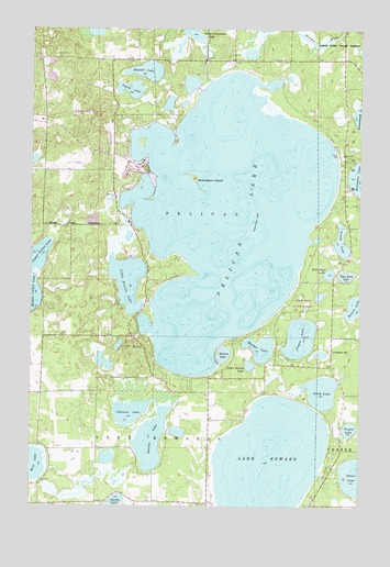
Pelican Lake, MN USGS Topographic Map
Click on map above to begin viewing in our Map Viewer.

This topographic map contains these locations and features:
Feature Name Type Latitude Longitude GNIS ID View Map
Bonnie LakeLakeN46.5525°W94.1270°640366View Map
Breezy PointPopulated PlaceN46.6166°W94.2169°649244View Map
Breezy Point AirportAirportN46.5978°W94.2202°660347View Map
Breezy Point Police DepartmentBuildingN46.5960°W94.2187°2758516View Map
Breezy Point Post Office (historical)Post OfficeN46.6167°W94.2167°2071705View Map
City of Breezy PointCivilN46.6054°W94.2146°2393410View Map
Deacon's Lodge Golf ClubLocaleN46.6056°W94.2139°2071709View Map
East Twin LakeLakeN46.5605°W94.1303°643114View Map
Garden LakeLakeN46.5171°W94.2042°644028View Map
Gooseberry IslandIslandN46.5861°W94.1883°644270View Map
Guida LakeLakeN46.5011°W94.2175°644523View Map
Johnson LakeLakeN46.5246°W94.2124°645699View Map
Lake EdwardLakeN46.5097°W94.1603°643188View Map
Little Markee LakeLakeN46.5369°W94.1669°646851View Map
Little Pelican LakeLakeN46.5589°W94.2134°646879View Map
Lougee LakeLakeN46.5442°W94.1479°647218View Map
Lynch LakeLakeN46.6091°W94.2125°647326View Map
Markee LakeLakeN46.5413°W94.1628°647542View Map
Mission Township Fire DepartmentBuildingN46.5803°W94.1304°2666233View Map
Ossipee Post Office (historical)Post OfficeN46.5403°W94.1347°2071664View Map
Ossipee SchoolSchoolN46.5408°W94.1350°649025View Map
Pelican LakeLakeN46.5762°W94.1760°649236View Map
Pelican LakeReservoirN46.6166°W94.1836°1775955View Map
Pelican Lake DamDamN46.6166°W94.1836°1775954View Map
Perch LakeLakeN46.5300°W94.1393°649287View Map
Rice LakeLakeN46.5110°W94.2489°650026View Map
Shaffer LakeLakeN46.6138°W94.2070°651895View Map
Shing Wako Resort and CampgroundLocaleN46.5167°W94.1347°2071471View Map
Silver LakeLakeN46.5081°W94.1268°652061View Map
Stevens LakeLakeN46.5398°W94.1771°652631View Map
Taylor LakeLakeN46.5203°W94.1290°653049View Map
Township of Lake EdwardCivilN46.5004°W94.2036°664668View Map
Township of PelicanCivilN46.5730°W94.1935°665270View Map
Traditional Eighteen Hole Golf CourseLocaleN46.5903°W94.2167°2071710View Map
West Twin LakeLakeN46.5610°W94.1369°654018View Map
Whitebirch Golf CourseLocaleN46.5889°W94.2333°2071711View Map
Young LakeLakeN46.5694°W94.1322°654425View Map

Note: Coordinates in the location and feature list above are referenced to NAD83 datum.


Copyright (C) 2008-2025 Ryan Niemi / Sunset Dynamics ... All Rights Reserved