TopoQuest Logo
Do you find TopoQuest useful?
Help keep TopoQuest running and adding new maps/features by donating!
Bitcoin:  19c7KJd3qBynnjoSw5npx9KScwjBe4ifkT
Litecoin:  LXs6TkuXGGXo1vDsWCkWVdjQX94eUKd6ui
Home View Maps Find Maps Find Places Resources & Links


Merrillville, Georgia Topographic Map

USGS Map Title: Merrillville, GA
USGS Map MRC: 30083H8
DRG (GeoTIFF) Download: o30083h8.tif


Neighboring USGS Topographic Map Quads:


  Meigs, GA  
31084A1
 

  Chastain, GA  
31083A8
 

  Coolidge, GA  
31083A7
 

  Ochlocknee, GA  
30084H1
 

  Merrillville, GA  
30083H8
 

  Patten, GA  
30083H7
 

  Pine Park, GA  
30084G1
 

  Thomasville, GA  
30083G8
 

  Boston, GA  
30083G7


Map MRC Location:

N31°
W84°
N31°
W83°
H8 H7 H6 H5 H4 H3 H2 H1
G8 G7 G6 G5 G4 G3 G2 G1
F8 F7 F6 F5 F4 F3 F2 F1
E8 E7 E6 E5 E4 E3 E2 E1
D8 D7 D6 D5 D4 D3 D2 D1
C8 C7 C6 C5 C4 C3 C2 C1
B8 B7 B6 B5 B4 B3 B2 B1
A8 A7 A6 A5 A4 A3 A2 A1
N30°
W84°
N30°
W83°

Merrillville, GA USGS 1:24K Topographic Map Preview:
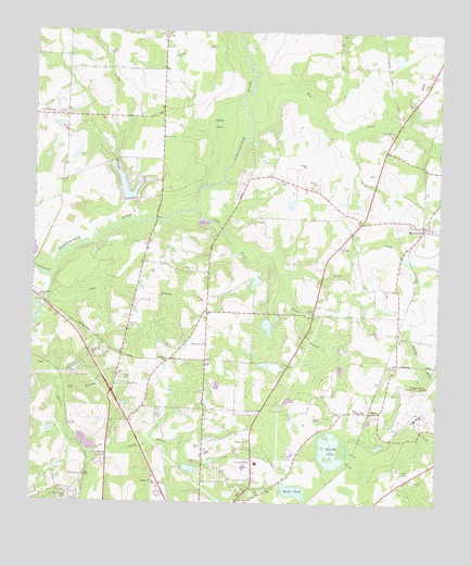
Merrillville, GA USGS Topographic Map
Click on map above to begin viewing in our Map Viewer.

This topographic map contains these locations and features:
Feature Name Type Latitude Longitude GNIS ID View Map
Bay BranchStreamN30.9288°W83.9963°310874View Map
Beulah Hill ChurchChurchN30.8821°W83.9835°354702View Map
Big BranchStreamN30.9044°W83.9913°311303View Map
Big CreekStreamN30.9719°W83.9343°311362View Map
Big Creek CemeteryCemeteryN30.9732°W83.8907°343687View Map
Big Creek ChurchChurchN30.9732°W83.8896°354716View Map
Church of GodChurchN30.8802°W83.9271°343701View Map
Confederate BridgeBridgeN30.9282°W83.9971°312891View Map
Coolidge DivisionCivilN30.9818°W83.8784°1936199View Map
Coon CreekStreamN30.9521°W83.9493°312939View Map
DillonPopulated PlaceN30.8996°W83.8924°331554View Map
Dillon CemeteryCemeteryN30.8996°W83.8982°343709View Map
Dillon ChurchChurchN30.8996°W83.8988°355501View Map
Dillon Volunteer Fire Department Station 7BuildingN30.8991°W83.8921°2604741View Map
Forrest Acres ChurchChurchN30.8780°W83.9918°343725View Map
FredoniaPopulated PlaceN30.9127°W83.9466°343729View Map
Fredonia CemeteryCemeteryN30.9135°W83.9585°343730View Map
Fredonia ChurchChurchN30.9132°W83.9579°355912View Map
Good Water CreekStreamN30.8902°W83.9843°356048View Map
Griffin LakeReservoirN30.9340°W83.9312°342094View Map
Griffin Lake DamDamN30.9352°W83.9299°342093View Map
Gully BranchStreamN30.9507°W83.9691°314949View Map
Halls PondLakeN30.8785°W83.9185°315047View Map
Heards LakeLakeN30.8895°W83.9070°315284View Map
Lake Riverside Volunteer Fire Department Station 10BuildingN30.9720°W83.9609°2604142View Map
Little Ochlocknee CemeteryCemeteryN30.9771°W83.9952°343751View Map
Little Ochlockonee ChurchChurchN30.9771°W83.9946°317130View Map
Little Ochlockonee RiverStreamN30.9352°W83.9943°317132View Map
MerrillvillePopulated PlaceN30.9491°W83.8799°332374View Map
Merrillville Baptist ChurchChurchN30.9491°W83.8779°343761View Map
Merrillville Poultry FarmsLocaleN30.9575°W83.8808°2635592View Map
Midway ChurchChurchN30.9721°W83.9599°318105View Map
New Shiloh ChurchChurchN30.8860°W83.9324°319545View Map
Oak Hill School (historical)SchoolN30.8805°W83.9466°343783View Map
Oquina CreekStreamN30.9105°W83.9999°320087View Map
PascoPopulated PlaceN30.9116°W83.9957°332616View Map
Peacock CemeteryCemeteryN30.8816°W83.8807°343789View Map
Robin BaySwampN30.9759°W83.9435°321679View Map
Saint George ChurchChurchN30.9430°W83.9054°322065View Map
Saint Georges CemeteryCemeteryN30.9432°W83.9052°343809View Map
Saint Marys CemeteryCemeteryN30.8802°W83.9616°343814View Map
Saint Marys ChurchChurchN30.8802°W83.9618°322190View Map
Saint Paul CemeteryCemeteryN30.9252°W83.9143°343815View Map
Saint Pauls ChurchChurchN30.9252°W83.9132°322244View Map
Scale BranchStreamN30.9357°W83.9229°322617View Map
Searcy LakeReservoirN30.9220°W83.9275°342092View Map
Searcy Lake DamDamN30.9235°W83.9266°342091View Map
Spring Hill ChurchChurchN30.9174°W83.9463°323410View Map
Spring Hill School (historical)SchoolN30.9182°W83.9466°334735View Map
Springhill CemeteryCemeteryN30.9177°W83.9466°343828View Map
Thomas County Fire Department Station 11 CoolidgeBuildingN30.9684°W83.8887°2604131View Map
Thomas County Fire Department Station 16 NorthsideBuildingN30.9046°W83.9747°2604132View Map
Thomasville Army Air Field (historical)MilitaryN30.9014°W83.8819°1987108View Map
Thomasville Regional AirportAirportN30.8988°W83.8797°351931View Map
Touraine (historical)Populated PlaceN30.9274°W83.8843°343849View Map
Wilson Cemetery Number 1CemeteryN30.9602°W83.9124°344383View Map
Wilson Cemetery Number 2CemeteryN30.8916°W83.9327°344384View Map
WJEP-AM (Ochlocknee)TowerN30.9002°W83.9985°352519View Map

Note: Coordinates in the location and feature list above are referenced to NAD83 datum.


Copyright (C) 2008-2025 Ryan Niemi / Sunset Dynamics ... All Rights Reserved