TopoQuest Logo
Do you find TopoQuest useful?
Help keep TopoQuest running and adding new maps/features by donating!
Bitcoin:  19c7KJd3qBynnjoSw5npx9KScwjBe4ifkT
Litecoin:  LXs6TkuXGGXo1vDsWCkWVdjQX94eUKd6ui
Home View Maps Find Maps Find Places Resources & Links


Pine Park, Georgia Topographic Map

USGS Map Title: Pine Park, GA
USGS Map MRC: 30084G1
DRG (GeoTIFF) Download: o30084g1.tif


Neighboring USGS Topographic Map Quads:


  Cairo North, GA  
30084H2
 

  Ochlocknee, GA  
30084H1
 

  Merrillville, GA  
30083H8
 

  Cairo South, GA  
30084G2
 

  Pine Park, GA  
30084G1
 

  Thomasville, GA  
30083G8
 

  Beachton, GA  
30084F2
 

  Miccosukee NE, GA  
30084F1
 

  Metcalf, GA  
30083F8


Map MRC Location:

N31°
W85°
N31°
W84°
H8 H7 H6 H5 H4 H3 H2 H1
G8 G7 G6 G5 G4 G3 G2 G1
F8 F7 F6 F5 F4 F3 F2 F1
E8 E7 E6 E5 E4 E3 E2 E1
D8 D7 D6 D5 D4 D3 D2 D1
C8 C7 C6 C5 C4 C3 C2 C1
B8 B7 B6 B5 B4 B3 B2 B1
A8 A7 A6 A5 A4 A3 A2 A1
N30°
W85°
N30°
W84°

Pine Park, GA USGS 1:24K Topographic Map Preview:
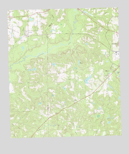
Pine Park, GA USGS Topographic Map
Click on map above to begin viewing in our Map Viewer.

This topographic map contains these locations and features:
Feature Name Type Latitude Longitude GNIS ID View Map
Ballards Mill (historical)LocaleN30.8738°W84.0799°342441View Map
Barnetts CreekStreamN30.8330°W84.0805°354466View Map
Box Hall PlantationLocaleN30.8288°W84.0143°343693View Map
Bricknell LakeReservoirN30.8054°W84.0364°338374View Map
Bricknell Lake DamDamN30.8035°W84.0399°338373View Map
Brookwood SchoolSchoolN30.8135°W84.0154°311837View Map
Cheek LakeReservoirN30.8404°W84.0366°342243View Map
Cheek Lake DamDamN30.8402°W84.0382°342242View Map
Community ChurchChurchN30.8666°W84.1227°334680View Map
Grace ChurchChurchN30.8082°W84.0143°343736View Map
Grady County Volunteer Fire Department Pine Park StationBuildingN30.8627°W84.1023°2604190View Map
Greenwood LakeReservoirN30.8713°W84.0367°342245View Map
Greenwood Lake DamDamN30.8719°W84.0382°342244View Map
Greenwood School (historical)SchoolN30.8644°W84.0088°334731View Map
Inwood LakeReservoirN30.8082°W84.0011°315932View Map
Ireland ChurchChurchN30.7732°W84.0735°315933View Map
Jones CemeteryCemeteryN30.8552°W84.0266°316208View Map
Lake ConstanceReservoirN30.8226°W84.0457°312908View Map
Lake Constance DamDamN30.8241°W84.0454°342240View Map
Lees CreekStreamN30.8235°W84.1124°316748View Map
Melrose PlantationLocaleN30.7891°W84.0346°351616View Map
Melrose Plantation LakeReservoirN30.7975°W84.0628°342237View Map
Melrose Plantation Lake DamDamN30.7985°W84.0632°342236View Map
Mount Olive (historical)Populated PlaceN30.8155°W84.0521°343775View Map
Mount Olive ChurchChurchN30.8130°W84.0491°318723View Map
Ochlocknee ChurchChurchN30.7571°W84.0927°319888View Map
Oliver LakeReservoirN30.8170°W84.0960°340851View Map
Oliver Lake DamDamN30.8169°W84.0966°340850View Map
Pebble HillPopulated PlaceN30.8085°W84.0174°343790View Map
Pebble Hill CemeteryCemeteryN30.7810°W84.0635°343791View Map
Pebble Hill PlantationLocaleN30.7807°W84.0646°343792View Map
Pebble Hill School (historical)SchoolN30.7813°W84.0621°334734View Map
Pebble Hill Workers CemeteryCemeteryN30.7810°W84.0613°343793View Map
Pebble Way Shopping CenterLocaleN30.8177°W84.0007°343794View Map
Pierce Chapel CemeteryCemeteryN30.8741°W84.1232°320496View Map
Pine ParkPopulated PlaceN30.8513°W84.1018°320642View Map
Pine Park Baptist ChurchChurchN30.8541°W84.1035°342519View Map
Pine Park CemeteryCemeteryN30.8538°W84.1038°342520View Map
Plantation Oak Industrial ParkLocaleN30.8621°W84.0027°343796View Map
Rose City Industrial ParkLocaleN30.8294°W84.0018°343805View Map
Scott LakeReservoirN30.8550°W84.0741°338372View Map
Scott Lake DamDamN30.8535°W84.0766°338371View Map
Sinkola CemeteryCemeteryN30.7616°W84.0716°323036View Map
Tall Pines Industrial ParkLocaleN30.8224°W84.0041°343833View Map
Thomasville SchoolSchoolN30.8088°W84.0127°324096View Map
Ward LakeReservoirN30.8656°W84.0984°338521View Map
Ward Lake DamDamN30.8652°W84.0999°338520View Map
Wards CreekStreamN30.8066°W84.0002°324840View Map
Watts BranchStreamN30.8707°W84.0435°324923View Map
Winstead Plantation Airport (historical)AirportN30.8216°W84.0666°343858View Map
Winstead Plantation LakeReservoirN30.8209°W84.0736°342239View Map
Winstead Plantation Lake DamDamN30.8219°W84.0749°342238View Map
WSTT-AM (Thomasville)TowerN30.8141°W84.0132°352567View Map
WSTT-FM (Thomasville)TowerN30.8141°W84.0132°352794View Map

Note: Coordinates in the location and feature list above are referenced to NAD83 datum.


Copyright (C) 2008-2025 Ryan Niemi / Sunset Dynamics ... All Rights Reserved