TopoQuest Logo
Do you find TopoQuest useful?
Help keep TopoQuest running and adding new maps/features by donating!
Bitcoin:  19c7KJd3qBynnjoSw5npx9KScwjBe4ifkT
Litecoin:  LXs6TkuXGGXo1vDsWCkWVdjQX94eUKd6ui
Home View Maps Find Maps Find Places Resources & Links


Beatty, Oregon Topographic Map

USGS Map Title: Beatty, OR
USGS Map MRC: 42121D3
DRG (GeoTIFF) Download: o42121d3.tif


Neighboring USGS Topographic Map Quads:


  Cooks Mountain, OR  
42121E4
 

  Spodue Mountain, OR  
42121E3
 

  Ponina Butte, OR  
42121E2
 

  Sprague River East, OR  
42121D4
 

  Beatty, OR  
42121D3
 

  Ferguson Mountain, OR  
42121D2
 

  Yonna, OR  
42121C4
 

  Yainax Butte, OR  
42121C3
 

  Dry Prairie, OR  
42121C2


Map MRC Location:

N43°
W122°
N43°
W121°
H8 H7 H6 H5 H4 H3 H2 H1
G8 G7 G6 G5 G4 G3 G2 G1
F8 F7 F6 F5 F4 F3 F2 F1
E8 E7 E6 E5 E4 E3 E2 E1
D8 D7 D6 D5 D4 D3 D2 D1
C8 C7 C6 C5 C4 C3 C2 C1
B8 B7 B6 B5 B4 B3 B2 B1
A8 A7 A6 A5 A4 A3 A2 A1
N42°
W122°
N42°
W121°

Beatty, OR USGS 1:24K Topographic Map Preview:
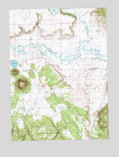
Beatty, OR USGS Topographic Map
Click on map above to begin viewing in our Map Viewer.

This topographic map contains these locations and features:
Feature Name Type Latitude Longitude GNIS ID View Map
BeattyPopulated PlaceN42.4418°W121.2708°1137794View Map
Beatty Census Designated PlaceCensusN42.4419°W121.2716°2745366View Map
Beatty Post OfficePost OfficeN42.4425°W121.2707°1164896View Map
Beatty StationLocaleN42.4507°W121.2589°1137795View Map
Brown CreekStreamN42.4479°W121.2683°1138668View Map
Bug ButteSummitN42.4288°W121.3600°1138885View Map
Chief Schonchin CemeteryCemeteryN42.4229°W121.3522°1139639View Map
Crater Lake CampLocaleN42.3979°W121.3583°1140397View Map
East Branch Whisky CreekStreamN42.4004°W121.3195°1155313View Map
Flying T Ranch AirportAirportN42.4344°W121.3501°1154056View Map
Gunsight WellWellN42.3904°W121.2631°1155837View Map
K Davis HillSummitN42.4376°W121.3194°1144473View Map
Klamath ReservationCivilN42.4274°W121.3357°2418990View Map
Lola K West SpringSpringN42.4235°W121.3400°1155314View Map
Modoc Billy CreekStreamN42.3971°W121.3608°1155316View Map
Paiute CemeteryCemeteryN42.4874°W121.2654°1147360View Map
Smokey LakeReservoirN42.4480°W121.3708°1155317View Map
Snake CreekStreamN42.4865°W121.2783°1149787View Map
Spring ButteSummitN42.4401°W121.3683°1150150View Map
Spring CreekStreamN42.4371°W121.2597°1150161View Map
Sycan (historical)LocaleN42.4496°W121.2547°1699674View Map
Sycan RiverStreamN42.4610°W121.2869°1150799View Map
Whisky CreekStreamN42.4590°W121.3611°1158552View Map
Williams DrainCanalN42.4179°W121.3567°1155315View Map

Note: Coordinates in the location and feature list above are referenced to NAD83 datum.


Copyright (C) 2008-2025 Ryan Niemi / Sunset Dynamics ... All Rights Reserved