TopoQuest Logo
Do you find TopoQuest useful?
Help keep TopoQuest running and adding new maps/features by donating!
Bitcoin:  19c7KJd3qBynnjoSw5npx9KScwjBe4ifkT
Litecoin:  LXs6TkuXGGXo1vDsWCkWVdjQX94eUKd6ui
Home View Maps Find Maps Find Places Resources & Links


Dry Prairie, Oregon Topographic Map

USGS Map Title: Dry Prairie, OR
USGS Map MRC: 42121C2
DRG (GeoTIFF) Download: o42121c2.tif


Neighboring USGS Topographic Map Quads:


  Beatty, OR  
42121D3
 

  Ferguson Mountain, OR  
42121D2
 

  Bly, OR  
42121D1
 

  Yainax Butte, OR  
42121C3
 

  Dry Prairie, OR  
42121C2
 

  Horsefly Mountain, OR  
42121C1
 

  Lorella, OR  
42121B3
 

  Goodlow Mountain, OR  
42121B2
 

  Gerber Reservoir, OR  
42121B1


Map MRC Location:

N43°
W122°
N43°
W121°
H8 H7 H6 H5 H4 H3 H2 H1
G8 G7 G6 G5 G4 G3 G2 G1
F8 F7 F6 F5 F4 F3 F2 F1
E8 E7 E6 E5 E4 E3 E2 E1
D8 D7 D6 D5 D4 D3 D2 D1
C8 C7 C6 C5 C4 C3 C2 C1
B8 B7 B6 B5 B4 B3 B2 B1
A8 A7 A6 A5 A4 A3 A2 A1
N42°
W122°
N42°
W121°

Dry Prairie, OR USGS 1:24K Topographic Map Preview:
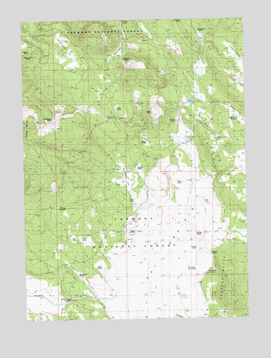
Dry Prairie, OR USGS Topographic Map
Click on map above to begin viewing in our Map Viewer.

This topographic map contains these locations and features:
Feature Name Type Latitude Longitude GNIS ID View Map
Buckmaster FlatSwampN42.3088°W121.1939°1118246View Map
Buckmaster SpringSpringN42.2679°W121.2207°1118247View Map
Chipmunk SpringSpringN42.3749°W121.1611°1118923View Map
Coyote ButteSummitN42.2843°W121.1528°1136183View Map
Dead SpringSpringN42.2689°W121.1496°1133411View Map
Deadman WellWellN42.2796°W121.2281°1119767View Map
Dry GulchValleyN42.3354°W121.1536°1120157View Map
Dry Gulch PondLakeN42.3257°W121.1413°1133417View Map
Dry PrairieFlatN42.2582°W121.1830°1120181View Map
Dry Prairie Number One PondLakeN42.2715°W121.1595°1133413View Map
Dry Prairie ReservoirSwampN42.2537°W121.1830°1133510View Map
Forty PondLakeN42.2996°W121.1893°1133419View Map
Gerber RimCliffN42.3054°W121.1364°1121106View Map
Goop SpringSpringN42.3244°W121.1833°1121239View Map
Gully PondLakeN42.2836°W121.2248°1133410View Map
Horn PondLakeN42.2982°W121.1505°1133415View Map
Horse Canyon SpringSpringN42.2578°W121.2256°1133408View Map
Hungry HollowValleyN42.2596°W121.2092°1122134View Map
James ButteSummitN42.3354°W121.1747°1122374View Map
James SpringSpringN42.3326°W121.1652°1122378View Map
Manhattan SpringSpringN42.3705°W121.1514°1123724View Map
Miner PondLakeN42.3067°W121.1621°1133416View Map
Mineral PrairieFlatN42.3624°W121.1955°1116532View Map
Mineral SpringSpringN42.3585°W121.1935°1124233View Map
Murray FieldFlatN42.3274°W121.1780°1124556View Map
Near PondReservoirN42.2834°W121.2191°1161690View Map
Nuthatch SpringsSpringN42.3619°W121.2469°1116500View Map
O'Connor ReservoirReservoirN42.2970°W121.2319°1124880View Map
Paddock ButteSummitN42.2607°W121.1361°1125121View Map
Painter SpringSpringN42.2766°W121.1462°1125131View Map
Prairie PondLakeN42.2793°W121.1547°1133414View Map
Royston Post Office (historical)Post OfficeN42.3124°W121.1886°1165892View Map
Royston SpringSpringN42.3123°W121.1869°1126350View Map
Seven SpringsSpringN42.2854°W121.1895°1126759View Map
Summit PrairieFlatN42.3565°W121.1289°1127718View Map
Thimbleberry SpringSpringN42.3338°W121.2341°1128008View Map
Tumble SpringSpringN42.3379°W121.1987°1128293View Map
Vinson PondLakeN42.2716°W121.2111°1133409View Map
Vinson RanchLocaleN42.2671°W121.2206°1128547View Map
Wild SpringSpringN42.2696°W121.1486°1133412View Map
Willow FlatFlatN42.3335°W121.1289°1129150View Map
Willow Flat ReservoirReservoirN42.3340°W121.1302°1133418View Map
Wilson RanchLocaleN42.3082°W121.1455°1167162View Map
Yellow Jacket FlatFlatN42.3618°W121.2258°1129368View Map
Yellow Jacket SpringSpringN42.3604°W121.2456°1129370View Map

Note: Coordinates in the location and feature list above are referenced to NAD83 datum.


Copyright (C) 2008-2024 Ryan Niemi / Sunset Dynamics ... All Rights Reserved