TopoQuest Logo
Do you find TopoQuest useful?
Help keep TopoQuest running and adding new maps/features by donating!
Bitcoin:  19c7KJd3qBynnjoSw5npx9KScwjBe4ifkT
Litecoin:  LXs6TkuXGGXo1vDsWCkWVdjQX94eUKd6ui
Home View Maps Find Maps Find Places Resources & Links


Sprague River East, Oregon Topographic Map

USGS Map Title: Sprague River East, OR
USGS Map MRC: 42121D4
DRG (GeoTIFF) Download: o42121d4.tif


Neighboring USGS Topographic Map Quads:


  Buttes of the Gods, OR  
42121E5
 

  Cooks Mountain, OR  
42121E4
 

  Spodue Mountain, OR  
42121E3
 

  Sprague River West, OR  
42121D5
 

  Sprague River East, OR  
42121D4
 

  Beatty, OR  
42121D3
 

  Swan Lake, OR  
42121C5
 

  Yonna, OR  
42121C4
 

  Yainax Butte, OR  
42121C3


Map MRC Location:

N43°
W122°
N43°
W121°
H8 H7 H6 H5 H4 H3 H2 H1
G8 G7 G6 G5 G4 G3 G2 G1
F8 F7 F6 F5 F4 F3 F2 F1
E8 E7 E6 E5 E4 E3 E2 E1
D8 D7 D6 D5 D4 D3 D2 D1
C8 C7 C6 C5 C4 C3 C2 C1
B8 B7 B6 B5 B4 B3 B2 B1
A8 A7 A6 A5 A4 A3 A2 A1
N42°
W122°
N42°
W121°

Sprague River East, OR USGS 1:24K Topographic Map Preview:
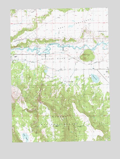
Sprague River East, OR USGS Topographic Map
Click on map above to begin viewing in our Map Viewer.

This topographic map contains these locations and features:
Feature Name Type Latitude Longitude GNIS ID View Map
Bly MountainSummitN42.4038°W121.4372°1138345View Map
Cliney FlatFlatN42.3899°W121.4053°1139837View Map
Council ButteSummitN42.4538°W121.4056°1140253View Map
Dams CanyonValleyN42.4318°W121.4492°1140611View Map
Dams MeadowFlatN42.3985°W121.4531°1140612View Map
Erskine Beal SpringSpringN42.3894°W121.4111°1141892View Map
Gem PondReservoirN42.4040°W121.4872°1162543View Map
Horton DamDamN42.3779°W121.4868°1133561View Map
Horton ReservoirReservoirN42.3796°W121.4839°1143826View Map
Jackson CemeteryCemeteryN42.4258°W121.4354°1144194View Map
Knot TablelandPlainN42.4857°W121.3822°1144692View Map
Muckney LakeLakeN42.4335°W121.3944°1146560View Map
Nimrod River County ParkParkN42.4638°W121.4650°1162542View Map
Rattlesnake SpringSpringN42.3903°W121.4447°1155472View Map
Rock CreekStreamN42.4604°W121.4125°1148588View Map
Rock Creek CemeteryCemeteryN42.4328°W121.4352°1155318View Map
Yainax AgencyLocaleN42.4307°W121.4292°1152687View Map
Yainax Post Office (historical)Post OfficeN42.4310°W121.4289°1164797View Map
Yainax RidgeRidgeN42.3932°W121.4267°1152688View Map

Note: Coordinates in the location and feature list above are referenced to NAD83 datum.


Copyright (C) 2008-2025 Ryan Niemi / Sunset Dynamics ... All Rights Reserved