TopoQuest Logo
Do you find TopoQuest useful?
Help keep TopoQuest running and adding new maps/features by donating!
Bitcoin:  19c7KJd3qBynnjoSw5npx9KScwjBe4ifkT
Litecoin:  LXs6TkuXGGXo1vDsWCkWVdjQX94eUKd6ui
Home View Maps Find Maps Find Places Resources & Links


Mesa Cencerro, New Mexico Topographic Map

USGS Map Title: Mesa Cencerro, NM
USGS Map MRC: 34107C3
DRG (GeoTIFF) Download: o34107c3.tif


Neighboring USGS Topographic Map Quads:


  Puertecito, NM  
34107D4
 

  La Jara Peak, NM  
34107D3
 

  Riley, NM  
34107D2
 

  Indian Spring Canyon, NM  
34107C4
 

  Mesa Cencerro, NM  
34107C3
 

  Carbon Springs, NM  
34107C2
 

  Gallinas Peak, NM  
34107B4
 

  Silver Hill, NM  
34107B3
 

  Granite Mountain, NM  
34107B2


Map MRC Location:

N35°
W108°
N35°
W107°
H8 H7 H6 H5 H4 H3 H2 H1
G8 G7 G6 G5 G4 G3 G2 G1
F8 F7 F6 F5 F4 F3 F2 F1
E8 E7 E6 E5 E4 E3 E2 E1
D8 D7 D6 D5 D4 D3 D2 D1
C8 C7 C6 C5 C4 C3 C2 C1
B8 B7 B6 B5 B4 B3 B2 B1
A8 A7 A6 A5 A4 A3 A2 A1
N34°
W108°
N34°
W107°

Mesa Cencerro, NM USGS 1:24K Topographic Map Preview:
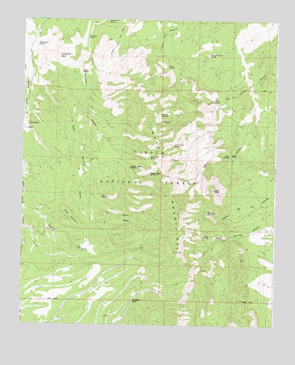
Mesa Cencerro, NM USGS Topographic Map
Click on map above to begin viewing in our Map Viewer.

This topographic map contains these locations and features:
Feature Name Type Latitude Longitude GNIS ID View Map
Baca SpringSpringN34.3198°W107.2734°1989141View Map
Balata SpringSpringN34.2959°W107.2833°903507View Map
Barrel SpringSpringN34.3537°W107.3456°903585View Map
Bear MountainsRidgeN34.2798°W107.2989°903664View Map
Bird SpringSpringN34.3320°W107.3720°903834View Map
Bluff SpringSpringN34.3559°W107.3031°903969View Map
Buckhorn TankReservoirN34.2601°W107.3199°904154View Map
Caņon Barranco BlancoValleyN34.3514°W107.3745°904618View Map
Canon Casa de MaderaValleyN34.3192°W107.3461°937095View Map
Carrizozo SpringSpringN34.3678°W107.3428°904812View Map
Cedar SpringSpringN34.2862°W107.2850°904875View Map
Cement Trough SpringSpringN34.3601°W107.2831°904893View Map
Chavez RanchLocaleN34.3298°W107.3725°905057View Map
Cottonwood SpringSpringN34.3237°W107.2998°905425View Map
Cottonwood SpringSpringN34.3642°W107.3678°905426View Map
Deer SpringSpringN34.3040°W107.2950°937081View Map
Dugout SpringSpringN34.3215°W107.2984°913995View Map
Fall SpringSpringN34.3417°W107.2806°906227View Map
Fenceline SpringSpringN34.3373°W107.3109°914116View Map
Grapevine SpringSpringN34.3348°W107.3298°914113View Map
Hells MesaSummitN34.3056°W107.2800°906921View Map
Hidden SpringSpringN34.3701°W107.3270°914114View Map
Little Bear SpringSpringN34.3187°W107.3120°907990View Map
Los Cerros BarrilSummitN34.3601°W107.3570°908206View Map
Lumber House Spring Number OneSpringN34.3120°W107.3117°908316View Map
Lumber House Spring Number TwoSpringN34.3148°W107.3214°908317View Map
Mesa CencerroSummitN34.2909°W107.3461°908590View Map
New TankReservoirN34.2891°W107.3630°913997View Map
New WellWellN34.2534°W107.3336°913998View Map
Palo Blanco SpringSpringN34.3739°W107.3325°909449View Map
Red Rock SpringSpringN34.3362°W107.3028°910079View Map
Red Rock SpringSpringN34.3534°W107.3075°914115View Map
Scott MesaSummitN34.2937°W107.3220°910885View Map
Scott SpringSpringN34.3023°W107.3353°910888View Map
Scott Spring CanyonValleyN34.3087°W107.3459°937096View Map
Spears RanchLocaleN34.3201°W107.2720°911300View Map
Tub SpringSpringN34.3195°W107.2731°911844View Map
Winter SpringSpringN34.3177°W107.2991°913996View Map

Note: Coordinates in the location and feature list above are referenced to NAD83 datum.


Copyright (C) 2008-2024 Ryan Niemi / Sunset Dynamics ... All Rights Reserved