TopoQuest Logo
Do you find TopoQuest useful?
Help keep TopoQuest running and adding new maps/features by donating!
Bitcoin:  19c7KJd3qBynnjoSw5npx9KScwjBe4ifkT
Litecoin:  LXs6TkuXGGXo1vDsWCkWVdjQX94eUKd6ui
Home View Maps Find Maps Find Places Resources & Links


Mesick NE, Michigan Topographic Map

USGS Map Title: Mesick NE, MI
USGS Map MRC: 44085D5
DRG (GeoTIFF) Download: o44085d5.tif


Neighboring USGS Topographic Map Quads:


  Walton, MI  
44085E4
 

  Mesick, MI  
44085D6
 

  Mesick NE, MI  
44085D5


  Harrietta, MI  
44085C6
 

  Boon, MI  
44085C5


Map MRC Location:

N45°
W86°
N45°
W85°
H8 H7 H6 H5 H4 H3 H2 H1
G8 G7 G6 G5 G4 G3 G2 G1
F8 F7 F6 F5 F4 F3 F2 F1
E8 E7 E6 E5 E4 E3 E2 E1
D8 D7 D6 D5 D4 D3 D2 D1
C8 C7 C6 C5 C4 C3 C2 C1
B8 B7 B6 B5 B4 B3 B2 B1
A8 A7 A6 A5 A4 A3 A2 A1
N44°
W86°
N44°
W85°

Mesick NE, MI USGS 1:24K Topographic Map Preview:
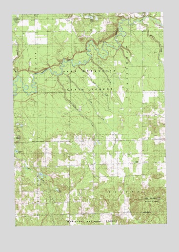
Mesick NE, MI USGS Topographic Map
Click on map above to begin viewing in our Map Viewer.

This topographic map contains these locations and features:
Feature Name Type Latitude Longitude GNIS ID View Map
Anderson CreekStreamN44.4636°W85.6209°1619025View Map
Apple CreekStreamN44.4736°W85.5606°1619035View Map
Baxter BridgeBridgeN44.4933°W85.5267°1623223View Map
Baxter Bridge State Forest CampgroundLocaleN44.4922°W85.5256°2509098View Map
Blind CreekStreamN44.4697°W85.5706°1619250View Map
Carp LakeLakeN44.3961°W85.5899°1619427View Map
Cedar LakeLakeN44.4117°W85.5258°1619462View Map
Colfax - Greenwood Volunteer Fire DepartmentBuildingN44.4103°W85.5190°2626752View Map
Colfax ChurchChurchN44.4106°W85.5392°1619554View Map
Ferguson LakeLakeN44.4192°W85.6231°1619898View Map
Filer CreekStreamN44.4656°W85.5840°1619909View Map
Grassy LakesLakeN44.4967°W85.5553°1620067View Map
Silver CreekStreamN44.4950°W85.5176°1621608View Map
Soper CemeteryCemeteryN44.4042°W85.5581°1621672View Map
Soper CreekStreamN44.4633°W85.5878°1621673View Map
Township of ColfaxCivilN44.3816°W85.5198°1626115View Map
Township of GreenwoodCivilN44.4684°W85.5178°1626406View Map
Twin LakesLakeN44.4344°W85.6184°1621985View Map
Wheatland Post Office (historical)Post OfficeN44.3953°W85.5597°2509053View Map

Note: Coordinates in the location and feature list above are referenced to NAD83 datum.


Copyright (C) 2008-2025 Ryan Niemi / Sunset Dynamics ... All Rights Reserved