TopoQuest Logo
Do you find TopoQuest useful?
Help keep TopoQuest running and adding new maps/features by donating!
Bitcoin:  19c7KJd3qBynnjoSw5npx9KScwjBe4ifkT
Litecoin:  LXs6TkuXGGXo1vDsWCkWVdjQX94eUKd6ui
Home View Maps Find Maps Find Places Resources & Links


Walton, Michigan Topographic Map

USGS Map Title: Walton, MI
USGS Map MRC: 44085E4
DRG (GeoTIFF) Download: o44085e4.tif


Neighboring USGS Topographic Map Quads:


  Jacks Landing, MI  
44085F4
 

  South Boardman, MI  
44085F3


  Walton, MI  
44085E4
 

  Fife Lake, MI  
44085E3
 

  Mesick NE, MI  
44085D5


Map MRC Location:

N45°
W86°
N45°
W85°
H8 H7 H6 H5 H4 H3 H2 H1
G8 G7 G6 G5 G4 G3 G2 G1
F8 F7 F6 F5 F4 F3 F2 F1
E8 E7 E6 E5 E4 E3 E2 E1
D8 D7 D6 D5 D4 D3 D2 D1
C8 C7 C6 C5 C4 C3 C2 C1
B8 B7 B6 B5 B4 B3 B2 B1
A8 A7 A6 A5 A4 A3 A2 A1
N44°
W86°
N44°
W85°

Walton, MI USGS 1:24K Topographic Map Preview:
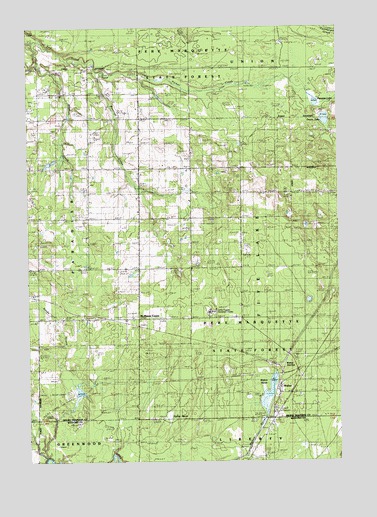
Walton, MI USGS Topographic Map
Click on map above to begin viewing in our Map Viewer.

This topographic map contains these locations and features:
Feature Name Type Latitude Longitude GNIS ID View Map
Bancroft CreekStreamN44.6122°W85.4723°620539View Map
Camp Pugsley Correction FacilityLocaleN44.5431°W85.4272°2104181View Map
Dell CemeteryCemeteryN44.5408°W85.4958°2496207View Map
Downs LakeLakeN44.5985°W85.3802°624861View Map
Fife Lake Lookout TowerTowerN44.5808°W85.3795°1623348View Map
Hodge Post Office (historical)Post OfficeN44.5844°W85.4339°2495794View Map
Iilif GraveCemeteryN44.5842°W85.4681°2496201View Map
Jackson CreekStreamN44.6217°W85.4998°629169View Map
McManus CornerPopulated PlaceN44.5408°W85.4562°1617712View Map
Milks CemeteryCemeteryN44.5553°W85.4667°2496206View Map
North Paradise SchoolSchoolN44.5983°W85.4956°633619View Map
Old Walton CemeteryCemeteryN44.5213°W85.4001°2774406View Map
Parker CreekStreamN44.6122°W85.4723°634384View Map
Parsons LakeLakeN44.6035°W85.3842°634434View Map
Pugsley Correctional FacilityBuildingN44.5421°W85.4272°2735682View Map
Riplow MarshSwampN44.5122°W85.4442°635950View Map
Sands CreekStreamN44.5283°W85.4873°637215View Map
Sparling CemeteryCemeteryN44.5737°W85.4750°2496202View Map
Township of Fife LakeCivilN44.5555°W85.3946°1626281View Map
WaltonPopulated PlaceN44.5208°W85.3995°1615746View Map
Walton CemeteryCemeteryN44.5192°W85.3911°2496209View Map
Walton JunctionPopulated PlaceN44.5275°W85.4020°1617920View Map
Walton MarshLakeN44.5216°W85.4028°1615749View Map
Walton Post Office (historical)Post OfficeN44.5208°W85.3994°2495781View Map
Walton StationLocaleN44.5214°W85.4006°2495758View Map
Whipple Post Office (historical)Post OfficeN44.5386°W85.4550°2495780View Map

Note: Coordinates in the location and feature list above are referenced to NAD83 datum.


Copyright (C) 2008-2024 Ryan Niemi / Sunset Dynamics ... All Rights Reserved