TopoQuest Logo
Do you find TopoQuest useful?
Help keep TopoQuest running and adding new maps/features by donating!
Bitcoin:  19c7KJd3qBynnjoSw5npx9KScwjBe4ifkT
Litecoin:  LXs6TkuXGGXo1vDsWCkWVdjQX94eUKd6ui
Home View Maps Find Maps Find Places Resources & Links


Metaline, Washington Topographic Map

USGS Map Title: Metaline, WA
USGS Map MRC: 48117G4
DRG (GeoTIFF) Download: o48117g4.tif


Neighboring USGS Topographic Map Quads:


  Leadpoint, WA  
48117H5
 

  Abercrombie Mountain, WA  
48117H4
 

  Boundary Dam, WA  
48117H3
 

  Deep Lake, WA  
48117G5
 

  Metaline, WA  
48117G4
 

  Metaline Falls, WA  
48117G3
 

  Aladdin Mountain, WA  
48117F5
 

  Ione, WA  
48117F4
 

  Scotchman Lake, WA  
48117F3


Map MRC Location:

N49°
W118°
N49°
W117°
H8 H7 H6 H5 H4 H3 H2 H1
G8 G7 G6 G5 G4 G3 G2 G1
F8 F7 F6 F5 F4 F3 F2 F1
E8 E7 E6 E5 E4 E3 E2 E1
D8 D7 D6 D5 D4 D3 D2 D1
C8 C7 C6 C5 C4 C3 C2 C1
B8 B7 B6 B5 B4 B3 B2 B1
A8 A7 A6 A5 A4 A3 A2 A1
N48°
W118°
N48°
W117°

Metaline, WA USGS 1:24K Topographic Map Preview:
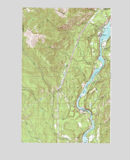
Metaline, WA USGS Topographic Map
Click on map above to begin viewing in our Map Viewer.

This topographic map contains these locations and features:
Feature Name Type Latitude Longitude GNIS ID View Map
Bella May MineMineN48.8480°W117.4052°1516395View Map
Box CanyonValleyN48.7802°W117.4100°1516893View Map
Box Canyon DamDamN48.7803°W117.4128°1516899View Map
Box Canyon Dam ViewpointLocaleN48.7799°W117.4097°1529523View Map
Box Canyon ReservoirReservoirN48.7802°W117.4125°1531955View Map
Cameron MeadowFlatN48.7882°W117.4577°1517245View Map
Cedar Creek ReservoirReservoirN48.7540°W117.4430°1532648View Map
Cedar Creek Reservoir DamDamN48.7536°W117.4425°1532647View Map
Cement MountainSummitN48.7552°W117.4225°1517589View Map
Deer MountainSummitN48.7980°W117.4447°1518644View Map
Edgewater CampgroundLocaleN48.7566°W117.4086°1529509View Map
Exposure CreekStreamN48.7538°W117.4072°1519423View Map
Flume Creek ReservoirSwampN48.8750°W117.3873°1532016View Map
Flume Creek Reservoir DamDamN48.8749°W117.3877°1532015View Map
Jim CreekStreamN48.7607°W117.4552°1521374View Map
Jordan CreekStreamN48.8649°W117.4677°1521466View Map
Linton CreekStreamN48.8535°W117.3855°1522140View Map
Linton MountainSummitN48.8685°W117.4408°1522141View Map
Lost CreekStreamN48.8063°W117.4080°1522457View Map
Lost LakeLakeN48.8214°W117.4391°1522479View Map
Lost Lake CreekStreamN48.7919°W117.4558°1522496View Map
Lunch CreekStreamN48.8263°W117.4133°1522576View Map
MetalinePopulated PlaceN48.8505°W117.3908°1523022View Map
Metaline City HallBuildingN48.8485°W117.3918°2610582View Map
Metaline Sewage Treatment PlantLocaleN48.8558°W117.3860°2610696View Map
Mickey CreekStreamN48.7691°W117.3991°1523047View Map
Oriole MineMineN48.8602°W117.4133°1524074View Map
Pend Oreille County Pud DamDamN48.7799°W117.4177°1532884View Map
Perkins Family CemeteryCemeteryN48.8419°W117.3851°1524336View Map
Pocahontas CreekStreamN48.8394°W117.3889°1524521View Map
Sand CreekStreamN48.8116°W117.3961°1525412View Map
Sand CreekLocaleN48.8083°W117.3933°1530090View Map
Selkirk Junior Senior High SchoolSchoolN48.8189°W117.3982°1531121View Map
South Fork Flume CreekStreamN48.8738°W117.3872°1526193View Map
South Fork Jim CreekStreamN48.7996°W117.4925°1526205View Map
Sweet CreekStreamN48.8202°W117.3900°1526855View Map
Thorson MeadowLakeN48.8050°W117.4445°1527132View Map
Town of MetalineCivilN48.8541°W117.3899°2412989View Map
Wolf CreekStreamN48.8274°W117.3852°1528281View Map

Note: Coordinates in the location and feature list above are referenced to NAD83 datum.


Copyright (C) 2008-2025 Ryan Niemi / Sunset Dynamics ... All Rights Reserved