TopoQuest Logo
Do you find TopoQuest useful?
Help keep TopoQuest running and adding new maps/features by donating!
Bitcoin:  19c7KJd3qBynnjoSw5npx9KScwjBe4ifkT
Litecoin:  LXs6TkuXGGXo1vDsWCkWVdjQX94eUKd6ui
Home View Maps Find Maps Find Places Resources & Links


Metasville, Georgia Topographic Map

USGS Map Title: Metasville, GA
USGS Map MRC: 33082G5
DRG (GeoTIFF) Download: o33082g5.tif


Neighboring USGS Topographic Map Quads:


  Broad, GA  
33082H6
 

  Chennault, GA  
33082H5
 

  Willington, SC  
33082H4
 

  Tignall, GA  
33082G6
 

  Metasville, GA  
33082G5
 

  Lincolnton, GA  
33082G4
 

  Washington East, GA  
33082F6
 

  Aonia, GA  
33082F5
 

  Woodlawn, GA  
33082F4


Map MRC Location:

N34°
W83°
N34°
W82°
H8 H7 H6 H5 H4 H3 H2 H1
G8 G7 G6 G5 G4 G3 G2 G1
F8 F7 F6 F5 F4 F3 F2 F1
E8 E7 E6 E5 E4 E3 E2 E1
D8 D7 D6 D5 D4 D3 D2 D1
C8 C7 C6 C5 C4 C3 C2 C1
B8 B7 B6 B5 B4 B3 B2 B1
A8 A7 A6 A5 A4 A3 A2 A1
N33°
W83°
N33°
W82°

Metasville, GA USGS 1:24K Topographic Map Preview:
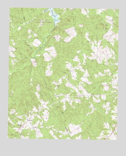
Metasville, GA USGS Topographic Map
Click on map above to begin viewing in our Map Viewer.

This topographic map contains these locations and features:
Feature Name Type Latitude Longitude GNIS ID View Map
Anthony ChurchChurchN33.8004°W82.5690°354321View Map
Anthonys Chapel CemeteryCemeteryN33.7996°W82.5687°342825View Map
Beach BranchStreamN33.8704°W82.5346°327022View Map
Curry HillPopulated PlaceN33.8432°W82.5304°331497View Map
Ebenezer ChurchChurchN33.8565°W82.5162°335573View Map
Ebenezer SchoolSchoolN33.8560°W82.5154°313845View Map
Estes CemeteryCemeteryN33.7917°W82.5035°313973View Map
Fishing Creek Public Hunting AreaParkN33.8598°W82.5840°342757View Map
Gold Mine BranchStreamN33.8501°W82.5782°314669View Map
GoshenPopulated PlaceN33.8637°W82.5079°331841View Map
Goshen BranchStreamN33.8698°W82.5174°314728View Map
Goshen CemeteryCemeteryN33.8604°W82.5157°342826View Map
Goshen ChurchChurchN33.8601°W82.5151°356064View Map
Gualett BranchStreamN33.8390°W82.5837°314943View Map
Harmony ChurchChurchN33.7876°W82.5137°335577View Map
Harmony SchoolSchoolN33.7871°W82.5137°315157View Map
Jerry BranchStreamN33.7904°W82.5351°316085View Map
Jones ChapelChurchN33.8529°W82.5976°342767View Map
Kary Wood BranchStreamN33.8335°W82.5935°316323View Map
Lincolnton DivisionCivilN33.8583°W82.5231°1936362View Map
LovelacePopulated PlaceN33.7912°W82.5710°326378View Map
Magruda MinesMineN33.7757°W82.5632°317628View Map
MetasvillePopulated PlaceN33.7679°W82.6015°326396View Map
Metasville ChurchChurchN33.7601°W82.5960°318054View Map
Metasville Fire DepartmentBuildingN33.7669°W82.6020°2604944View Map
Metasville High SchoolSchoolN33.7621°W82.6090°318055View Map
Midway CemeteryCemeteryN33.8746°W82.5518°342828View Map
Midway ChurchChurchN33.8746°W82.5512°318131View Map
Mine BranchStreamN33.7785°W82.5474°318309View Map
Morris CreekStreamN33.8718°W82.5857°318491View Map
Mount Nebo ChurchChurchN33.7526°W82.6179°342778View Map
Mount Nebo SchoolSchoolN33.7535°W82.6162°318716View Map
Saint Johns SchoolSchoolN33.8526°W82.5971°322134View Map
Saint Lukes ChurchChurchN33.8135°W82.5585°322165View Map
SybertPopulated PlaceN33.8148°W82.5549°326539View Map
Ware BranchStreamN33.8212°W82.6007°324844View Map
Wolf BranchStreamN33.8254°W82.6007°325475View Map

Note: Coordinates in the location and feature list above are referenced to NAD83 datum.


Copyright (C) 2008-2025 Ryan Niemi / Sunset Dynamics ... All Rights Reserved