TopoQuest Logo
Do you find TopoQuest useful?
Help keep TopoQuest running and adding new maps/features by donating!
Bitcoin:  19c7KJd3qBynnjoSw5npx9KScwjBe4ifkT
Litecoin:  LXs6TkuXGGXo1vDsWCkWVdjQX94eUKd6ui
Home View Maps Find Maps Find Places Resources & Links


Beaukiss, Texas Topographic Map

USGS Map Title: Beaukiss, TX
USGS Map MRC: 30097D2
DRG (GeoTIFF) Download: o30097d2.tif


Neighboring USGS Topographic Map Quads:


  Thrall, TX  
30097E3
 

  Thorndale, TX  
30097E2
 

  Alcoa Lake, TX  
30097E1
 

  Structure, TX  
30097D3
 

  Beaukiss, TX  
30097D2
 

  Lexington, TX  
30097D1
 

  Elgin East, TX  
30097C3
 

  McDade, TX  
30097C2
 

  Fedor, TX  
30097C1


Map MRC Location:

N31°
W98°
N31°
W97°
H8 H7 H6 H5 H4 H3 H2 H1
G8 G7 G6 G5 G4 G3 G2 G1
F8 F7 F6 F5 F4 F3 F2 F1
E8 E7 E6 E5 E4 E3 E2 E1
D8 D7 D6 D5 D4 D3 D2 D1
C8 C7 C6 C5 C4 C3 C2 C1
B8 B7 B6 B5 B4 B3 B2 B1
A8 A7 A6 A5 A4 A3 A2 A1
N30°
W98°
N30°
W97°

Beaukiss, TX USGS 1:24K Topographic Map Preview:
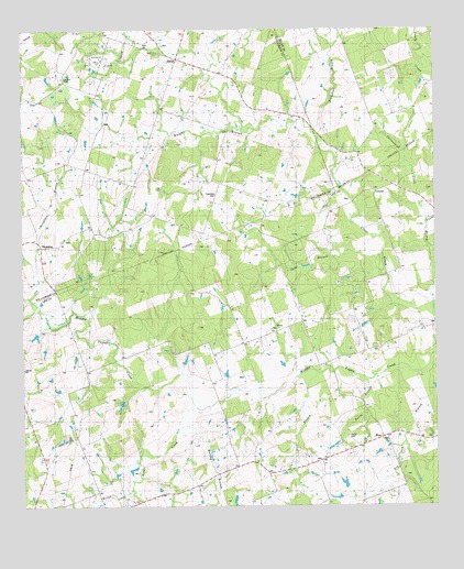
Beaukiss, TX USGS Topographic Map
Click on map above to begin viewing in our Map Viewer.

This topographic map contains these locations and features:
Feature Name Type Latitude Longitude GNIS ID View Map
Abbott Oil FieldOilfieldN30.4938°W97.2264°1350845View Map
AdinaPopulated PlaceN30.4216°W97.1725°1379320View Map
BeaukissPopulated PlaceN30.4430°W97.2444°1351713View Map
BluePopulated PlaceN30.3919°W97.1475°1388206View Map
Blue BranchStreamN30.4099°W97.1611°1372634View Map
Blue SchoolSchoolN30.3919°W97.1461°1352490View Map
Blue Volunteer Fire DepartmentBuildingN30.3929°W97.1406°2552470View Map
Burns BranchStreamN30.4088°W97.1436°1358197View Map
Burns CemeteryCemeteryN30.3933°W97.1511°1353355View Map
Clay HillSummitN30.4199°W97.1436°1354587View Map
Cottonwood CreekStreamN30.4499°W97.1261°1355073View Map
Draeger LakeReservoirN30.4018°W97.2207°1865468View Map
Draeger Lake DamDamN30.4035°W97.2203°1865467View Map
Eckman SchoolSchoolN30.4785°W97.2069°1356802View Map
Florence ChurchChurchN30.4572°W97.1414°1357492View Map
Guentzel CemeteryCemeteryN30.4569°W97.1911°1358495View Map
Houghton BranchStreamN30.4297°W97.2483°1359697View Map
Knight BranchStreamN30.4683°W97.1586°1360718View Map
Lawrence SchoolSchoolN30.4888°W97.2380°1360993View Map
Marshy BranchStreamN30.3958°W97.2022°1374805View Map
Mine CreekStreamN30.4010°W97.1983°1374964View Map
Sand BranchStreamN30.4366°W97.1403°1367552View Map
ShilohPopulated PlaceN30.4924°W97.2028°1989110View Map
Shiloh ChurchChurchN30.4921°W97.2028°1368160View Map
Slaughter BranchStreamN30.4583°W97.1533°1368409View Map
Willow CreekStreamN30.3797°W97.2178°1376817View Map
Wood Triple D AirportAirportN30.3791°W97.1947°1386599View Map

Note: Coordinates in the location and feature list above are referenced to NAD83 datum.


Copyright (C) 2008-2025 Ryan Niemi / Sunset Dynamics ... All Rights Reserved