TopoQuest Logo
Do you find TopoQuest useful?
Help keep TopoQuest running and adding new maps/features by donating!
Bitcoin:  19c7KJd3qBynnjoSw5npx9KScwjBe4ifkT
Litecoin:  LXs6TkuXGGXo1vDsWCkWVdjQX94eUKd6ui
Home View Maps Find Maps Find Places Resources & Links


Micaville, North Carolina Topographic Map

USGS Map Title: Micaville, NC
USGS Map MRC: 35082H2
DRG (GeoTIFF) Download: o35082h2.tif


Neighboring USGS Topographic Map Quads:


  Huntdale, NC  
36082A3
 

  Bakersville, NC  
36082A2
 

  Carvers Gap, NC  
36082A1
 

  Burnsville, NC  
35082H3
 

  Micaville, NC  
35082H2
 

  Spruce Pine, NC  
35082H1
 

  Mount Mitchell, NC  
35082G3
 

  Celo, NC  
35082G2
 

  Little Switzerland, NC  
35082G1


Map MRC Location:

N36°
W83°
N36°
W82°
H8 H7 H6 H5 H4 H3 H2 H1
G8 G7 G6 G5 G4 G3 G2 G1
F8 F7 F6 F5 F4 F3 F2 F1
E8 E7 E6 E5 E4 E3 E2 E1
D8 D7 D6 D5 D4 D3 D2 D1
C8 C7 C6 C5 C4 C3 C2 C1
B8 B7 B6 B5 B4 B3 B2 B1
A8 A7 A6 A5 A4 A3 A2 A1
N35°
W83°
N35°
W82°

Micaville, NC USGS 1:24K Topographic Map Preview:
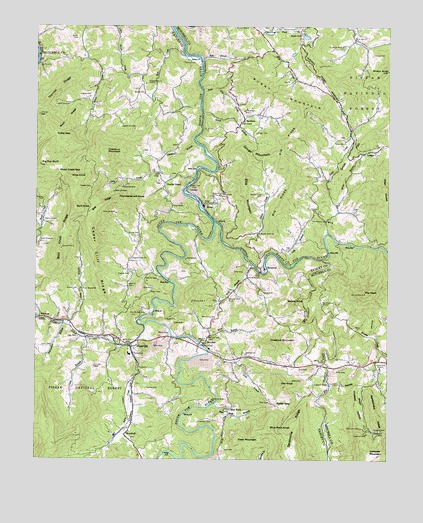
Micaville, NC USGS Topographic Map
Click on map above to begin viewing in our Map Viewer.

This topographic map contains these locations and features:
Feature Name Type Latitude Longitude GNIS ID View Map
Ayles CreekStreamN35.9082°W82.2160°1008827View Map
BacchusPopulated PlaceN35.9279°W82.2054°1018889View Map
Bald KnobSummitN35.9476°W82.2362°1018922View Map
Bald Knob RidgeRidgeN35.9396°W82.2404°1008874View Map
BandanaPopulated PlaceN35.9732°W82.1760°1018950View Map
Bearwallow BranchStreamN35.9146°W82.2396°1009046View Map
Bee RidgeRidgeN35.9482°W82.2268°1009115View Map
Big Crabtree ChurchChurchN35.9196°W82.1482°1009296View Map
Big Crabtree CreekStreamN35.9329°W82.1482°1009297View Map
Big RidgeRidgeN35.9576°W82.1576°1009365View Map
Blue RockPopulated PlaceN35.8907°W82.1796°1019231View Map
Blue Rock BranchStreamN35.8912°W82.1865°1009496View Map
Blue Rock KnobSummitN35.8840°W82.1668°1019232View Map
Boone CemeteryCemeteryN35.9246°W82.2348°1009540View Map
Boone KnobSummitN35.9207°W82.1612°1019257View Map
BoonfordPopulated PlaceN35.9304°W82.1690°1019262View Map
BowditchPopulated PlaceN35.8840°W82.2162°1019266View Map
Brushy CreekStreamN35.9104°W82.1432°1009689View Map
Buchanan CemeteryCemeteryN35.9940°W82.1412°1009725View Map
Buck RidgeRidgeN35.9729°W82.2385°1009749View Map
Burnt MountainSummitN35.9771°W82.1543°1019431View Map
Butler GapGapN35.8910°W82.1646°1009864View Map
Cane BranchStreamN35.9104°W82.2315°1009998View Map
Cedar Cliff RidgeRidgeN35.9334°W82.2293°1010119View Map
Chestnut BranchStreamN35.9665°W82.1937°1010225View Map
Chestnut MountainSummitN35.9087°W82.1637°1019648View Map
Chestnut MountainSummitN35.9640°W82.2254°1019650View Map
Clay Mound ChurchChurchN35.9173°W82.2112°1010304View Map
Covy Rock ChurchChurchN35.9893°W82.2490°1010515View Map
Cox CemeteryCemeteryN35.9040°W82.1401°1010536View Map
Cox KnobSummitN35.8968°W82.1626°1019827View Map
Crabtree ChapelChurchN35.8968°W82.1457°1010548View Map
Crabtree ChurchChurchN35.9098°W82.2310°1010549View Map
Crabtree MountainSummitN35.8768°W82.1315°1019837View Map
Deneen DamDamN35.9035°W82.1882°1017314View Map
Deneen ReservoirReservoirN35.9035°W82.1882°1017313View Map
Dobag CreekStreamN35.9565°W82.1940°1019986View Map
Double IslandPopulated PlaceN35.9551°W82.2043°1020006View Map
Double Island Baptist ChurchChurchN35.9549°W82.2041°2678456View Map
Double Island Volunteer Fire Department Station 1BuildingN35.9618°W82.2061°2639520View Map
Double Island Volunteer Fire Department Station 2BuildingN35.9576°W82.2062°2639530View Map
Duck BranchStreamN35.9985°W82.1698°1010930View Map
Edge CemeteryCemeteryN35.9104°W82.2348°1011018View Map
Ellis MountainSummitN35.9568°W82.1760°1020139View Map
Fawn MountainSummitN35.8810°W82.1779°1020225View Map
Gouge BranchStreamN35.9751°W82.1910°1011573View Map
Gouge CemeteryCemeteryN35.9693°W82.1721°1011574View Map
Gouge MountainSummitN35.9623°W82.1743°1020482View Map
Gouge Primary ElementarySchoolN35.9751°W82.1679°1017627View Map
Hensley CemeteryCemeteryN35.8954°W82.2107°1011977View Map
Hootowl HollowValleyN35.8966°W82.1448°1012164View Map
Hootowl MineMineN35.8837°W82.1271°1012165View Map
Hughes CemeteryCemeteryN35.9287°W82.2162°1012258View Map
Hughes CemeteryCemeteryN35.9496°W82.2471°1012259View Map
Hughes CemeteryCemeteryN35.9534°W82.2304°1012260View Map
Hughes CemeteryCemeteryN35.9796°W82.2310°1012261View Map
KonaPopulated PlaceN35.9501°W82.1918°1021066View Map
Kona ChurchChurchN35.9515°W82.1846°1012649View Map
Ledford CemeteryCemeteryN35.9918°W82.1310°1012784View Map
LedgerPopulated PlaceN35.9643°W82.1296°1021127View Map
Liberty Hill ChurchChurchN35.9018°W82.1276°1012845View Map
Lily BranchStreamN35.9307°W82.1593°1012870View Map
Lily Branch ChurchChurchN35.9443°W82.1521°1012871View Map
Little Crabtree CreekStreamN35.9140°W82.2112°1012932View Map
Long BranchStreamN35.9082°W82.1901°1013127View Map
LundayPopulated PlaceN35.9543°W82.1951°1013257View Map
Martin ChapelChurchN35.9082°W82.1912°1013339View Map
MicavillePopulated PlaceN35.9096°W82.2132°1021421View Map
Micaville Elementary SchoolSchoolN35.9051°W82.2165°1017689View Map
Micaville Post OfficePost OfficeN35.9077°W82.2161°2766617View Map
Mine BranchStreamN35.9082°W82.1901°1013606View Map
Mine Creek ChurchChurchN35.9993°W82.1690°1013610View Map
Mine KnobSummitN35.9562°W82.2371°1021483View Map
Narrow RidgeRidgeN35.9815°W82.2421°1013875View Map
NewdalePopulated PlaceN35.9107°W82.1890°1013938View Map
Newdale ChurchChurchN35.9057°W82.1754°1013939View Map
Newdale Volunteer Fire DepartmentBuildingN35.9088°W82.1959°2639531View Map
Otter KnobsSummitN35.9521°W82.1251°1021765View Map
Pig Pen BluffSummitN35.9598°W82.2482°1021890View Map
Pilgrim ChapelChurchN35.9437°W82.2471°1014397View Map
Pleasant Gap ChurchChurchN35.9329°W82.2157°1014510View Map
Pleasant Grove ChurchChurchN35.9837°W82.2112°1014516View Map
Plum BranchStreamN35.9137°W82.2385°1014540View Map
Plum Branch ChurchChurchN35.9243°W82.2335°1014541View Map
Rattlesnake RidgeRidgeN35.8887°W82.1287°1014758View Map
Rebels CreekStreamN35.9362°W82.1807°1014777View Map
Rebels Creek CemeteryCemeteryN35.9515°W82.1696°1014778View Map
Rebels Creek ChurchChurchN35.9404°W82.1707°1014779View Map
Riddle CemeteryCemeteryN35.9965°W82.2351°1014884View Map
Roaring BranchStreamN35.8965°W82.1448°993427View Map
Robinson CemeteryCemeteryN35.8857°W82.1921°1014974View Map
Rose BranchStreamN35.9907°W82.1915°1015081View Map
Rose CreekStreamN35.9915°W82.1965°1015084View Map
Saylor LakeReservoirN35.9973°W82.1548°1015310View Map
Shoal CreekStreamN35.9193°W82.2498°1015455View Map
Shoal Creek ChurchChurchN35.9379°W82.2482°1015460View Map
Shoal Creek GapGapN35.9579°W82.2415°1015461View Map
Silver CemeteryCemeteryN35.9073°W82.2468°1015517View Map
Silver CemeteryCemeteryN35.9515°W82.1840°1015518View Map
Silver ChapelChurchN35.9729°W82.1773°1015519View Map
Sink Hole CreekStreamN35.9821°W82.1912°1015554View Map
Sink Hole MineMineN35.9757°W82.1765°1015555View Map
Snow CreekStreamN35.9401°W82.1465°1015639View Map
Snow HillSummitN35.9601°W82.1398°1022689View Map
Snow Hill ChurchChurchN35.9671°W82.1401°1015645View Map
South Toe RiverStreamN35.9435°W82.1862°1015714View Map
South Toe Volunteer Fire and Rescue Station 2BuildingN35.9293°W82.1707°2638680View Map
The PeakSummitN35.9229°W82.1332°1022924View Map
Thomas CemeteryCemeteryN35.9901°W82.1979°1016108View Map
Thunderstruck KnobSummitN35.9501°W82.2212°1022945View Map
Tolley GapGapN35.9690°W82.2429°1016172View Map
Township of Brush CreekCivilN35.9788°W82.2162°1027360View Map
Township of CrabtreeCivilN35.9085°W82.2088°1027363View Map
Township of Snow CreekCivilN35.9617°W82.1325°1026955View Map
White Oak ChurchChurchN35.9973°W82.1368°1016590View Map
Will Young CemeteryCemeteryN35.9157°W82.1860°1016696View Map
Wilson CemeteryCemeteryN35.9112°W82.2029°1016721View Map
Wilson CemeteryCemeteryN35.9229°W82.2090°1016722View Map
Wilson KnobSummitN35.9873°W82.1254°1016730View Map
WingPopulated PlaceN35.9448°W82.1457°1023284View Map
Wing BranchStreamN35.9476°W82.1435°1016756View Map
Wolf BranchStreamN35.9310°W82.1723°1016770View Map
Woody CemeteryCemeteryN35.9807°W82.2118°1016828View Map
Wyatt CemeteryCemeteryN35.9157°W82.2037°1016850View Map
Young CemeteryCemeteryN35.9232°W82.1696°1016877View Map
Young CemeteryCemeteryN35.9396°W82.2137°1016879View Map
Young ChapelChurchN35.9273°W82.1748°1016880View Map

Note: Coordinates in the location and feature list above are referenced to NAD83 datum.


Copyright (C) 2008-2024 Ryan Niemi / Sunset Dynamics ... All Rights Reserved