TopoQuest Logo
Do you find TopoQuest useful?
Help keep TopoQuest running and adding new maps/features by donating!
Bitcoin:  19c7KJd3qBynnjoSw5npx9KScwjBe4ifkT
Litecoin:  LXs6TkuXGGXo1vDsWCkWVdjQX94eUKd6ui
Home View Maps Find Maps Find Places Resources & Links


Celo, North Carolina Topographic Map

USGS Map Title: Celo, NC
USGS Map MRC: 35082G2
DRG (GeoTIFF) Download: o35082g2.tif


Neighboring USGS Topographic Map Quads:


  Burnsville, NC  
35082H3
 

  Micaville, NC  
35082H2
 

  Spruce Pine, NC  
35082H1
 

  Mount Mitchell, NC  
35082G3
 

  Celo, NC  
35082G2
 

  Little Switzerland, NC  
35082G1
 

  Montreat, NC  
35082F3
 

  Old Fort, NC  
35082F2
 

  Marion West, NC  
35082F1


Map MRC Location:

N36°
W83°
N36°
W82°
H8 H7 H6 H5 H4 H3 H2 H1
G8 G7 G6 G5 G4 G3 G2 G1
F8 F7 F6 F5 F4 F3 F2 F1
E8 E7 E6 E5 E4 E3 E2 E1
D8 D7 D6 D5 D4 D3 D2 D1
C8 C7 C6 C5 C4 C3 C2 C1
B8 B7 B6 B5 B4 B3 B2 B1
A8 A7 A6 A5 A4 A3 A2 A1
N35°
W83°
N35°
W82°

Celo, NC USGS 1:24K Topographic Map Preview:
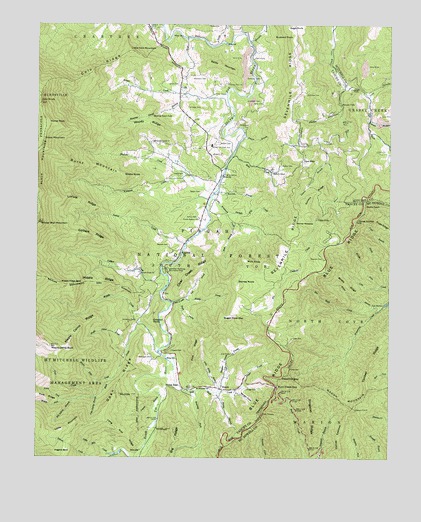
Celo, NC USGS Topographic Map
Click on map above to begin viewing in our Map Viewer.

This topographic map contains these locations and features:
Feature Name Type Latitude Longitude GNIS ID View Map
Autrey CemeteryCemeteryN35.8196°W82.1932°1008819View Map
Bailey MountainSummitN35.8618°W82.1815°1018903View Map
Ballew CemeteryCemeteryN35.8346°W82.1634°1008901View Map
Ballew CemeteryCemeteryN35.8407°W82.1857°1008902View Map
Ballew StoreLocaleN35.8326°W82.1673°1008904View Map
Bee Rock CreekStreamN35.7932°W82.1279°1009118View Map
Big RidgeRidgeN35.7551°W82.2004°1009363View Map
Bill Autrey BranchStreamN35.7671°W82.2365°1009395View Map
Black Mountain CampgroundLocaleN35.7529°W82.2212°1018000View Map
Bobs CreekStreamN35.8376°W82.1807°1009520View Map
Bracher CemeteryCemeteryN35.8076°W82.1487°1009565View Map
Bridle RidgeRidgeN35.8001°W82.1396°1009600View Map
Brown CreekStreamN35.8557°W82.1832°1009655View Map
Buck CreekGapN35.7710°W82.1646°1009733View Map
Burgin CoveValleyN35.7694°W82.1785°1009820View Map
Burnett BranchStreamN35.8479°W82.1326°1009834View Map
Burnt MountainSummitN35.8326°W82.2254°1019430View Map
Busic Nork CenterLocaleN35.7668°W82.1935°1018002View Map
BusickPopulated PlaceN35.7698°W82.1829°1019439View Map
Buzzard RockSummitN35.8710°W82.1596°1019455View Map
Carolina Hemlocks Recreation AreaParkN35.8046°W82.2043°1010041View Map
Carroway CemeteryCemeteryN35.8507°W82.1971°1010057View Map
CeloPopulated PlaceN35.8551°W82.1979°1019590View Map
Celo KnobSummitN35.8523°W82.2487°1010141View Map
Celo RidgeRidgeN35.8626°W82.2285°1010142View Map
Clear CreekStreamN35.7951°W82.2018°1010312View Map
Clear Creek RidgeRidgeN35.8035°W82.1946°1010320View Map
Colbert CreekStreamN35.8012°W82.2032°1010369View Map
Colbert Creek ChurchChurchN35.8037°W82.2132°1010370View Map
Colbert RidgeRidgeN35.8140°W82.2304°1010371View Map
Crabtree FallsFallsN35.8567°W82.1361°1010551View Map
Crisawn CemeteryCemeteryN35.7809°W82.2023°1010585View Map
Crisawn KnobSummitN35.7896°W82.2090°1019861View Map
Dicks GapGapN35.7707°W82.2037°1010812View Map
Dovers BranchStreamN35.7690°W82.1854°1010895View Map
Dovers BranchStreamN35.8357°W82.1471°1010896View Map
Dovers RidgeRidgeN35.8265°W82.1521°1010897View Map
East Branch Little Whiteoak CreekStreamN35.8168°W82.1804°1010971View Map
East Fork Big Crabtree CreekStreamN35.8568°W82.1412°1010979View Map
Estatoe ChurchChurchN35.8376°W82.1882°1011104View Map
Fairview CemeteryCemeteryN35.8548°W82.1548°1011133View Map
Fairview ChurchChurchN35.8404°W82.1576°1011138View Map
Fork RidgeRidgeN35.7682°W82.2490°1011332View Map
Gibbs CemeteryCemeteryN35.8323°W82.2021°1011475View Map
Gibbs CemeteryCemeteryN35.8576°W82.2001°1011476View Map
Gibbs MountainSummitN35.8407°W82.2482°1020423View Map
Glenn ChurchChurchN35.8385°W82.1296°1011534View Map
Good CemeteryCemeteryN35.7848°W82.1593°1011560View Map
Gragg CemeteryCemeteryN35.7698°W82.1754°1011582View Map
Grindstaff CemeteryCemeteryN35.8529°W82.1712°1011751View Map
Haines EyebrowRidgeN35.7540°W82.1415°1011793View Map
Hall ChapelChurchN35.8654°W82.1735°1011801View Map
HamrickPopulated PlaceN35.8098°W82.1990°1020605View Map
Hannah BranchStreamN35.8273°W82.1862°1011841View Map
Hazelnut GapGapN35.7732°W82.1626°1011948View Map
Higgins BaldRidgeN35.7523°W82.2390°1012032View Map
Hoover MeadowFlatN35.8173°W82.1596°1012167View Map
House BranchStreamN35.7943°W82.1290°1012228View Map
John Autrey BranchStreamN35.7676°W82.2282°1012497View Map
Laurel BranchStreamN35.7685°W82.2060°1012704View Map
Lee Fields CemeteryCemeteryN35.7798°W82.1846°1012799View Map
Left Prong Clear CreekStreamN35.7960°W82.1976°1012813View Map
Left Prong Still Fork CreekStreamN35.7693°W82.1851°1012818View Map
Little Celo MountainSummitN35.8673°W82.2171°1021178View Map
Little MountainSummitN35.7587°W82.2387°1021215View Map
Little Mountain CreekStreamN35.7512°W82.2240°1012993View Map
Little Whiteoak CreekStreamN35.8262°W82.1876°1013041View Map
Locust CreekStreamN35.8118°W82.1973°1013056View Map
Locust RidgeRidgeN35.8240°W82.2337°1013068View Map
Long Arm RidgeRidgeN35.7579°W82.2182°1013088View Map
Long BranchStreamN35.8548°W82.1323°1013141View Map
Lost Cove Picnic AreaLocaleN35.7540°W82.2126°1018003View Map
Low GapGapN35.8357°W82.1554°1013226View Map
Maple Bald CreekStreamN35.7729°W82.2229°1013306View Map
Maple Camp BaldSummitN35.7823°W82.2448°1013308View Map
Maple Camp CreekStreamN35.7826°W82.2173°1013309View Map
Maple Camp RidgeRidgeN35.7879°W82.2337°1013310View Map
Middle CreekStreamN35.7982°W82.2060°1013489View Map
Middle Fork Cow CreekStreamN35.7996°W82.1279°1013498View Map
Middle Fork Rock CreekStreamN35.7668°W82.2398°1013503View Map
Middle Prong Clear CreekStreamN35.7960°W82.1979°1013509View Map
Middle RidgeRidgeN35.8004°W82.2276°1013516View Map
Middle Ridge BaldRidgeN35.8001°W82.2401°1013521View Map
Miller ChapelChurchN35.8551°W82.1876°1013582View Map
Mount Mitchell ChurchChurchN35.7704°W82.1882°1013746View Map
Murphy BranchStreamN35.8701°W82.1754°1013850View Map
Murphy FallsFallsN35.8521°W82.1420°1013851View Map
Nettie PatchGapN35.8229°W82.1335°1013908View Map
North Fork Cow CreekStreamN35.7996°W82.1251°1013995View Map
North Fork Rock CreekStreamN35.7668°W82.2398°1014005View Map
Open RidgeRidgeN35.7735°W82.2190°1014124View Map
Patton CemeteryCemeteryN35.8271°W82.1921°1014264View Map
Percys PeakSummitN35.8482°W82.2477°1017359View Map
Phipps BranchStreamN35.8435°W82.1768°1014375View Map
Pine RidgeRidgeN35.7815°W82.1932°1014436View Map
Pine Ridge BranchStreamN35.7707°W82.1848°1014442View Map
Rich KnobSummitN35.8065°W82.1754°1022256View Map
Right Prong Clear CreekStreamN35.7954°W82.1998°1014905View Map
Right Prong Still Fork CreekStreamN35.7712°W82.1762°1014909View Map
Roaring ForkStreamN35.7696°W82.1935°1014944View Map
Roaring Spout BranchStreamN35.8548°W82.1951°1014949View Map
Roaring Spout FallsFallsN35.8490°W82.2090°1014950View Map
Robinson CemeteryCemeteryN35.7790°W82.2084°1014971View Map
Robinson CemeteryCemeteryN35.8596°W82.1712°1014972View Map
Robinson CemeteryCemeteryN35.8596°W82.1907°1014973View Map
Rock CreekStreamN35.7815°W82.2060°1014991View Map
Sage RockSummitN35.8737°W82.1576°1022458View Map
Sevenmile RidgeRidgeN35.8340°W82.1560°1015365View Map
Shingle Pile CreekStreamN35.8210°W82.1832°1015439View Map
Shuford CreekStreamN35.8321°W82.1968°1015496View Map
Simmons CemeteryCemeteryN35.7898°W82.2148°1015539View Map
Singecat RidgeRidgeN35.7626°W82.1526°1015552View Map
Snake KnobSummitN35.8312°W82.2190°1022680View Map
South Estatoe ChurchChurchN35.8193°W82.1923°1015680View Map
South Toe River SchoolSchoolN35.8404°W82.1887°1015715View Map
South Toe Volunteer Fire and Rescue Station 1BuildingN35.8144°W82.1938°2639519View Map
Still Fork CreekStreamN35.7782°W82.2026°1015835View Map
Stones KnobSummitN35.8007°W82.1790°1022799View Map
Sugar CoveValleyN35.7697°W82.1850°1015909View Map
Sugar Cove GapGapN35.7910°W82.1835°1015913View Map
Thee CreekStreamN35.7676°W82.2290°1016098View Map
Three KnobsSummitN35.8187°W82.1365°1016133View Map
Timber RidgeRidgeN35.7848°W82.1271°1016154View Map
Township of South ToeCivilN35.7966°W82.2104°1027370View Map
Twin Tunnel NorthTunnelN35.7637°W82.1690°2035911View Map
Twin Tunnel SouthTunnelN35.7621°W82.1698°2035912View Map
Twin TunnelsTunnelN35.7637°W82.1690°1016303View Map
Upper FallsFallsN35.8190°W82.1508°1016337View Map
Victor Place Hunt CampLocaleN35.7946°W82.1771°1018001View Map
Westall CemeteryCemeteryN35.8112°W82.2032°1016554View Map
Whiteoak CreekStreamN35.8287°W82.1860°1016612View Map
Whiteoak Creek ChurchChurchN35.8410°W82.2090°1016617View Map
Winter Star MountainSummitN35.8176°W82.2493°1016759View Map
Woody RidgeRidgeN35.8465°W82.2112°1016831View Map

Note: Coordinates in the location and feature list above are referenced to NAD83 datum.


Copyright (C) 2008-2024 Ryan Niemi / Sunset Dynamics ... All Rights Reserved