TopoQuest Logo
Do you find TopoQuest useful?
Help keep TopoQuest running and adding new maps/features by donating!
Bitcoin:  19c7KJd3qBynnjoSw5npx9KScwjBe4ifkT
Litecoin:  LXs6TkuXGGXo1vDsWCkWVdjQX94eUKd6ui
Home View Maps Find Maps Find Places Resources & Links


Midland, North Carolina Topographic Map

USGS Map Title: Midland, NC
USGS Map MRC: 35080B5
DRG (GeoTIFF) Download: o35080b5.tif


Neighboring USGS Topographic Map Quads:


  Harrisburg, NC  
35080C6
 

  Concord SE, NC  
35080C5
 

  Locust, NC  
35080C4
 

  Mint Hill, NC  
35080B6
 

  Midland, NC  
35080B5
 

  Stanfield, NC  
35080B4
 

  Matthews, NC  
35080A6
 

  Bakers, NC  
35080A5
 

  Watson, NC  
35080A4


Map MRC Location:

N36°
W81°
N36°
W80°
H8 H7 H6 H5 H4 H3 H2 H1
G8 G7 G6 G5 G4 G3 G2 G1
F8 F7 F6 F5 F4 F3 F2 F1
E8 E7 E6 E5 E4 E3 E2 E1
D8 D7 D6 D5 D4 D3 D2 D1
C8 C7 C6 C5 C4 C3 C2 C1
B8 B7 B6 B5 B4 B3 B2 B1
A8 A7 A6 A5 A4 A3 A2 A1
N35°
W81°
N35°
W80°

Midland, NC USGS 1:24K Topographic Map Preview:
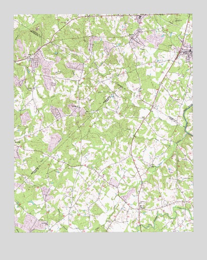
Midland, NC USGS Topographic Map
Click on map above to begin viewing in our Map Viewer.

This topographic map contains these locations and features:
Feature Name Type Latitude Longitude GNIS ID View Map
AllenPopulated PlaceN35.2260°W80.6140°980096View Map
Arlington Baptist ChurchChurchN35.2074°W80.6115°980282View Map
Arlington Church CemeteryCemeteryN35.2083°W80.6113°2778967View Map
Bethel ChurchChurchN35.2413°W80.5370°981124View Map
Bethel SchoolSchoolN35.2488°W80.5365°981183View Map
Bethlehem ChurchChurchN35.1418°W80.5370°981206View Map
Bethlehem Presbyterian Church CemeteryCemeteryN35.1415°W80.5364°2778838View Map
Black & Phillips American Legion Midland Post 433BuildingN35.2387°W80.5395°2723605View Map
BriefPopulated PlaceN35.1901°W80.5334°981883View Map
CabarrusPopulated PlaceN35.2371°W80.5417°1019462View Map
Clear CreekPopulated PlaceN35.2021°W80.6001°1001234View Map
Clear CreekStreamN35.1849°W80.5051°1019690View Map
Clear Creek (historical)Populated PlaceN35.2021°W80.5990°1001235View Map
Clear Creek ChurchChurchN35.1974°W80.5801°983255View Map
Clear Creek Church CemeteryCemeteryN35.1974°W80.5790°2778966View Map
Cockburns Post OfficePost OfficeN35.1385°W80.5376°1025070View Map
Duck CreekStreamN35.1735°W80.5131°984378View Map
Dulins Grove Advent Christian Church CemeteryCemeteryN35.2254°W80.6129°2778968View Map
Emmanuel CemeteryCemeteryN35.1310°W80.5569°984767View Map
FairviewPopulated PlaceN35.1385°W80.5376°1024890View Map
Fairview Fire and Rescue Association Station 3BuildingN35.1358°W80.5371°2638584View Map
Fairview SchoolSchoolN35.1396°W80.5367°1002221View Map
Far BranchStreamN35.2224°W80.5687°985002View Map
Goose CreekStreamN35.1815°W80.5040°985822View Map
Hopewell ChurchChurchN35.1626°W80.5287°987048View Map
Hopewell Church CemeteryCemeteryN35.1630°W80.5289°2778834View Map
Hornets Nest (historical)Populated PlaceN35.2085°W80.5781°1001292View Map
Long BranchStreamN35.2004°W80.5428°988893View Map
Macedonia ChurchChurchN35.2463°W80.5112°989176View Map
MidlandPopulated PlaceN35.2274°W80.5006°1021438View Map
Midland Post OfficePost OfficeN35.2332°W80.5063°2773856View Map
Midland Speedway (historical)BuildingN35.2115°W80.5109°1001178View Map
Midland Volunteer Fire DepartmentBuildingN35.2417°W80.5035°2638739View Map
Mill Grove ChurchChurchN35.2293°W80.5076°989968View Map
Mitchells LakeReservoirN35.1435°W80.6098°998437View Map
Mitchells Lake DamDamN35.1435°W80.6098°998438View Map
Rock Hill ChurchChurchN35.1301°W80.6023°993509View Map
Rock Hill Church CemeteryCemeteryN35.1303°W80.6020°2778839View Map
Rockhill School (historical)SchoolN35.1438°W80.5815°1001387View Map
Rockhill School (historical)SchoolN35.1438°W80.5817°1002222View Map
Sherman BranchStreamN35.2085°W80.5795°994665View Map
Town of FairviewCivilN35.1545°W80.5345°2406481View Map
Town of MidlandCivilN35.2451°W80.5212°2406159View Map
Union CemeteryCemeteryN35.1778°W80.5190°996421View Map
Wayside ChurchChurchN35.2007°W80.5126°996894View Map
Wiley BranchStreamN35.2160°W80.5645°997324View Map

Note: Coordinates in the location and feature list above are referenced to NAD83 datum.


Copyright (C) 2008-2024 Ryan Niemi / Sunset Dynamics ... All Rights Reserved