TopoQuest Logo
Do you find TopoQuest useful?
Help keep TopoQuest running and adding new maps/features by donating!
Bitcoin:  19c7KJd3qBynnjoSw5npx9KScwjBe4ifkT
Litecoin:  LXs6TkuXGGXo1vDsWCkWVdjQX94eUKd6ui
Home View Maps Find Maps Find Places Resources & Links


Concord SE, North Carolina Topographic Map

USGS Map Title: Concord SE, NC
USGS Map MRC: 35080C5
DRG (GeoTIFF) Download: o35080c5.tif


Neighboring USGS Topographic Map Quads:


  Kannapolis, NC  
35080D6
 

  Concord, NC  
35080D5
 

  Mount Pleasant, NC  
35080D4
 

  Harrisburg, NC  
35080C6
 

  Concord SE, NC  
35080C5
 

  Locust, NC  
35080C4
 

  Mint Hill, NC  
35080B6
 

  Midland, NC  
35080B5
 

  Stanfield, NC  
35080B4


Map MRC Location:

N36°
W81°
N36°
W80°
H8 H7 H6 H5 H4 H3 H2 H1
G8 G7 G6 G5 G4 G3 G2 G1
F8 F7 F6 F5 F4 F3 F2 F1
E8 E7 E6 E5 E4 E3 E2 E1
D8 D7 D6 D5 D4 D3 D2 D1
C8 C7 C6 C5 C4 C3 C2 C1
B8 B7 B6 B5 B4 B3 B2 B1
A8 A7 A6 A5 A4 A3 A2 A1
N35°
W81°
N35°
W80°

Concord SE, NC USGS 1:24K Topographic Map Preview:
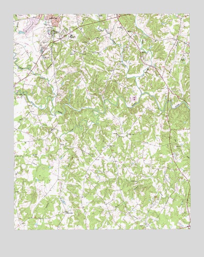
Concord SE, NC USGS Topographic Map
Click on map above to begin viewing in our Map Viewer.

This topographic map contains these locations and features:
Feature Name Type Latitude Longitude GNIS ID View Map
Allen SchoolSchoolN35.3651°W80.5437°980114View Map
Allen Volunteer Fire DepartmentBuildingN35.3614°W80.5419°2638693View Map
Back CreekStreamN35.3163°W80.5956°1018892View Map
Benton School (historical)SchoolN35.2554°W80.5903°1001136View Map
Bethany ChurchChurchN35.3526°W80.5337°981074View Map
Bogers ChapelChurchN35.3054°W80.5440°981679View Map
Cabarrus County Emergency Medical Services Station 2BuildingN35.3657°W80.5835°2720328View Map
Caldwell CreekStreamN35.3038°W80.5920°982416View Map
Carrikers StoreLocaleN35.2532°W80.5517°1001148View Map
Cedar Grove ChurchChurchN35.3051°W80.5509°982843View Map
Central Cabarrus High SchoolSchoolN35.3627°W80.5839°982950View Map
Coddle CreekStreamN35.3249°W80.5976°1019715View Map
Cold Water CreekStreamN35.3290°W80.5342°983359View Map
Collins PondLakeN35.3694°W80.5169°1001154View Map
Concord Fire and Life Safety Station 8BuildingN35.3619°W80.5954°2639826View Map
Ebenezer ChurchChurchN35.2524°W80.5317°984588View Map
Ebenezer SchoolSchoolN35.2532°W80.5267°1001163View Map
Faggarts CrossroadsPopulated PlaceN35.3615°W80.5428°1001166View Map
Flowes Store Volunteer Fire DepartmentBuildingN35.2980°W80.5582°2639574View Map
Flows StorePopulated PlaceN35.2990°W80.5576°985243View Map
Frank Liske ParkParkN35.3746°W80.6234°1001167View Map
Hamby BranchStreamN35.3240°W80.5037°986332View Map
Horton BranchStreamN35.2743°W80.5245°987151View Map
Howell ChurchChurchN35.2982°W80.5098°987192View Map
Irish Buffalo CreekStreamN35.3385°W80.5384°987396View Map
Jackson Park Volunteer Fire DepartmentBuildingN35.3722°W80.5985°2639148View Map
Jackson Training SchoolSchoolN35.3657°W80.5970°987500View Map
Jackson Training School LakeReservoirN35.3645°W80.6192°998874View Map
Jackson Training School Lake DamDamN35.3651°W80.6215°998873View Map
Kirkland (historical)Populated PlaceN35.3404°W80.5976°1001174View Map
Mount Hermon ChurchChurchN35.3671°W80.5473°990404View Map
Oak Ridge ChurchChurchN35.3426°W80.5542°991440View Map
Pharrs MillPopulated PlaceN35.3285°W80.6178°1006327View Map
Pine Grove ChurchChurchN35.2943°W80.5720°992241View Map
Piney Grove ChurchChurchN35.3526°W80.5645°992347View Map
Pioneer MillsPopulated PlaceN35.2604°W80.5887°1006333View Map
Plum RunStreamN35.3347°W80.5072°2071277View Map
Reedy CreekStreamN35.3185°W80.5653°993189View Map
Reeves ChapelChurchN35.3493°W80.5048°993218View Map
Rocky Ridge ChurchChurchN35.3665°W80.5973°993615View Map
Rocky RiverPopulated PlaceN35.3063°W80.5978°1001186View Map
Rocky River ChurchChurchN35.3076°W80.5981°993619View Map
Township 1-HarrisburgCivilN35.2980°W80.6144°1026470View Map
Township 10, MidlandCivilN35.2610°W80.5187°1026479View Map
Township 11-Central CabarrusCivilN35.3709°W80.5519°1026480View Map
United ChurchChurchN35.3518°W80.5823°996522View Map
Zion Hill ChurchChurchN35.3588°W80.5726°997798View Map

Note: Coordinates in the location and feature list above are referenced to NAD83 datum.


Copyright (C) 2008-2024 Ryan Niemi / Sunset Dynamics ... All Rights Reserved