TopoQuest Logo
Do you find TopoQuest useful?
Help keep TopoQuest running and adding new maps/features by donating!
Bitcoin:  19c7KJd3qBynnjoSw5npx9KScwjBe4ifkT
Litecoin:  LXs6TkuXGGXo1vDsWCkWVdjQX94eUKd6ui
Home View Maps Find Maps Find Places Resources & Links


Mikado, Michigan Topographic Map

USGS Map Title: Mikado, MI
USGS Map MRC: 44083E4
DRG (GeoTIFF) Download: o44083e4.tif


Neighboring USGS Topographic Map Quads:


  Barton City, MI  
44083F5
 

  Lincoln, MI  
44083F4
 

  Harrisville, MI  
44083F3
 

  Sprinkler Lake, MI  
44083E5
 

  Mikado, MI  
44083E4
 

  Greenbush, MI  
44083E3
 

  Sid Town, MI  
44083D5
 

  Foote Site Village, MI  
44083D4
 

  Oscoda, MI  
44083D3


Map MRC Location:

N45°
W84°
N45°
W83°
H8 H7 H6 H5 H4 H3 H2 H1
G8 G7 G6 G5 G4 G3 G2 G1
F8 F7 F6 F5 F4 F3 F2 F1
E8 E7 E6 E5 E4 E3 E2 E1
D8 D7 D6 D5 D4 D3 D2 D1
C8 C7 C6 C5 C4 C3 C2 C1
B8 B7 B6 B5 B4 B3 B2 B1
A8 A7 A6 A5 A4 A3 A2 A1
N44°
W84°
N44°
W83°

Mikado, MI USGS 1:24K Topographic Map Preview:
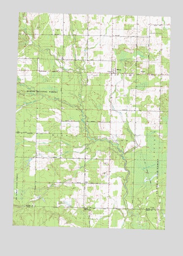
Mikado, MI USGS Topographic Map
Click on map above to begin viewing in our Map Viewer.

This topographic map contains these locations and features:
Feature Name Type Latitude Longitude GNIS ID View Map
Alpena State ForestForestN44.5228°W83.4958°620019View Map
AlvinPopulated PlaceN44.5245°W83.4425°1617414View Map
Alvin Post Office (historical)Post OfficeN44.5244°W83.4425°2498699View Map
Backus CreekStreamN44.6072°W83.4891°620412View Map
Bruce ParkParkN44.5911°W83.4172°1622885View Map
Calvary ChurchChurchN44.5903°W83.4075°622491View Map
Coppler CreekStreamN44.5061°W83.4014°623814View Map
County Line SchoolSchoolN44.5120°W83.3841°1617102View Map
Duval CreekStreamN44.5450°W83.4139°625044View Map
East Branch Pine RiverStreamN44.5931°W83.4491°625144View Map
Gimlet CreekStreamN44.5831°W83.4972°626840View Map
Grey CreekStreamN44.5486°W83.4403°627420View Map
Hill CreekStreamN44.5086°W83.4019°628275View Map
McDonald CreekStreamN44.5764°W83.4778°631871View Map
McGillis CreekStreamN44.5775°W83.4836°631896View Map
MikadoPopulated PlaceN44.5908°W83.4227°632295View Map
Mikado Branch LibraryBuildingN44.5908°W83.4278°2498712View Map
Mikado Post OfficePost OfficeN44.5908°W83.4306°2498711View Map
Mikado Station (historical)LocaleN44.5908°W83.4194°2498709View Map
Mikado Township CemeteryCemeteryN44.5915°W83.4053°2498773View Map
Mikado Township Volunteer Fire DepartmentBuildingN44.5920°W83.4230°2498710View Map
Oscoda Indian MissionChurchN44.5111°W83.4419°634133View Map
Reorganized ChurchChurchN44.5917°W83.3966°1617101View Map
Roy CreekStreamN44.5514°W83.4339°636350View Map
Roy Post Office (historical)Post OfficeN44.5419°W83.3944°2498686View Map
Roy Station (historical)LocaleN44.5419°W83.3944°2498683View Map
Saint Raphael ChurchChurchN44.5914°W83.4214°1617103View Map
South Branch Pine RiverStreamN44.5692°W83.4466°638305View Map
Van Etten CreekStreamN44.5445°W83.4111°1615472View Map
West Branch Pine RiverStreamN44.5906°W83.4489°1616061View Map
WXJD-FM (Oscoda)TowerN44.6203°W83.4875°1625748View Map

Note: Coordinates in the location and feature list above are referenced to NAD83 datum.


Copyright (C) 2008-2025 Ryan Niemi / Sunset Dynamics ... All Rights Reserved