TopoQuest Logo
Do you find TopoQuest useful?
Help keep TopoQuest running and adding new maps/features by donating!
Bitcoin:  19c7KJd3qBynnjoSw5npx9KScwjBe4ifkT
Litecoin:  LXs6TkuXGGXo1vDsWCkWVdjQX94eUKd6ui
Home View Maps Find Maps Find Places Resources & Links


Foote Site Village, Michigan Topographic Map

USGS Map Title: Foote Site Village, MI
USGS Map MRC: 44083D4
DRG (GeoTIFF) Download: o44083d4.tif


Neighboring USGS Topographic Map Quads:


  Sprinkler Lake, MI  
44083E5
 

  Mikado, MI  
44083E4
 

  Greenbush, MI  
44083E3
 

  Sid Town, MI  
44083D5
 

  Foote Site Village, MI  
44083D4
 

  Oscoda, MI  
44083D3
 

  Tawas City, MI  
44083C5
 

  East Tawas, MI  
44083C4
 

  Spencer Lake, MI  
44083C3


Map MRC Location:

N45°
W84°
N45°
W83°
H8 H7 H6 H5 H4 H3 H2 H1
G8 G7 G6 G5 G4 G3 G2 G1
F8 F7 F6 F5 F4 F3 F2 F1
E8 E7 E6 E5 E4 E3 E2 E1
D8 D7 D6 D5 D4 D3 D2 D1
C8 C7 C6 C5 C4 C3 C2 C1
B8 B7 B6 B5 B4 B3 B2 B1
A8 A7 A6 A5 A4 A3 A2 A1
N44°
W84°
N44°
W83°

Foote Site Village, MI USGS 1:24K Topographic Map Preview:
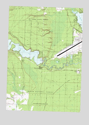
Foote Site Village, MI USGS Topographic Map
Click on map above to begin viewing in our Map Viewer.

This topographic map contains these locations and features:
Feature Name Type Latitude Longitude GNIS ID View Map
Allen LakeLakeN44.4346°W83.4162°619981View Map
Camp NissokoneLocaleN44.4781°W83.3802°622614View Map
Chippewa CemeteryCemeteryN44.4972°W83.4400°623214View Map
Dry CreekStreamN44.4828°W83.3852°624897View Map
Foote DamDamN44.4357°W83.4410°626217View Map
Foote Dam PondReservoirN44.4500°W83.4888°626218View Map
Foote Site VillagePopulated PlaceN44.4267°W83.4447°626220View Map
Indian CreekStreamN44.3992°W83.4844°628974View Map
Loud CreekStreamN44.3992°W83.4850°631124View Map
Old Orchard ParkParkN44.4433°W83.4797°634010View Map
Old Orchard Park CampgroundLocaleN44.4461°W83.4861°2513839View Map
Oscoda Fire Department Station 2BuildingN44.4285°W83.4468°2626827View Map
Oscoda High SchoolSchoolN44.4242°W83.3772°1617125View Map
Pine RiverStreamN44.4939°W83.3877°634987View Map
Richardson SchoolSchoolN44.4228°W83.3825°1617127View Map
River Road SchoolSchoolN44.4245°W83.3819°1617126View Map
Sevenmile Hill Lookout TowerTowerN44.4500°W83.4308°1623620View Map
State DitchCanalN44.4025°W83.3819°638758View Map
WilberPopulated PlaceN44.3897°W83.4878°1616427View Map
Wilber Post Office (historical)Post OfficeN44.3897°W83.4878°2513909View Map
Wurtsmith Air Force Base (historical)MilitaryN44.4525°W83.3803°2090479View Map

Note: Coordinates in the location and feature list above are referenced to NAD83 datum.


Copyright (C) 2008-2024 Ryan Niemi / Sunset Dynamics ... All Rights Reserved