TopoQuest Logo
Do you find TopoQuest useful?
Help keep TopoQuest running and adding new maps/features by donating!
Bitcoin:  19c7KJd3qBynnjoSw5npx9KScwjBe4ifkT
Litecoin:  LXs6TkuXGGXo1vDsWCkWVdjQX94eUKd6ui
Home View Maps Find Maps Find Places Resources & Links


Milano, Texas Topographic Map

USGS Map Title: Milano, TX
USGS Map MRC: 30096F7
DRG (GeoTIFF) Download: o30096f7.tif


Neighboring USGS Topographic Map Quads:


  Cameron, TX  
30096G8
 

  Hanover, TX  
30096G7
 

  Gause, TX  
30096G6
 

  Rockdale East, TX  
30096F8
 

  Milano, TX  
30096F7
 

  Goodwill, TX  
30096F6
 

  Hicks, TX  
30096E8
 

  Chriesman, TX  
30096E7
 

  Caldwell, TX  
30096E6


Map MRC Location:

N31°
W97°
N31°
W96°
H8 H7 H6 H5 H4 H3 H2 H1
G8 G7 G6 G5 G4 G3 G2 G1
F8 F7 F6 F5 F4 F3 F2 F1
E8 E7 E6 E5 E4 E3 E2 E1
D8 D7 D6 D5 D4 D3 D2 D1
C8 C7 C6 C5 C4 C3 C2 C1
B8 B7 B6 B5 B4 B3 B2 B1
A8 A7 A6 A5 A4 A3 A2 A1
N30°
W97°
N30°
W96°

Milano, TX USGS 1:24K Topographic Map Preview:
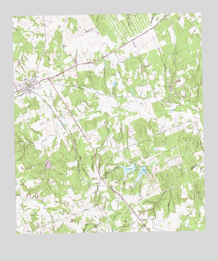
Milano, TX USGS Topographic Map
Click on map above to begin viewing in our Map Viewer.

This topographic map contains these locations and features:
Feature Name Type Latitude Longitude GNIS ID View Map
American Medical Response Ambulance Service Station 3BuildingN30.7090°W96.8639°2655794View Map
Bee BranchStreamN30.6958°W96.7678°1351749View Map
Buer BranchStreamN30.6860°W96.8425°1353183View Map
Bullock LakeReservoirN30.7057°W96.7968°1865232View Map
Bullock Lake DamDamN30.7035°W96.7969°1865231View Map
Cedar ParkParkN30.7327°W96.8014°1354139View Map
City of MilanoCivilN30.7083°W96.8593°2411103View Map
Copperas BranchStreamN30.6280°W96.8161°1354971View Map
Dave HollowValleyN30.6706°W96.7760°1967698View Map
Devils HollowValleyN30.6708°W96.7747°1355967View Map
ElevationPopulated PlaceN30.6535°W96.8189°1379710View Map
Ferguson BranchStreamN30.6677°W96.7841°1357290View Map
Foster BranchStreamN30.6869°W96.7514°1357610View Map
Friendship ChurchChurchN30.6321°W96.7922°1357745View Map
Gause-Milano DivisionCivilN30.7393°W96.7943°1938774View Map
Hammond BranchStreamN30.6708°W96.8205°1358707View Map
Harpers BranchStreamN30.6966°W96.8061°1358829View Map
Hurt - Graham CemeteryCemeteryN30.6560°W96.8214°1359858View Map
Jakes SpringSpringN30.7324°W96.8419°1360137View Map
Jeter CemeteryCemeteryN30.6824°W96.8278°2042278View Map
Langford BranchStreamN30.6944°W96.7911°1360933View Map
Lee Garden Springs CemeteryCemeteryN30.6752°W96.8472°2042275View Map
Lin Luce BranchStreamN30.6944°W96.7553°1361213View Map
MilanoPopulated PlaceN30.7105°W96.8633°1362829View Map
Milano City OfficesBuildingN30.7088°W96.8648°2753826View Map
Milano Post OfficePost OfficeN30.7077°W96.8666°2731337View Map
Milano Volunteer Fire DepartmentBuildingN30.7088°W96.8648°2552314View Map
Moore BranchStreamN30.6871°W96.8411°1363093View Map
Newton Lake Number 1ReservoirN30.6615°W96.7994°1858945View Map
Newton Lake Number 1 DamDamN30.6619°W96.7953°1858944View Map
Newton Lake Number 2ReservoirN30.6591°W96.7914°1858943View Map
Newton Lake Number 2 DamDamN30.6585°W96.7886°1858942View Map
Newton LakesReservoirN30.6647°W96.7829°1363865View Map
Rail HollowValleyN30.6530°W96.7739°1365956View Map
Sand Grove ChurchChurchN30.6394°W96.8530°1367600View Map
Sand Point CemeteryCemeteryN30.6644°W96.8314°1367632View Map
Santana Ruize CemeteryCemeteryN30.7088°W96.8603°2042276View Map
Sewell BranchStreamN30.6708°W96.7747°1368003View Map
Smyrna CemeteryCemeteryN30.7194°W96.7886°1368528View Map
Sugar Mill BranchStreamN30.6338°W96.8228°1369319View Map
Swanzy BranchStreamN30.6949°W96.7686°1369453View Map
Texas No Name Number 50 DamDamN30.7152°W96.7903°1865229View Map
Texas No Name Number 50 LakeReservoirN30.7152°W96.7903°1865230View Map
Tyson CemeteryCemeteryN30.6699°W96.8211°2042273View Map
Wolf CemeteryCemeteryN30.7249°W96.8480°2043296View Map
Zalmanek LakeReservoirN30.6648°W96.8537°1858941View Map
Zalmanek Lake DamDamN30.6669°W96.8536°1858940View Map

Note: Coordinates in the location and feature list above are referenced to NAD83 datum.


Copyright (C) 2008-2025 Ryan Niemi / Sunset Dynamics ... All Rights Reserved