TopoQuest Logo
Do you find TopoQuest useful?
Help keep TopoQuest running and adding new maps/features by donating!
Bitcoin:  19c7KJd3qBynnjoSw5npx9KScwjBe4ifkT
Litecoin:  LXs6TkuXGGXo1vDsWCkWVdjQX94eUKd6ui
Home View Maps Find Maps Find Places Resources & Links


Caldwell, Texas Topographic Map

USGS Map Title: Caldwell, TX
USGS Map MRC: 30096E6
DRG (GeoTIFF) Download: o30096e6.tif


Neighboring USGS Topographic Map Quads:


  Milano, TX  
30096F7
 

  Goodwill, TX  
30096F6
 

  Mumford, TX  
30096F5
 

  Chriesman, TX  
30096E7
 

  Caldwell, TX  
30096E6
 

  Tunis, TX  
30096E5
 

  Deanville, TX  
30096D7
 

  Frenstat, TX  
30096D6
 

  Lyons, TX  
30096D5


Map MRC Location:

N31°
W97°
N31°
W96°
H8 H7 H6 H5 H4 H3 H2 H1
G8 G7 G6 G5 G4 G3 G2 G1
F8 F7 F6 F5 F4 F3 F2 F1
E8 E7 E6 E5 E4 E3 E2 E1
D8 D7 D6 D5 D4 D3 D2 D1
C8 C7 C6 C5 C4 C3 C2 C1
B8 B7 B6 B5 B4 B3 B2 B1
A8 A7 A6 A5 A4 A3 A2 A1
N30°
W97°
N30°
W96°

Caldwell, TX USGS 1:24K Topographic Map Preview:
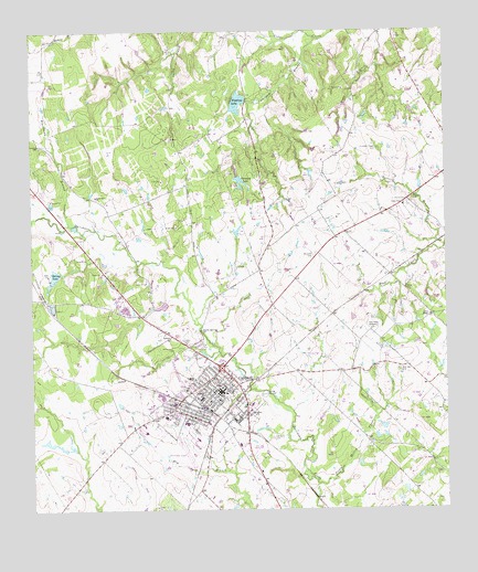
Caldwell, TX USGS Topographic Map
Click on map above to begin viewing in our Map Viewer.

This topographic map contains these locations and features:
Feature Name Type Latitude Longitude GNIS ID View Map
Blackhawk BranchStreamN30.5746°W96.7389°1352368View Map
Burleson County Constable's Office Precinct 2BuildingN30.5321°W96.6932°2739330View Map
Burleson County Constable's Office Precinct 3BuildingN30.5320°W96.6932°2739363View Map
Burleson County Czech Heritage MuseumBuildingN30.5313°W96.6936°2014253View Map
Burleson County Historical MuseumBuildingN30.5330°W96.6914°2014254View Map
Burleson County Hospital HeliportAirportN30.5213°W96.7161°1386327View Map
Burleson County JailBuildingN30.5247°W96.7105°2738757View Map
Burleson Saint Joseph Health CenterHospitalN30.5202°W96.7163°2015638View Map
CaldwellPopulated PlaceN30.5313°W96.6930°1353534View Map
Caldwell City HallBuildingN30.5310°W96.6940°2753379View Map
Caldwell Elementary SchoolSchoolN30.5255°W96.7105°2003809View Map
Caldwell Middle SchoolSchoolN30.5338°W96.6941°2003812View Map
Caldwell Municipal AirportAirportN30.5178°W96.7064°1386326View Map
Caldwell Police DepartmentBuildingN30.5279°W96.7145°2739175View Map
Caldwell Post OfficePost OfficeN30.5334°W96.6947°2732241View Map
Caldwell Volunteer Fire and Rescue DepartmentBuildingN30.5301°W96.6935°2552198View Map
Calvary ChurchChurchN30.5446°W96.7086°1353576View Map
City of CaldwellCivilN30.5307°W96.7006°2409957View Map
Cooks Point ChurchChurchN30.5794°W96.6378°1354908View Map
Cooks Point DivisionCivilN30.6244°W96.6270°1938643View Map
Elizabeth CemeteryCemeteryN30.5669°W96.6647°1356905View Map
Elizabeth Chapel CemeteryCemeteryN30.5942°W96.6452°1356906View Map
Gallilee ChurchChurchN30.5255°W96.6836°1357830View Map
Garwood LakeLakeN30.5863°W96.6875°1357908View Map
Garwood LakeReservoirN30.5838°W96.6866°1854364View Map
Garwood Lake DamDamN30.5869°W96.6886°1854363View Map
Gibbs LakeReservoirN30.5632°W96.6285°1854366View Map
Gibbs Lake DamDamN30.5652°W96.6286°1854365View Map
Hus SchoolSchoolN30.5505°W96.6319°1359859View Map
Kramer CemeteryCemeteryN30.5802°W96.6364°1360764View Map
Lake Woodrow DamDamN30.6069°W96.6853°1854361View Map
Masonic CemeteryCemeteryN30.5205°W96.7011°1362262View Map
New Tabor Brethren ChurchChurchN30.5469°W96.6480°1363782View Map
New Tabor CemeteryCemeteryN30.5369°W96.6391°1363783View Map
Oak Grove CemeteryCemeteryN30.5185°W96.6778°1364267View Map
Pecan Hollow CreekStreamN30.5069°W96.6641°1364978View Map
Porter BranchStreamN30.5685°W96.6258°1365598View Map
Reeves-Womack HouseBuildingN30.5299°W96.6958°2031700View Map
Rollin CemeteryCemeteryN30.5444°W96.7044°1366834View Map
Saint Marys ChurchChurchN30.5341°W96.7014°1367265View Map
Scotts SpringSpringN30.5471°W96.6990°1367894View Map
Seven Star ChurchChurchN30.5821°W96.7308°1367981View Map
Slovak CemeteryCemeteryN30.5577°W96.6372°1368443View Map
Spring LakeReservoirN30.5612°W96.7432°1369022View Map
Spring Lake DamDamN30.5608°W96.7436°1854367View Map
Sweetgum BranchStreamN30.6227°W96.6636°1369474View Map
Weber Ranch AirportAirportN30.5838°W96.6346°1386328View Map
Woodrow LakeReservoirN30.6065°W96.6876°1854362View Map

Note: Coordinates in the location and feature list above are referenced to NAD83 datum.


Copyright (C) 2008-2025 Ryan Niemi / Sunset Dynamics ... All Rights Reserved