TopoQuest Logo
Do you find TopoQuest useful?
Help keep TopoQuest running and adding new maps/features by donating!
Bitcoin:  19c7KJd3qBynnjoSw5npx9KScwjBe4ifkT
Litecoin:  LXs6TkuXGGXo1vDsWCkWVdjQX94eUKd6ui
Home View Maps Find Maps Find Places Resources & Links


Milford Flat, Utah Topographic Map

USGS Map Title: Milford Flat, UT
USGS Map MRC: 38113C1
DRG (GeoTIFF) Download: o38113c1.tif


Neighboring USGS Topographic Map Quads:


  Milford NW, UT  
38113D2
 

  Milford, UT  
38113D1
 

  Ranch Canyon, UT  
38112D8
 

  Picacho Peak, UT  
38113C2
 

  Milford Flat, UT  
38113C1
 

  Cave Canyon, UT  
38112C8
 

  Thermo, UT  
38113B2
 

  Ninemile Knoll, UT  
38113B1
 

  Minersville, UT  
38112B8


Map MRC Location:

N39°
W114°
N39°
W113°
H8 H7 H6 H5 H4 H3 H2 H1
G8 G7 G6 G5 G4 G3 G2 G1
F8 F7 F6 F5 F4 F3 F2 F1
E8 E7 E6 E5 E4 E3 E2 E1
D8 D7 D6 D5 D4 D3 D2 D1
C8 C7 C6 C5 C4 C3 C2 C1
B8 B7 B6 B5 B4 B3 B2 B1
A8 A7 A6 A5 A4 A3 A2 A1
N38°
W114°
N38°
W113°

Milford Flat, UT USGS 1:24K Topographic Map Preview:
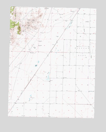
Milford Flat, UT USGS Topographic Map
Click on map above to begin viewing in our Map Viewer.

This topographic map contains these locations and features:
Feature Name Type Latitude Longitude GNIS ID View Map
Carlton WellWellN38.3677°W113.0541°1426359View Map
Cook CornerPopulated PlaceN38.2950°W113.0475°1437532View Map
Elephant CanyonValleyN38.3327°W113.1241°1427784View Map
Estelle MineMineN38.3539°W113.0988°1427843View Map
Flying M Ranch Airport (historical)AirportN38.3014°W113.0133°1434559View Map
Gold Crown MineMineN38.3475°W113.1047°1428230View Map
Grassy BendBendN38.2705°W113.0927°1428350View Map
Hay SpringsSpringN38.2975°W113.0688°1428597View Map
Hearn WellWellN38.3361°W113.0838°1428626View Map
LahoPopulated PlaceN38.2652°W113.1158°1437610View Map
Martin WellWellN38.3233°W113.0950°1430128View Map
Maud-S MineMineN38.3600°W113.0988°1430143View Map
Milford FlatFlatN38.3250°W113.0197°1430318View Map
Mollies NippleSummitN38.3750°W113.0741°1430407View Map
Rollins WellWellN38.3286°W113.0875°1431986View Map
Sand PondLakeN38.3085°W113.0864°1432201View Map
Smelter WellWellN38.3708°W113.0333°1432563View Map
Tadpole SpringsSpringN38.3558°W113.0383°1433172View Map
Tomsik WellWellN38.3311°W113.0841°1433586View Map
UptonPopulated PlaceN38.3241°W113.0663°1437708View Map
Vicksburg MineMineN38.3605°W113.0916°1433889View Map

Note: Coordinates in the location and feature list above are referenced to NAD83 datum.


Copyright (C) 2008-2025 Ryan Niemi / Sunset Dynamics ... All Rights Reserved