TopoQuest Logo
Do you find TopoQuest useful?
Help keep TopoQuest running and adding new maps/features by donating!
Bitcoin:  19c7KJd3qBynnjoSw5npx9KScwjBe4ifkT
Litecoin:  LXs6TkuXGGXo1vDsWCkWVdjQX94eUKd6ui
Home View Maps Find Maps Find Places Resources & Links


Picacho Peak, Utah Topographic Map

USGS Map Title: Picacho Peak, UT
USGS Map MRC: 38113C2
DRG (GeoTIFF) Download: o38113c2.tif


Neighboring USGS Topographic Map Quads:


  Frisco, UT  
38113D3
 

  Milford NW, UT  
38113D2
 

  Milford, UT  
38113D1
 

  White Mountain, UT  
38113C3
 

  Picacho Peak, UT  
38113C2
 

  Milford Flat, UT  
38113C1
 

  Burns Knoll, UT  
38113B3
 

  Thermo, UT  
38113B2
 

  Ninemile Knoll, UT  
38113B1


Map MRC Location:

N39°
W114°
N39°
W113°
H8 H7 H6 H5 H4 H3 H2 H1
G8 G7 G6 G5 G4 G3 G2 G1
F8 F7 F6 F5 F4 F3 F2 F1
E8 E7 E6 E5 E4 E3 E2 E1
D8 D7 D6 D5 D4 D3 D2 D1
C8 C7 C6 C5 C4 C3 C2 C1
B8 B7 B6 B5 B4 B3 B2 B1
A8 A7 A6 A5 A4 A3 A2 A1
N38°
W114°
N38°
W113°

Picacho Peak, UT USGS 1:24K Topographic Map Preview:
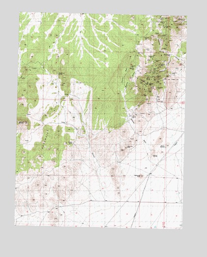
Picacho Peak, UT USGS Topographic Map
Click on map above to begin viewing in our Map Viewer.

This topographic map contains these locations and features:
Feature Name Type Latitude Longitude GNIS ID View Map
Atlas MineMineN38.3369°W113.1422°1425201View Map
Beaver CountyCivilN38.3570°W113.2357°1448015View Map
Cedar Talisman MineMineN38.3711°W113.1430°1426490View Map
Commonwealth MineMineN38.3361°W113.1486°1426822View Map
Hoosier Boy MineMineN38.3605°W113.1558°1428811View Map
Hub MineMineN38.3389°W113.1527°1428928View Map
Lady Bryan MineMineN38.3350°W113.1558°1429405View Map
Leonora MineMineN38.3627°W113.1436°1429589View Map
Long Lick CanyonValleyN38.2683°W113.1827°1429908View Map
Long Lick MountainSummitN38.3100°W113.2439°1429909View Map
Lucky Find MineMineN38.3411°W113.1361°1430007View Map
Magnolia MineMineN38.3155°W113.1636°1430038View Map
Mammoth CanyonValleyN38.3522°W113.1366°1430069View Map
Mammoth Lode MineMineN38.2922°W113.1491°1430070View Map
Mammoth MineMineN38.3455°W113.1441°1430071View Map
Moscow CanyonValleyN38.3327°W113.1700°1430508View Map
Moscow MineMineN38.3414°W113.1500°1430509View Map
Moscow ReservoirReservoirN38.2987°W113.1403°1430510View Map
Moscow WashValleyN38.2972°W113.1519°1430511View Map
Mowitza MineMineN38.3505°W113.1505°1430542View Map
Picacho PeakSummitN38.3383°W113.1505°1431214View Map
Progressive MineMineN38.3325°W113.1477°1431479View Map
Red Warrior MineMineN38.3464°W113.1477°1431708View Map
Saint Marys MineMineN38.3302°W113.1508°1432120View Map
ShauntiePopulated PlaceN38.3411°W113.1666°1437680View Map
Shauntie HillsSummitN38.2697°W113.2339°1432364View Map
Shauntie WashValleyN38.3297°W113.1733°1432365View Map
Shauntie WellWellN38.3444°W113.1666°1432366View Map
Shenendoah CityPopulated PlaceN38.3522°W113.1372°1437682View Map
Sonny Boy MineMineN38.3400°W113.1422°1432630View Map
South CampLocaleN38.3241°W113.1419°1432650View Map
Topache PeakSummitN38.3339°W113.1536°1433593View Map
Twelvemile KnollSummitN38.2805°W113.1577°1433718View Map
Velvet Silver MineMineN38.2972°W113.1680°1433880View Map
Wheeler SpringSpringN38.2994°W113.2088°1434144View Map
Woodhouse SpringSpringN38.3395°W113.2206°1434457View Map

Note: Coordinates in the location and feature list above are referenced to NAD83 datum.


Copyright (C) 2008-2025 Ryan Niemi / Sunset Dynamics ... All Rights Reserved