TopoQuest Logo
Do you find TopoQuest useful?
Help keep TopoQuest running and adding new maps/features by donating!
Bitcoin:  19c7KJd3qBynnjoSw5npx9KScwjBe4ifkT
Litecoin:  LXs6TkuXGGXo1vDsWCkWVdjQX94eUKd6ui
Home View Maps Find Maps Find Places Resources & Links


Beaver Creek Hills, Wyoming Topographic Map

USGS Map Title: Beaver Creek Hills, WY
USGS Map MRC: 44107F1
DRG (GeoTIFF) Download: o44107f1.tif


Neighboring USGS Topographic Map Quads:


  Wolf, WY  
44107G2
 

  Hultz Draw, WY  
44107G1
 

  Sheridan, WY  
44106G8
 

  Beckton, WY  
44107F2
 

  Beaver Creek Hills, WY  
44107F1
 

  Big Horn, WY  
44106F8
 

  Park Reservoir, WY  
44107E2
 

  Little Goose Peak, WY  
44107E1
 

  Story, WY  
44106E8


Map MRC Location:

N45°
W108°
N45°
W107°
H8 H7 H6 H5 H4 H3 H2 H1
G8 G7 G6 G5 G4 G3 G2 G1
F8 F7 F6 F5 F4 F3 F2 F1
E8 E7 E6 E5 E4 E3 E2 E1
D8 D7 D6 D5 D4 D3 D2 D1
C8 C7 C6 C5 C4 C3 C2 C1
B8 B7 B6 B5 B4 B3 B2 B1
A8 A7 A6 A5 A4 A3 A2 A1
N44°
W108°
N44°
W107°

Beaver Creek Hills, WY USGS 1:24K Topographic Map Preview:
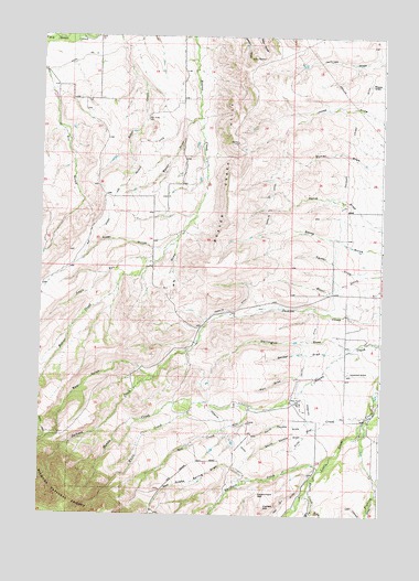
Beaver Creek Hills, WY USGS Topographic Map
Click on map above to begin viewing in our Map Viewer.

This topographic map contains these locations and features:
Feature Name Type Latitude Longitude GNIS ID View Map
Alder GulchValleyN44.6977°W107.0756°1597705View Map
Apple RunStreamN44.6908°W107.0840°1597789View Map
Baker DrawValleyN44.7289°W107.0692°1597875View Map
Barr DrawValleyN44.6611°W107.0306°1597933View Map
Bear GulchValleyN44.6611°W107.0837°1598012View Map
Beaver Creek HillsRangeN44.7225°W107.0542°1598067View Map
Big Goose and Beaver DitchCanalN44.7125°W107.0931°1598148View Map
Bracket Number 3 DamDamN44.7266°W107.1223°1608060View Map
Bracket Number 3 ReservoirReservoirN44.7266°W107.1223°1608061View Map
Colorado Colony DitchCanalN44.7411°W107.0101°1604329View Map
Curlew HillSummitN44.6275°W107.0426°1599081View Map
Darlington DrawValleyN44.6691°W107.0120°1599119View Map
Davis CreekStreamN44.6347°W107.0248°1599127View Map
Ditch Number 9CanalN44.7416°W107.1187°1605257View Map
East Fork Davis CreekStreamN44.6269°W107.0245°1599466View Map
Gallatin DrawValleyN44.6297°W107.0009°1599893View Map
Garber DrawValleyN44.6680°W107.0145°1599904View Map
Government GapGapN44.6308°W107.0445°1599995View Map
Hill CreekStreamN44.6533°W107.0470°1600341View Map
Hurlburt CreekStreamN44.6369°W107.0223°1600467View Map
Jerry Johns Reservoir Number 1ReservoirN44.7166°W107.0173°1608047View Map
Jerry Johns Reservoir Number 1 DamDamN44.7166°W107.0173°1608046View Map
Lone Star CreekStreamN44.6511°W107.0056°1601084View Map
North Coyote DrawValleyN44.6491°W107.0273°1601734View Map
Peralta DitchCanalN44.6825°W107.0495°1602098View Map
Red Grade Spring DrawValleyN44.6344°W107.0465°1602445View Map
Sheridan South DivisionCivilN44.6371°W107.0083°1939737View Map
South Coyote DrawValleyN44.6491°W107.0273°1603106View Map
Trabing CreekStreamN44.6497°W107.0067°1603719View Map
W S DrawValleyN44.6955°W107.0756°1603939View Map
West Fork Davis CreekStreamN44.6269°W107.0245°1604050View Map
White CreekStreamN44.6541°W107.0692°1604138View Map

Note: Coordinates in the location and feature list above are referenced to NAD83 datum.


Copyright (C) 2008-2024 Ryan Niemi / Sunset Dynamics ... All Rights Reserved