TopoQuest Logo
Do you find TopoQuest useful?
Help keep TopoQuest running and adding new maps/features by donating!
Bitcoin:  19c7KJd3qBynnjoSw5npx9KScwjBe4ifkT
Litecoin:  LXs6TkuXGGXo1vDsWCkWVdjQX94eUKd6ui
Home View Maps Find Maps Find Places Resources & Links


Big Horn, Wyoming Topographic Map

USGS Map Title: Big Horn, WY
USGS Map MRC: 44106F8
DRG (GeoTIFF) Download: o44106f8.tif


Neighboring USGS Topographic Map Quads:


  Hultz Draw, WY  
44107G1
 

  Sheridan, WY  
44106G8
 

  Wyarno, WY  
44106G7
 

  Beaver Creek Hills, WY  
44107F1
 

  Big Horn, WY  
44106F8
 

  Buffalo Run Creek, WY  
44106F7
 

  Little Goose Peak, WY  
44107E1
 

  Story, WY  
44106E8
 

  Banner, WY  
44106E7


Map MRC Location:

N45°
W107°
N45°
W106°
H8 H7 H6 H5 H4 H3 H2 H1
G8 G7 G6 G5 G4 G3 G2 G1
F8 F7 F6 F5 F4 F3 F2 F1
E8 E7 E6 E5 E4 E3 E2 E1
D8 D7 D6 D5 D4 D3 D2 D1
C8 C7 C6 C5 C4 C3 C2 C1
B8 B7 B6 B5 B4 B3 B2 B1
A8 A7 A6 A5 A4 A3 A2 A1
N44°
W107°
N44°
W106°

Big Horn, WY USGS 1:24K Topographic Map Preview:
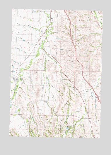
Big Horn, WY USGS Topographic Map
Click on map above to begin viewing in our Map Viewer.

This topographic map contains these locations and features:
Feature Name Type Latitude Longitude GNIS ID View Map
Allen DamDamN44.6516°W106.9640°1606760View Map
Allen ReservoirReservoirN44.6516°W106.9640°1606761View Map
Big HornPopulated PlaceN44.6833°W106.9923°1585474View Map
Big Horn CemeteryCemeteryN44.6739°W106.9717°1585475View Map
Big Horn Census Designated PlaceCensusN44.6791°W106.9971°2407840View Map
Big Horn High SchoolSchoolN44.6833°W106.9923°1795606View Map
Big Horn Middle SchoolSchoolN44.6833°W106.9923°1795607View Map
Big Horn Post OfficePost OfficeN44.6806°W106.9919°2767888View Map
Big Horn Rest HomeHospitalN44.6833°W106.9923°1794861View Map
Big Horn SchoolSchoolN44.6833°W106.9923°1795608View Map
Big Horn Volunteer Fire DepartmentBuildingN44.6816°W106.9920°2673675View Map
Chapparal DrawValleyN44.6714°W106.9170°1586584View Map
Coyote CreekStreamN44.7275°W106.9417°1587136View Map
Denio DrawValleyN44.6947°W106.9801°1599223View Map
Duncan DamDamN44.6583°W106.8790°1606798View Map
Duncan ReservoirReservoirN44.6583°W106.8790°1606799View Map
East Fork Kruse CreekStreamN44.6833°W106.9501°1599478View Map
East Fork Sackett CreekStreamN44.6475°W106.9701°1599488View Map
East Side DitchCanalN44.6969°W106.9515°1588133View Map
Gerdel DitchCanalN44.7214°W106.9617°1588865View Map
Hanes ForkStreamN44.6311°W106.9203°1600188View Map
Hanes ReservoirReservoirN44.6257°W106.8995°1589279View Map
Hanna CreekStreamN44.6719°W106.9917°1600195View Map
Iron GulchValleyN44.6750°W106.9181°1589953View Map
Jackson CreekStreamN44.6891°W106.9856°1600576View Map
Jeffries DrawValleyN44.7372°W106.9603°1600596View Map
Jennings GulchValleyN44.6711°W106.8851°1590083View Map
Johnson DrawValleyN44.6694°W106.9465°1590167View Map
Jones DrawValleyN44.7319°W106.9756°1600655View Map
Kemp CreekStreamN44.6605°W106.9990°1600691View Map
Kruse CreekStreamN44.7116°W106.9587°1600756View Map
Kusel CreekStreamN44.6866°W106.9895°1600759View Map
Larison SwaleSwampN44.6676°W106.8874°1590529View Map
Last Chance DitchCanalN44.6380°W106.9756°1590539View Map
Lee CreekStreamN44.6914°W106.9531°1590622View Map
May DrawValleyN44.6797°W106.8831°1591276View Map
McCormick CreekStreamN44.7186°W106.9534°1591307View Map
Meade Creek RanchLocaleN44.6333°W106.9126°1591408View Map
Meade Creek SchoolSchoolN44.6444°W106.8903°1591409View Map
Menardi and White DamDamN44.6350°W106.9156°1606764View Map
Menardi and White ReservoirReservoirN44.6343°W106.9205°1591468View Map
Moose DrawValleyN44.6727°W106.8867°1591747View Map
Parken ForkStreamN44.6466°W106.8992°1592585View Map
Parker DrawValleyN44.6891°W106.9965°1602032View Map
Reese GulchValleyN44.6916°W106.9867°1602482View Map
Rifle CreekStreamN44.6497°W106.8940°1602525View Map
Sackett CreekStreamN44.6833°W106.9870°1602668View Map
Sandy DrawValleyN44.7125°W106.9448°1593933View Map
Spring DrawValleyN44.7066°W106.9778°1603280View Map
Stanko DrawValleyN44.6797°W106.9467°1594977View Map
Swaim DrawValleyN44.7322°W106.9595°1603470View Map
Woodland Park Elementary SchoolSchoolN44.7446°W106.9427°1596606View Map
Wymer DrawValleyN44.7150°W106.9673°1604296View Map

Note: Coordinates in the location and feature list above are referenced to NAD83 datum.


Copyright (C) 2008-2025 Ryan Niemi / Sunset Dynamics ... All Rights Reserved