TopoQuest Logo
Do you find TopoQuest useful?
Help keep TopoQuest running and adding new maps/features by donating!
Bitcoin:  19c7KJd3qBynnjoSw5npx9KScwjBe4ifkT
Litecoin:  LXs6TkuXGGXo1vDsWCkWVdjQX94eUKd6ui
Home View Maps Find Maps Find Places Resources & Links


Hultz Draw, Wyoming Topographic Map

USGS Map Title: Hultz Draw, WY
USGS Map MRC: 44107G1
DRG (GeoTIFF) Download: o44107g1.tif


Neighboring USGS Topographic Map Quads:


  Ranchester, WY  
44107H2
 

  Monarch, WY  
44107H1
 

  Acme, WY  
44106H8
 

  Wolf, WY  
44107G2
 

  Hultz Draw, WY  
44107G1
 

  Sheridan, WY  
44106G8
 

  Beckton, WY  
44107F2
 

  Beaver Creek Hills, WY  
44107F1
 

  Big Horn, WY  
44106F8


Map MRC Location:

N45°
W108°
N45°
W107°
H8 H7 H6 H5 H4 H3 H2 H1
G8 G7 G6 G5 G4 G3 G2 G1
F8 F7 F6 F5 F4 F3 F2 F1
E8 E7 E6 E5 E4 E3 E2 E1
D8 D7 D6 D5 D4 D3 D2 D1
C8 C7 C6 C5 C4 C3 C2 C1
B8 B7 B6 B5 B4 B3 B2 B1
A8 A7 A6 A5 A4 A3 A2 A1
N44°
W108°
N44°
W107°

Hultz Draw, WY USGS 1:24K Topographic Map Preview:
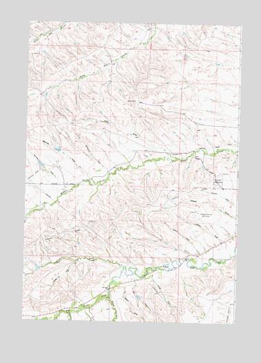
Hultz Draw, WY USGS Topographic Map
Click on map above to begin viewing in our Map Viewer.

This topographic map contains these locations and features:
Feature Name Type Latitude Longitude GNIS ID View Map
Alliance LateralCanalN44.7883°W107.0787°1597723View Map
Baker CreekStreamN44.7533°W107.0973°1597873View Map
Beaver CreekStreamN44.7600°W107.0740°1598064View Map
Beaver Creek MineMineN44.7516°W107.0587°1704031View Map
Big Goose SchoolSchoolN44.7630°W107.0748°1585461View Map
Dygert PitMineN44.8091°W107.0176°1704030View Map
Forbes DrawValleyN44.7691°W107.0487°1599789View Map
Fryberger DamDamN44.7716°W107.1106°1606786View Map
Fryberger ReservoirReservoirN44.7716°W107.1106°1606787View Map
Garrett DamDamN44.7600°W107.0556°1606782View Map
Garrett ReservoirReservoirN44.7602°W107.0573°1606783View Map
Gregg DrawValleyN44.7791°W107.0001°1589137View Map
Hammel DrawValleyN44.8055°W107.1009°1600185View Map
Hultz DrawValleyN44.8189°W107.0367°1589802View Map
Jenkins DrawValleyN44.7789°W107.0220°1590076View Map
Jensen DrawValleyN44.7827°W107.0059°1590089View Map
Moose MineMineN44.7514°W107.0634°1704032View Map
Nelson DrawValleyN44.7652°W107.0653°1601677View Map
Owl CreekStreamN44.7708°W107.0670°1601974View Map
Owl Creek MineMineN44.7677°W107.0765°1704033View Map
Sheep DrawValleyN44.7744°W107.0937°1594200View Map
Valley DrawValleyN44.8122°W107.0765°1595901View Map
Warriner DrawValleyN44.8100°W107.0879°1604524View Map
Warriner Number 2 DamDamN44.8200°W107.1006°1606772View Map
Warriner ReservoirReservoirN44.8200°W107.1006°1606773View Map
Wolf DrawValleyN44.7669°W107.0592°1604264View Map

Note: Coordinates in the location and feature list above are referenced to NAD83 datum.


Copyright (C) 2008-2025 Ryan Niemi / Sunset Dynamics ... All Rights Reserved