TopoQuest Logo
Do you find TopoQuest useful?
Help keep TopoQuest running and adding new maps/features by donating!
Bitcoin:  19c7KJd3qBynnjoSw5npx9KScwjBe4ifkT
Litecoin:  LXs6TkuXGGXo1vDsWCkWVdjQX94eUKd6ui
Home View Maps Find Maps Find Places Resources & Links


Millston, Wisconsin Topographic Map

USGS Map Title: Millston, WI
USGS Map MRC: 44090B6
DRG (GeoTIFF) Download: o44090b6.tif


Neighboring USGS Topographic Map Quads:


  Black River Falls, WI  
44090C7
 

  Hatfield SW, WI  
44090C6
 

  Hatfield SE, WI  
44090C5
 

  Shamrock, WI  
44090B7
 

  Millston, WI  
44090B6
 

  Warrens West, WI  
44090B5
 

  Cataract, WI  
44090A7
 

  Alderwood Lake, WI  
44090A6
 

  Tunnel City, WI  
44090A5


Map MRC Location:

N45°
W91°
N45°
W90°
H8 H7 H6 H5 H4 H3 H2 H1
G8 G7 G6 G5 G4 G3 G2 G1
F8 F7 F6 F5 F4 F3 F2 F1
E8 E7 E6 E5 E4 E3 E2 E1
D8 D7 D6 D5 D4 D3 D2 D1
C8 C7 C6 C5 C4 C3 C2 C1
B8 B7 B6 B5 B4 B3 B2 B1
A8 A7 A6 A5 A4 A3 A2 A1
N44°
W91°
N44°
W90°

Millston, WI USGS 1:24K Topographic Map Preview:
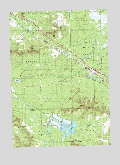
Millston, WI USGS Topographic Map
Click on map above to begin viewing in our Map Viewer.

This topographic map contains these locations and features:
Feature Name Type Latitude Longitude GNIS ID View Map
10 ReservoirReservoirN44.1495°W90.6971°1792912View Map
10 ReservoirReservoirN44.1439°W90.6840°1792914View Map
60 ReservoirReservoirN44.1850°W90.7418°1792157View Map
Brookside CemeteryCemeteryN44.1869°W90.6432°1562246View Map
Glenn CreekStreamN44.1897°W90.6915°1565558View Map
Glenn Creek PondLakeN44.2047°W90.6543°1845452View Map
Habelman DamDamN44.1500°W90.6968°1792911View Map
Habelman DamDamN44.1450°W90.6851°1792913View Map
Janke WP 445 DamDamN44.1850°W90.7418°1792156View Map
Ketchum CreekStreamN44.1958°W90.6460°1567434View Map
Lee LakeReservoirN44.1891°W90.6532°1567926View Map
Lee Lake 15ReservoirN44.1877°W90.6474°1791797View Map
Lees CrossingCrossingN44.1280°W90.6982°1846235View Map
Madison CreekStreamN44.1880°W90.7362°1845483View Map
MillstonPopulated PlaceN44.1930°W90.6476°1569526View Map
Millston Census Designated PlaceCensusN44.1884°W90.6445°2586532View Map
Millston DamDamN44.1883°W90.6518°1791796View Map
North FlowageLakeN44.1405°W90.6753°1846251View Map
Oak Ridge Fire TowerTowerN44.2136°W90.7226°1581299View Map
Pigeon CreekStreamN44.2061°W90.6537°1571361View Map
Ranch CreekStreamN44.1508°W90.7029°1572054View Map
Robinson Creek Pines State Natural AreaParkN44.1919°W90.6632°2062801View Map
Sharptail FlowageReservoirN44.2150°W90.6300°1573971View Map
Stanton CreekStreamN44.2061°W90.6537°1574795View Map
Washburn Marsh State Natural AreaParkN44.2439°W90.6346°2062802View Map
Wyman CreekStreamN44.1927°W90.6654°1577063View Map
Zahrte CreekStreamN44.1922°W90.6326°1573747View Map

Note: Coordinates in the location and feature list above are referenced to NAD83 datum.


Copyright (C) 2008-2025 Ryan Niemi / Sunset Dynamics ... All Rights Reserved