TopoQuest Logo
Do you find TopoQuest useful?
Help keep TopoQuest running and adding new maps/features by donating!
Bitcoin:  19c7KJd3qBynnjoSw5npx9KScwjBe4ifkT
Litecoin:  LXs6TkuXGGXo1vDsWCkWVdjQX94eUKd6ui
Home View Maps Find Maps Find Places Resources & Links


Alderwood Lake, Wisconsin Topographic Map

USGS Map Title: Alderwood Lake, WI
USGS Map MRC: 44090A6
DRG (GeoTIFF) Download: o44090a6.tif


Neighboring USGS Topographic Map Quads:


  Shamrock, WI  
44090B7
 

  Millston, WI  
44090B6
 

  Warrens West, WI  
44090B5
 

  Cataract, WI  
44090A7
 

  Alderwood Lake, WI  
44090A6
 

  Tunnel City, WI  
44090A5
 

  Sparta, WI  
43090H7
 

  City Rock, WI  
43090H6
 

  Tomah, WI  
43090H5


Map MRC Location:

N45°
W91°
N45°
W90°
H8 H7 H6 H5 H4 H3 H2 H1
G8 G7 G6 G5 G4 G3 G2 G1
F8 F7 F6 F5 F4 F3 F2 F1
E8 E7 E6 E5 E4 E3 E2 E1
D8 D7 D6 D5 D4 D3 D2 D1
C8 C7 C6 C5 C4 C3 C2 C1
B8 B7 B6 B5 B4 B3 B2 B1
A8 A7 A6 A5 A4 A3 A2 A1
N44°
W91°
N44°
W90°

Alderwood Lake, WI USGS 1:24K Topographic Map Preview:
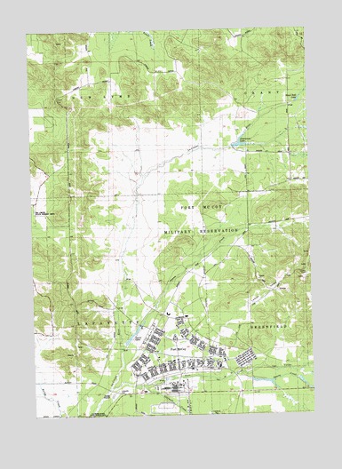
Alderwood Lake, WI USGS Topographic Map
Click on map above to begin viewing in our Map Viewer.

This topographic map contains these locations and features:
Feature Name Type Latitude Longitude GNIS ID View Map
Alder Lake 19ReservoirN44.0879°W90.6559°1793454View Map
Alder Lake WP358 DamDamN44.0866°W90.6601°1793453View Map
Alderwood LakeReservoirN44.0866°W90.6593°1560747View Map
Camp McCoyLocaleN44.0244°W90.6876°1562637View Map
Dorn CutGapN44.1027°W90.7371°1846199View Map
Fort McCoyMilitaryN44.0391°W90.6766°2512210View Map
Fort McCoy Fire Department Main StationBuildingN44.0191°W90.6916°2697931View Map
Fort McCoy Police DepartmentBuildingN44.0190°W90.6911°2759539View Map
Greenfield Fire TowerTowerN44.0452°W90.6279°1581228View Map
Hazel Dell LakeReservoirN44.1018°W90.6295°1846218View Map
Lafayette CemeteryCemeteryN44.0077°W90.7118°1846230View Map
Lemon ValleyValleyN44.0275°W90.6678°1846236View Map
Sparta CreekStreamN44.0127°W90.6579°1574516View Map
Stillwell CreekStreamN44.0091°W90.6999°1574900View Map
Suukjak Sep CreekStreamN44.0227°W90.7099°1574760View Map
Suukjak Sep LakeReservoirN44.0265°W90.7052°1846298View Map
Tarr CreekStreamN44.0083°W90.7168°1575259View Map
Tarr ValleyValleyN44.0138°W90.6576°1846303View Map
Town of LafayetteCivilN44.0286°W90.7318°1583503View Map
Town of New LymeCivilN44.1154°W90.7324°1583814View Map
Upper Sparta PondReservoirN44.0108°W90.6473°2770786View Map

Note: Coordinates in the location and feature list above are referenced to NAD83 datum.


Copyright (C) 2008-2024 Ryan Niemi / Sunset Dynamics ... All Rights Reserved