TopoQuest Logo
Do you find TopoQuest useful?
Help keep TopoQuest running and adding new maps/features by donating!
Bitcoin:  19c7KJd3qBynnjoSw5npx9KScwjBe4ifkT
Litecoin:  LXs6TkuXGGXo1vDsWCkWVdjQX94eUKd6ui
Home View Maps Find Maps Find Places Resources & Links


Milroy, Indiana Topographic Map

USGS Map Title: Milroy, IN
USGS Map MRC: 39085D4
DRG (GeoTIFF) Download: o39085d4.tif


Neighboring USGS Topographic Map Quads:


  Manilla, IN  
39085E5
 

  Rushville, IN  
39085E4
 

  New Salem, IN  
39085E3
 

  Adams, IN  
39085D5
 

  Milroy, IN  
39085D4
 

  Clarksburg, IN  
39085D3
 

  Forest Hill, IN  
39085C5
 

  Greensburg, IN  
39085C4
 

  New Point, IN  
39085C3


Map MRC Location:

N40°
W86°
N40°
W85°
H8 H7 H6 H5 H4 H3 H2 H1
G8 G7 G6 G5 G4 G3 G2 G1
F8 F7 F6 F5 F4 F3 F2 F1
E8 E7 E6 E5 E4 E3 E2 E1
D8 D7 D6 D5 D4 D3 D2 D1
C8 C7 C6 C5 C4 C3 C2 C1
B8 B7 B6 B5 B4 B3 B2 B1
A8 A7 A6 A5 A4 A3 A2 A1
N39°
W86°
N39°
W85°

Milroy, IN USGS 1:24K Topographic Map Preview:
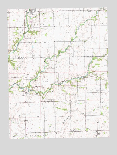
Milroy, IN USGS Topographic Map
Click on map above to begin viewing in our Map Viewer.

This topographic map contains these locations and features:
Feature Name Type Latitude Longitude GNIS ID View Map
Anderson Township Volunteer Fire DepartmentBuildingN39.4972°W85.4698°2625714View Map
Bethesda CemeteryCemeteryN39.4602°W85.4246°430970View Map
Butcher CemeteryCemeteryN39.4237°W85.4581°431896View Map
KingstonPopulated PlaceN39.3789°W85.3883°437339View Map
Layton CemeteryCemeteryN39.4552°W85.4601°437685View Map
Lick CreekStreamN39.4934°W85.4761°437864View Map
McLaughlin CemeteryCemeteryN39.4174°W85.4634°438913View Map
Middle Branch Clifty CreekStreamN39.4231°W85.4755°439085View Map
MilroyPopulated PlaceN39.4970°W85.4697°439254View Map
Milroy Census Designated PlaceCensusN39.4981°W85.4676°2629873View Map
Milroy Elementary and Junior High SchoolSchoolN39.4984°W85.4705°447129View Map
Milroy Emergency Medical ServicesBuildingN39.4971°W85.4698°2719375View Map
North Branch Clifty CreekStreamN39.4234°W85.4752°440221View Map
Old Richland Methodist CemeteryCemeteryN39.4981°W85.3775°441959View Map
Overleese CemeteryCemeteryN39.4769°W85.4796°440780View Map
RichlandPopulated PlaceN39.4975°W85.3950°441957View Map
SanduskyPopulated PlaceN39.4195°W85.4780°443005View Map
South Branch Clifty CreekStreamN39.4200°W85.4597°443782View Map
Springhill (historical)Populated PlaceN39.4334°W85.4211°448503View Map
Springhill ChurchChurchN39.4331°W85.4039°444013View Map
Swails CemeteryCemeteryN39.4286°W85.4800°444450View Map
Township of AndersonCivilN39.4960°W85.4606°453089View Map
Township of ClintonCivilN39.4201°W85.4635°453230View Map
WilliamstownPopulated PlaceN39.4528°W85.4691°446089View Map

Note: Coordinates in the location and feature list above are referenced to NAD83 datum.


Copyright (C) 2008-2024 Ryan Niemi / Sunset Dynamics ... All Rights Reserved