TopoQuest Logo
Do you find TopoQuest useful?
Help keep TopoQuest running and adding new maps/features by donating!
Bitcoin:  19c7KJd3qBynnjoSw5npx9KScwjBe4ifkT
Litecoin:  LXs6TkuXGGXo1vDsWCkWVdjQX94eUKd6ui
Home View Maps Find Maps Find Places Resources & Links


Greensburg, Indiana Topographic Map

USGS Map Title: Greensburg, IN
USGS Map MRC: 39085C4
DRG (GeoTIFF) Download: o39085c4.tif


Neighboring USGS Topographic Map Quads:


  Adams, IN  
39085D5
 

  Milroy, IN  
39085D4
 

  Clarksburg, IN  
39085D3
 

  Forest Hill, IN  
39085C5
 

  Greensburg, IN  
39085C4
 

  New Point, IN  
39085C3
 

  Westport, IN  
39085B5
 

  Millhousen, IN  
39085B4
 

  Osgood, IN  
39085B3


Map MRC Location:

N40°
W86°
N40°
W85°
H8 H7 H6 H5 H4 H3 H2 H1
G8 G7 G6 G5 G4 G3 G2 G1
F8 F7 F6 F5 F4 F3 F2 F1
E8 E7 E6 E5 E4 E3 E2 E1
D8 D7 D6 D5 D4 D3 D2 D1
C8 C7 C6 C5 C4 C3 C2 C1
B8 B7 B6 B5 B4 B3 B2 B1
A8 A7 A6 A5 A4 A3 A2 A1
N39°
W86°
N39°
W85°

Greensburg, IN USGS 1:24K Topographic Map Preview:
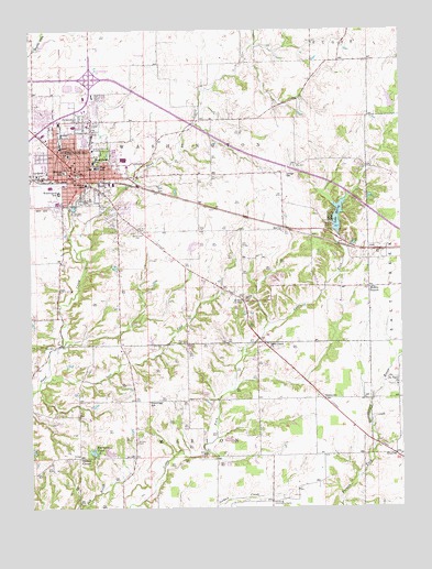
Greensburg, IN USGS Topographic Map
Click on map above to begin viewing in our Map Viewer.

This topographic map contains these locations and features:
Feature Name Type Latitude Longitude GNIS ID View Map
Antioch CemeteryCemeteryN39.2671°W85.4647°430202View Map
Billings Elementary SchoolSchoolN39.3384°W85.4886°431078View Map
Cresswood Lake DamDamN39.3217°W85.3966°448567View Map
Decatur County Emergency Medical ServicesBuildingN39.3450°W85.4772°2719285View Map
Decatur County Memorial HospitalHospitalN39.3442°W85.4786°2660468View Map
Decatur County Sheriff DepartmentBuildingN39.3326°W85.4901°2758390View Map
Fellowship ChurchChurchN39.3514°W85.4839°434439View Map
GreensburgPopulated PlaceN39.3373°W85.4836°449663View Map
Greensburg Community High SchoolSchoolN39.3395°W85.4764°446506View Map
Greensburg Fire DepartmentBuildingN39.3418°W85.4885°2625600View Map
Greensburg Fire DepartmentBuildingN39.3418°W85.4887°2701449View Map
Greensburg Police DepartmentBuildingN39.3352°W85.4847°2758152View Map
Hamburg Community CenterLocaleN39.2514°W85.4191°435632View Map
Hazelrigg SchoolSchoolN39.2778°W85.4605°435939View Map
Knarr CornerPopulated PlaceN39.3042°W85.4286°437385View Map
Lake McCoyReservoirN39.3255°W85.3961°438826View Map
Lost ForkStreamN39.2834°W85.4964°438322View Map
McCoyPopulated PlaceN39.3231°W85.4144°438817View Map
Middle BranchPopulated PlaceN39.3078°W85.3858°439084View Map
Morrison PondReservoirN39.2649°W85.4794°439466View Map
Morrison Pond DamDamN39.2639°W85.4789°447721View Map
Odd Fellows HomeBuildingN39.3398°W85.4655°452376View Map
Reed DamDamN39.3551°W85.3783°447805View Map
Reed ReservoirReservoirN39.3563°W85.3783°447804View Map
Rosenmund Elementary SchoolSchoolN39.3412°W85.4783°442311View Map
Saint Mary SchoolSchoolN39.3348°W85.4805°442710View Map
Saint Marys CemeteryCemeteryN39.3301°W85.4758°442691View Map
Saint Pauls ChurchChurchN39.2820°W85.3766°442777View Map
Sand Creek CemeteryCemeteryN39.3223°W85.4636°442968View Map
Sand Creek ChurchChurchN39.2928°W85.4202°442969View Map
SlabtownPopulated PlaceN39.2784°W85.4014°443589View Map
SmyrnaPopulated PlaceN39.2639°W85.3772°443715View Map
South Park CemeteryCemeteryN39.3303°W85.4812°443836View Map
Springer CemeteryCemeteryN39.3379°W85.4121°444006View Map
Tarkeo CornerPopulated PlaceN39.2628°W85.4839°444577View Map
Township of WashingtonCivilN39.3372°W85.4721°453992View Map
Washington Elementary SchoolSchoolN39.3331°W85.4902°445511View Map

Note: Coordinates in the location and feature list above are referenced to NAD83 datum.


Copyright (C) 2008-2025 Ryan Niemi / Sunset Dynamics ... All Rights Reserved