TopoQuest Logo
Do you find TopoQuest useful?
Help keep TopoQuest running and adding new maps/features by donating!
Bitcoin:  19c7KJd3qBynnjoSw5npx9KScwjBe4ifkT
Litecoin:  LXs6TkuXGGXo1vDsWCkWVdjQX94eUKd6ui
Home View Maps Find Maps Find Places Resources & Links


Fairfield, Vermont Topographic Map

USGS Map Title: Fairfield, VT
USGS Map MRC: 44072G8
DRG (GeoTIFF) Download: o44072g8.tif


Neighboring USGS Topographic Map Quads:


  Highgate Center, VT  
44073H1
 

  Sheldon Springs, VT  
44072H8
 

  Enosburg Falls, VT  
44072H7
 

  Saint Albans, VT  
44073G1
 

  Fairfield, VT  
44072G8
 

  Bakersfield, VT  
44072G7
 

  Milton, VT  
44073F1
 

  Gilson Mountain, VT  
44072F8
 

  Jeffersonville, VT  
44072F7


Map MRC Location:

N45°
W73°
N45°
W72°
H8 H7 H6 H5 H4 H3 H2 H1
G8 G7 G6 G5 G4 G3 G2 G1
F8 F7 F6 F5 F4 F3 F2 F1
E8 E7 E6 E5 E4 E3 E2 E1
D8 D7 D6 D5 D4 D3 D2 D1
C8 C7 C6 C5 C4 C3 C2 C1
B8 B7 B6 B5 B4 B3 B2 B1
A8 A7 A6 A5 A4 A3 A2 A1
N44°
W73°
N44°
W72°

Fairfield, VT USGS 1:24K Topographic Map Preview:
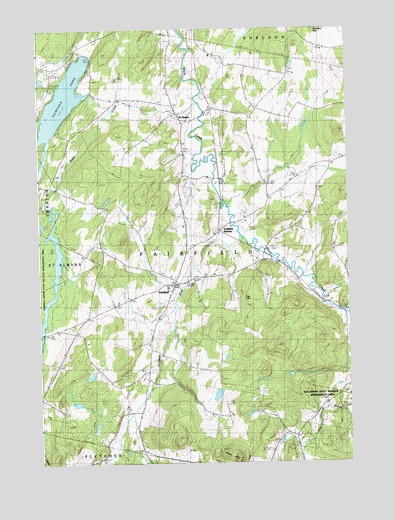
Fairfield, VT USGS Topographic Map
Click on map above to begin viewing in our Map Viewer.

This topographic map contains these locations and features:
Feature Name Type Latitude Longitude GNIS ID View Map
Barlow CemeteryCemeteryN44.8043°W72.9527°1920528View Map
Bradley CemeteryCemeteryN44.7769°W72.9583°1456540View Map
Callan SchoolSchoolN44.8559°W72.9687°1456718View Map
Creek SchoolSchoolN44.8034°W72.8982°1457057View Map
Dead CreekStreamN44.8545°W72.9357°1457130View Map
Diamond CemeteryCemeteryN44.8364°W72.9135°1457167View Map
Elm BrookStreamN44.7937°W72.8790°1457358View Map
Elm Brook State Wildlife Management AreaParkN44.7695°W72.8885°1920586View Map
FairfieldPopulated PlaceN44.8020°W72.9457°1457393View Map
Fairfield Center SchoolSchoolN44.8004°W72.9480°1920604View Map
Fairfield Fire DepartmentBuildingN44.7998°W72.9478°2121443View Map
Fairfield PondReservoirN44.8547°W72.9896°1457394View Map
Fairfield Post OfficePost OfficeN44.8019°W72.9408°1920605View Map
Fairfield RiverStreamN44.8153°W72.9196°1457395View Map
Fairfield StationLocaleN44.8173°W72.9274°1457397View Map
Fairfield Swamp DamDamN44.8542°W72.9896°1766516View Map
Fairview CemeteryCemeteryN44.7637°W72.8890°1457402View Map
Fox HillSummitN44.7967°W72.9137°1457485View Map
Franklin CountyCivilN44.8575°W72.9120°1461762View Map
Gould School (historical)SchoolN44.8250°W72.9068°1920628View Map
Kirley CemeteryCemeteryN44.8631°W72.8982°1920673View Map
Leach CemeteryCemeteryN44.8406°W72.9408°1458179View Map
Lost Nation School (historical)SchoolN44.7581°W72.8968°1920677View Map
McCarty School (historical)SchoolN44.8237°W72.9724°1920687View Map
Morey CemeteryCemeteryN44.8147°W72.9042°1920699View Map
Pine HillSummitN44.7512°W72.9212°1458973View Map
Pumpkin Village CemeteryCemeteryN44.8372°W72.9120°1920723View Map
Pumpkin Village SchoolSchoolN44.8517°W72.9124°1459106View Map
Saint Patricks CemeteryCemeteryN44.8050°W72.9535°1920764View Map
Saint Patricks ChurchChurchN44.8039°W72.9460°1920765View Map
Saint RocksPopulated PlaceN44.8509°W72.9443°1459346View Map
Saint Rocks CemeteryCemeteryN44.8404°W72.9410°1920767View Map
School Number 6SchoolN44.7887°W72.9854°1459420View Map
Soule SchoolSchoolN44.7642°W72.9613°1459563View Map
Town of FairfieldCivilN44.8079°W72.9321°1462093View Map
Waite CemeteryCemeteryN44.8634°W72.8982°1460036View Map

Note: Coordinates in the location and feature list above are referenced to NAD83 datum.


Copyright (C) 2008-2024 Ryan Niemi / Sunset Dynamics ... All Rights Reserved