TopoQuest Logo
Do you find TopoQuest useful?
Help keep TopoQuest running and adding new maps/features by donating!
Bitcoin:  19c7KJd3qBynnjoSw5npx9KScwjBe4ifkT
Litecoin:  LXs6TkuXGGXo1vDsWCkWVdjQX94eUKd6ui
Home View Maps Find Maps Find Places Resources & Links


Minam, Oregon Topographic Map

USGS Map Title: Minam, OR
USGS Map MRC: 45117E6
DRG (GeoTIFF) Download: o45117e6.tif


Neighboring USGS Topographic Map Quads:


  Rondowa, OR  
45117F7
 

  Howard Butte, OR  
45117F6
 

  Akers Butte, OR  
45117F5
 

  Cricket Flat, OR  
45117E7
 

  Minam, OR  
45117E6
 

  Wallowa, OR  
45117E5
 

  Gasset Bluff, OR  
45117D7
 

  Mount Moriah, OR  
45117D6
 

  Fox Point, OR  
45117D5


Map MRC Location:

N46°
W118°
N46°
W117°
H8 H7 H6 H5 H4 H3 H2 H1
G8 G7 G6 G5 G4 G3 G2 G1
F8 F7 F6 F5 F4 F3 F2 F1
E8 E7 E6 E5 E4 E3 E2 E1
D8 D7 D6 D5 D4 D3 D2 D1
C8 C7 C6 C5 C4 C3 C2 C1
B8 B7 B6 B5 B4 B3 B2 B1
A8 A7 A6 A5 A4 A3 A2 A1
N45°
W118°
N45°
W117°

Minam, OR USGS 1:24K Topographic Map Preview:
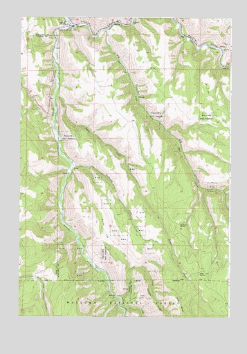
Minam, OR USGS Topographic Map
Click on map above to begin viewing in our Map Viewer.

This topographic map contains these locations and features:
Feature Name Type Latitude Longitude GNIS ID View Map
Alder SpringSpringN45.5189°W117.6422°1137108View Map
Big CanyonValleyN45.6196°W117.6987°1137992View Map
Big Canyon Fish WeirDamN45.6207°W117.7192°1167213View Map
Big Canyon Fish Weir Recreation SiteLocaleN45.6190°W117.6983°1156547View Map
Chestnut SpringSpringN45.5387°W117.6556°1139609View Map
Cougar CreekStreamN45.5079°W117.6888°1140222View Map
Deer CreekStreamN45.6196°W117.6983°1140836View Map
Gunderson CreekStreamN45.5651°W117.7188°1143157View Map
Harris (historical)LocaleN45.6193°W117.6994°1167776View Map
Meads FlatFlatN45.5213°W117.7033°1146069View Map
MinamPopulated PlaceN45.6218°W117.7233°1146300View Map
Minam Post Office (historical)Post OfficeN45.6218°W117.7233°1165642View Map
Minam RiverStreamN45.6213°W117.7205°1146303View Map
Minham State Recreation Area Boat RampLocaleN45.6217°W117.7215°2700163View Map
North Fork Gravel PitLocaleN45.5015°W117.7296°1156548View Map
Skylight CanyonStreamN45.6132°W117.6482°1153081View Map
Trout CreekStreamN45.5029°W117.6866°1151440View Map
Wallowa Lake Highway Forest State ParkParkN45.6226°W117.6852°1851898View Map
weelike?ecet CreekStreamN45.5915°W117.7294°1150260View Map

Note: Coordinates in the location and feature list above are referenced to NAD83 datum.


Copyright (C) 2008-2024 Ryan Niemi / Sunset Dynamics ... All Rights Reserved