TopoQuest Logo
Do you find TopoQuest useful?
Help keep TopoQuest running and adding new maps/features by donating!
Bitcoin:  19c7KJd3qBynnjoSw5npx9KScwjBe4ifkT
Litecoin:  LXs6TkuXGGXo1vDsWCkWVdjQX94eUKd6ui
Home View Maps Find Maps Find Places Resources & Links


Mount Moriah, Oregon Topographic Map

USGS Map Title: Mount Moriah, OR
USGS Map MRC: 45117D6
DRG (GeoTIFF) Download: o45117d6.tif


Neighboring USGS Topographic Map Quads:


  Cricket Flat, OR  
45117E7
 

  Minam, OR  
45117E6
 

  Wallowa, OR  
45117E5
 

  Gasset Bluff, OR  
45117D7
 

  Mount Moriah, OR  
45117D6
 

  Fox Point, OR  
45117D5
 

  Cove, OR  
45117C7
 

  Mount Fanny, OR  
45117C6
 

  Jim White Ridge, OR  
45117C5


Map MRC Location:

N46°
W118°
N46°
W117°
H8 H7 H6 H5 H4 H3 H2 H1
G8 G7 G6 G5 G4 G3 G2 G1
F8 F7 F6 F5 F4 F3 F2 F1
E8 E7 E6 E5 E4 E3 E2 E1
D8 D7 D6 D5 D4 D3 D2 D1
C8 C7 C6 C5 C4 C3 C2 C1
B8 B7 B6 B5 B4 B3 B2 B1
A8 A7 A6 A5 A4 A3 A2 A1
N45°
W118°
N45°
W117°

Mount Moriah, OR USGS 1:24K Topographic Map Preview:
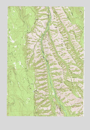
Mount Moriah, OR USGS Topographic Map
Click on map above to begin viewing in our Map Viewer.

This topographic map contains these locations and features:
Feature Name Type Latitude Longitude GNIS ID View Map
Big Sheep RidgeRidgeN45.4257°W117.6283°1138064View Map
Bluch CreekStreamN45.3963°W117.6760°1117830View Map
Burnt SpringSpringN45.4013°W117.6394°1129519View Map
Chicken SpringSpringN45.4263°W117.7201°1118889View Map
Collusion PointSummitN45.4760°W117.6677°1119155View Map
Cougar RidgeRidgeN45.4682°W117.6277°1140241View Map
Cougar Ridge TrailTrailN45.4807°W117.6377°1140242View Map
Coyote SpringSpringN45.3882°W117.6388°1129518View Map
Crooked TrailTrailN45.4829°W117.6274°1140475View Map
Division GulchValleyN45.4701°W117.6513°1119963View Map
Dunning CreekStreamN45.4293°W117.6521°1125221View Map
Eagle CreekStreamN45.4618°W117.6938°1120260View Map
Elk PointLocaleN45.4288°W117.7227°1120461View Map
Faun CreekStreamN45.4051°W117.6738°1120643View Map
Grouse CreekStreamN45.3838°W117.6721°1121459View Map
High RidgeRidgeN45.4951°W117.6477°1143579View Map
Horse Basin CreekStreamN45.3774°W117.6524°1143738View Map
Horse MeadowFlatN45.4115°W117.7097°1122008View Map
Jim SpringSpringN45.4874°W117.7191°1129520View Map
Line BluffSummitN45.4063°W117.7138°1123108View Map
Little Minam RiverStreamN45.4004°W117.6716°1145211View Map
Little Sheep RidgeRidgeN45.4285°W117.6610°1145254View Map
Lobo CreekStreamN45.4179°W117.6802°1123331View Map
Mahogany RidgeRidgeN45.4188°W117.6349°1123687View Map
Monument PointCapeN45.3963°W117.6283°1124306View Map
Moonrise SpringSpringN45.3787°W117.7036°1124326View Map
Mount MoriahSummitN45.4851°W117.7033°1124362View Map
Murphy CreekStreamN45.4732°W117.6827°1146679View Map
Rock SpringSpringN45.4043°W117.7045°1126215View Map
Rock Spring TrailTrailN45.3982°W117.6910°1126219View Map
Trippier PointSummitN45.4049°W117.6480°1128233View Map
Twin SpringSpringN45.4610°W117.6372°1129472View Map

Note: Coordinates in the location and feature list above are referenced to NAD83 datum.


Copyright (C) 2008-2025 Ryan Niemi / Sunset Dynamics ... All Rights Reserved