TopoQuest Logo
Do you find TopoQuest useful?
Help keep TopoQuest running and adding new maps/features by donating!
Bitcoin:  19c7KJd3qBynnjoSw5npx9KScwjBe4ifkT
Litecoin:  LXs6TkuXGGXo1vDsWCkWVdjQX94eUKd6ui
Home View Maps Find Maps Find Places Resources & Links


Minong, Wisconsin Topographic Map

USGS Map Title: Minong, WI
USGS Map MRC: 46091A7
DRG (GeoTIFF) Download: o46091a7.tif


Neighboring USGS Topographic Map Quads:


  Minong Flowage, WI  
46091B8
 

  Gordon, WI  
46091B7
 

  Chittamo, WI  
46091B6
 

  Horseshoe Lake, WI  
46091A8
 

  Minong, WI  
46091A7
 

  Stanberry West, WI  
46091A6
 

  Dunn Lake, WI  
45091H8
 

  Trego, WI  
45091H7
 

  Springbrook, WI  
45091H6


Map MRC Location:

N47°
W92°
N47°
W91°
H8 H7 H6 H5 H4 H3 H2 H1
G8 G7 G6 G5 G4 G3 G2 G1
F8 F7 F6 F5 F4 F3 F2 F1
E8 E7 E6 E5 E4 E3 E2 E1
D8 D7 D6 D5 D4 D3 D2 D1
C8 C7 C6 C5 C4 C3 C2 C1
B8 B7 B6 B5 B4 B3 B2 B1
A8 A7 A6 A5 A4 A3 A2 A1
N46°
W92°
N46°
W91°

Minong, WI USGS 1:24K Topographic Map Preview:
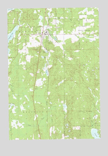
Minong, WI USGS Topographic Map
Click on map above to begin viewing in our Map Viewer.

This topographic map contains these locations and features:
Feature Name Type Latitude Longitude GNIS ID View Map
Bond LakeLakeN46.0960°W91.8103°1562050View Map
Fischer Dam WP380DamN46.1149°W91.8602°1793541View Map
Greenwood CemeteryCemeteryN46.1063°W91.8091°1565874View Map
Lakeside LakeLakeN46.0637°W91.8222°1567781View Map
Little Frog CreekStreamN46.1111°W91.7827°1568261View Map
MinongPopulated PlaceN46.0994°W91.8249°1569582View Map
Minong Area Ambulance ServiceBuildingN46.1000°W91.8203°2698409View Map
Minong Police DepartmentBuildingN46.1000°W91.8203°2759634View Map
Minong Volunteer Fire DepartmentBuildingN46.1000°W91.8202°2696700View Map
Pokegama LakeReservoirN46.1149°W91.8602°1793542View Map
Pokegama LakeLakeN46.0938°W91.8748°1571730View Map
Round LakeLakeN46.0783°W91.8275°1572668View Map
Sink CreekStreamN46.0963°W91.7685°1574189View Map
Town of BrooklynCivilN46.0078°W91.8485°1582872View Map
Tucker LakeLakeN46.0836°W91.8224°1575701View Map
Village of MinongCivilN46.0977°W91.8263°1583728View Map

Note: Coordinates in the location and feature list above are referenced to NAD83 datum.


Copyright (C) 2008-2025 Ryan Niemi / Sunset Dynamics ... All Rights Reserved