TopoQuest Logo
Do you find TopoQuest useful?
Help keep TopoQuest running and adding new maps/features by donating!
Bitcoin:  19c7KJd3qBynnjoSw5npx9KScwjBe4ifkT
Litecoin:  LXs6TkuXGGXo1vDsWCkWVdjQX94eUKd6ui
Home View Maps Find Maps Find Places Resources & Links


Miramonte, California Topographic Map

USGS Map Title: Miramonte, CA
USGS Map MRC: 36119F1
DRG (GeoTIFF) Download: o36119f1.tif


Neighboring USGS Topographic Map Quads:


  Luckett Mountain, CA  
36119G2
 

  Verplank Ridge, CA  
36119G1
 

  Hume, CA  
36118G8
 

  Tucker Mountain, CA  
36119F2
 

  Miramonte, CA  
36119F1
 

  General Grant Grove, CA  
36118F8
 

  Stokes Mountain, CA  
36119E2
 

  Auckland, CA  
36119E1
 

  Shadequarter Mountain, CA  
36118E8


Map MRC Location:

N37°
W120°
N37°
W119°
H8 H7 H6 H5 H4 H3 H2 H1
G8 G7 G6 G5 G4 G3 G2 G1
F8 F7 F6 F5 F4 F3 F2 F1
E8 E7 E6 E5 E4 E3 E2 E1
D8 D7 D6 D5 D4 D3 D2 D1
C8 C7 C6 C5 C4 C3 C2 C1
B8 B7 B6 B5 B4 B3 B2 B1
A8 A7 A6 A5 A4 A3 A2 A1
N36°
W120°
N36°
W119°

Miramonte, CA USGS 1:24K Topographic Map Preview:
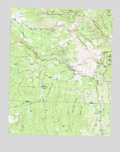
Miramonte, CA USGS Topographic Map
Click on map above to begin viewing in our Map Viewer.

This topographic map contains these locations and features:
Feature Name Type Latitude Longitude GNIS ID View Map
BadgerPopulated PlaceN36.6313°W119.0132°256414View Map
Badger Fire Control StationLocaleN36.6483°W119.0146°256416View Map
Black Oak FlatFlatN36.7452°W119.0554°257143View Map
Burns FlatFlatN36.6974°W119.0371°257717View Map
CedarbrookPopulated PlaceN36.7069°W119.0082°1658245View Map
Cedarbrook Picnic AreaLocaleN36.7069°W119.0118°275611View Map
Deer CrossingPopulated PlaceN36.6899°W119.0487°1658389View Map
Deer Park School (historical)SchoolN36.7299°W119.0451°1702948View Map
Depot FlatFlatN36.6363°W119.0204°259280View Map
DunlapPopulated PlaceN36.7383°W119.1209°259614View Map
Dunlap Baptist ChurchChurchN36.7349°W119.1159°1811873View Map
Dunlap Elementary SchoolSchoolN36.7344°W119.1171°1811874View Map
Dunlap Post OfficePost OfficeN36.7376°W119.1179°2780953View Map
Etheda SpringsPopulated PlaceN36.6941°W119.0073°1658512View Map
Greeley Ranger Station (historical)LocaleN36.7058°W119.0648°1702949View Map
Hilltop ChapelChurchN36.6841°W119.0332°261358View Map
Indian HillSummitN36.6341°W119.0596°261750View Map
Johnson FlatFlatN36.7174°W119.0557°261978View Map
Johnson PointSummitN36.7013°W119.0687°1702951View Map
McKenzie RidgeRidgeN36.7350°W119.0109°228396View Map
Meadows RidgeRidgeN36.6508°W119.0368°263430View Map
Milk Ranch CanyonValleyN36.7188°W119.0954°263577View Map
Millwood (historical)Populated PlaceN36.7447°W119.0046°263655View Map
MiramontePopulated PlaceN36.6924°W119.0523°263693View Map
Miramonte Conservation CampLocaleN36.6724°W119.0859°263694View Map
Miramonte Elementary SchoolSchoolN36.6905°W119.0546°263695View Map
Miramonte Post OfficePost OfficeN36.6922°W119.0519°2780955View Map
Miramonte RanchLocaleN36.6805°W119.0426°1702954View Map
Mitchell PeakSummitN36.6822°W119.0751°1659148View Map
Morlar FlatFlatN36.7036°W119.1026°263832View Map
Mountain Valley Volunteer Fire DepartmentBuildingN36.6894°W119.1186°2624003View Map
Neffs CampPopulated PlaceN36.7038°W119.0040°264023View Map
Oak Flat School (historical)SchoolN36.6899°W119.0479°1702953View Map
PinehurstPopulated PlaceN36.6952°W119.0165°1659397View Map
Pinehurst Work CenterLocaleN36.6980°W119.0157°275612View Map
Sierra Elementary SchoolSchoolN36.6355°W119.0029°266160View Map
Sierra GlenPopulated PlaceN36.6394°W119.0001°1659663View Map
Stillwell RanchLocaleN36.6486°W119.1007°267751View Map
Stony FlatFlatN36.7147°W119.0315°267784View Map
Todd RanchLocaleN36.7105°W119.0332°268315View Map
United States Forest Service Sierra National ForestBuildingN36.7487°W119.0899°2624345View Map
Whale RockPillarN36.7338°W119.0704°252271View Map
Wild Hog CanyonValleyN36.6444°W119.0512°269078View Map
Wildwood FarmLocaleN36.7144°W119.1154°1702959View Map

Note: Coordinates in the location and feature list above are referenced to NAD83 datum.


Copyright (C) 2008-2025 Ryan Niemi / Sunset Dynamics ... All Rights Reserved