TopoQuest Logo
Do you find TopoQuest useful?
Help keep TopoQuest running and adding new maps/features by donating!
Bitcoin:  19c7KJd3qBynnjoSw5npx9KScwjBe4ifkT
Litecoin:  LXs6TkuXGGXo1vDsWCkWVdjQX94eUKd6ui
Home View Maps Find Maps Find Places Resources & Links


Verplank Ridge, California Topographic Map

USGS Map Title: Verplank Ridge, CA
USGS Map MRC: 36119G1
DRG (GeoTIFF) Download: o36119g1.tif


Neighboring USGS Topographic Map Quads:


  Sacate Ridge, CA  
36119H2
 

  Patterson Mountain, CA  
36119H1
 

  Rough Spur, CA  
36118H8
 

  Luckett Mountain, CA  
36119G2
 

  Verplank Ridge, CA  
36119G1
 

  Hume, CA  
36118G8
 

  Tucker Mountain, CA  
36119F2
 

  Miramonte, CA  
36119F1
 

  General Grant Grove, CA  
36118F8


Map MRC Location:

N37°
W120°
N37°
W119°
H8 H7 H6 H5 H4 H3 H2 H1
G8 G7 G6 G5 G4 G3 G2 G1
F8 F7 F6 F5 F4 F3 F2 F1
E8 E7 E6 E5 E4 E3 E2 E1
D8 D7 D6 D5 D4 D3 D2 D1
C8 C7 C6 C5 C4 C3 C2 C1
B8 B7 B6 B5 B4 B3 B2 B1
A8 A7 A6 A5 A4 A3 A2 A1
N36°
W120°
N36°
W119°

Verplank Ridge, CA USGS 1:24K Topographic Map Preview:
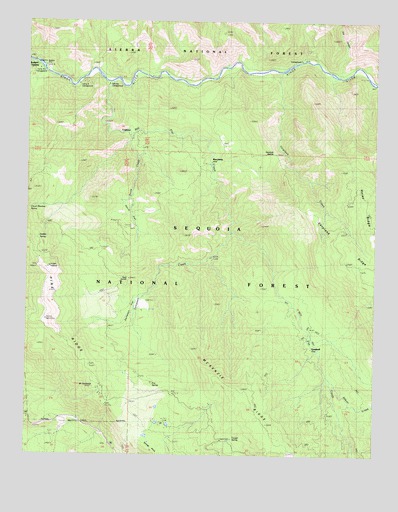
Verplank Ridge, CA USGS Topographic Map
Click on map above to begin viewing in our Map Viewer.

This topographic map contains these locations and features:
Feature Name Type Latitude Longitude GNIS ID View Map
Abbott CreekStreamN36.7722°W119.0165°233397View Map
Camp FourLocaleN36.8547°W119.1076°275930View Map
Camp Four and One HalfLocaleN36.8588°W119.1212°275925View Map
Camp Four and One Half StationLocaleN36.8616°W119.1229°275926View Map
Camp Four CampgroundLocaleN36.8569°W119.1079°1667459View Map
Camp Four StationLocaleN36.8561°W119.1059°275929View Map
Clover Meadow SpringSpringN36.8174°W119.1157°275928View Map
Converse CreekStreamN36.8569°W119.0007°258659View Map
CrabtreePopulated PlaceN36.8436°W119.0898°1658340View Map
Davis CreekStreamN36.8424°W119.0904°222042View Map
Davis FlatFlatN36.8202°W119.0901°222050View Map
Delilah LookoutLocaleN36.8041°W119.1187°222249View Map
Delilah SpringSpringN36.8122°W119.1223°1667460View Map
Fox CanyonValleyN36.8599°W119.0157°223778View Map
Fox SpringSpringN36.7705°W119.0805°223792View Map
Goat SaddleGapN36.8008°W119.0890°1667462View Map
GoodmillPopulated PlaceN36.7808°W119.0234°1658636View Map
Gravel Flat CmapgroundLocaleN36.8630°W119.1176°275922View Map
McKenzie Guard StationLocaleN36.7502°W119.0496°275935View Map
McKenzie Guard StationLocaleN36.7513°W119.0512°228393View Map
Mill FlatFlatN36.8566°W119.0979°228712View Map
Mill Flat CampgroundLocaleN36.8594°W119.0979°275923View Map
Mill Flat CampgroundLocaleN36.8544°W119.0940°275924View Map
Mill Flat CreekStreamN36.8566°W119.0982°228713View Map
Mount SampsonSummitN36.7669°W119.0968°275934View Map
Pine RidgeRidgeN36.7888°W119.1196°234477View Map
RancheriaLocaleN36.8349°W119.0612°231209View Map
Rock House Guard StationLocaleN36.8572°W119.1087°231734View Map
Rodgers CrossingPopulated PlaceN36.8619°W119.1209°1659539View Map
Rogers CrossingCrossingN36.8638°W119.1240°275927View Map
Sampson CreekStreamN36.8144°W119.0532°253815View Map
Sampson FlatFlatN36.7930°W119.0865°253816View Map
Sontag PointSummitN36.7522°W119.0818°267396View Map
Trough SpringSpringN36.7548°W119.0514°1667474View Map
Upper Kings CampgroundLocaleN36.8649°W119.0243°275918View Map
Verplank CampgroundLocaleN36.8619°W119.0351°275917View Map
Verplank CreekStreamN36.8605°W119.0357°237057View Map
Verplank SaddleGapN36.8355°W119.0373°237059View Map
Winfrey CampgroundsLocaleN36.8619°W119.0473°275916View Map

Note: Coordinates in the location and feature list above are referenced to NAD83 datum.


Copyright (C) 2008-2024 Ryan Niemi / Sunset Dynamics ... All Rights Reserved