TopoQuest Logo
Do you find TopoQuest useful?
Help keep TopoQuest running and adding new maps/features by donating!
Bitcoin:  19c7KJd3qBynnjoSw5npx9KScwjBe4ifkT
Litecoin:  LXs6TkuXGGXo1vDsWCkWVdjQX94eUKd6ui
Home View Maps Find Maps Find Places Resources & Links


Miranda Pine Mountain, California Topographic Map

USGS Map Title: Miranda Pine Mountain, CA
USGS Map MRC: 35120A1
DRG (GeoTIFF) Download: o35120a1.tif


Neighboring USGS Topographic Map Quads:


  Los Machos Hills, CA  
35120B2
 

  Branch Mountain, CA  
35120B1
 

  Chimineas Ranch, CA  
35119B8
 

  Chimney Canyon, CA  
35120A2
 

  Miranda Pine Mountain, CA  
35120A1
 

  Taylor Canyon, CA  
35119A8
 

  Tepusquet Canyon, CA  
34120H2
 

  Manzanita Mountain, CA  
34120H1
 

  Bates Canyon, CA  
34119H8


Map MRC Location:

N36°
W121°
N36°
W120°
H8 H7 H6 H5 H4 H3 H2 H1
G8 G7 G6 G5 G4 G3 G2 G1
F8 F7 F6 F5 F4 F3 F2 F1
E8 E7 E6 E5 E4 E3 E2 E1
D8 D7 D6 D5 D4 D3 D2 D1
C8 C7 C6 C5 C4 C3 C2 C1
B8 B7 B6 B5 B4 B3 B2 B1
A8 A7 A6 A5 A4 A3 A2 A1
N35°
W121°
N35°
W120°

Miranda Pine Mountain, CA USGS 1:24K Topographic Map Preview:
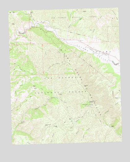
Miranda Pine Mountain, CA USGS Topographic Map
Click on map above to begin viewing in our Map Viewer.

This topographic map contains these locations and features:
Feature Name Type Latitude Longitude GNIS ID View Map
Brookshire CampgroundLocaleN35.0211°W120.1149°270023View Map
Brown CanyonValleyN35.1125°W120.0954°270029View Map
Brown MountainSummitN35.1239°W120.1213°270034View Map
Cuyama ValleyValleyN35.1097°W120.0832°270724View Map
Davis CabinLocaleN35.0516°W120.0968°270761View Map
Gifford RanchLocaleN35.1153°W120.0446°271294View Map
Gifford SpringSpringN35.1224°W120.0407°271295View Map
Gypsum CanyonValleyN35.0953°W120.0604°271463View Map
Indians TrailTrailN35.0372°W120.0860°271721View Map
Johnson Surprise SpringSpringN35.0176°W120.0878°271813View Map
Kerry Canyon TrailTrailN35.0358°W120.0629°271884View Map
Lake Ridge TrailTrailN35.0375°W120.1129°271967View Map
Miranda Pine CampgroundLocaleN35.0353°W120.0374°272497View Map
Miranda Pine MountainSummitN35.0378°W120.0371°1661040View Map
Miranda Pine SpringSpringN35.0350°W120.0388°245986View Map
Pine FlatFlatN35.0228°W120.0582°272986View Map
Plowshare PeakSummitN35.0528°W120.0424°1661244View Map
Plowshare SpringSpringN35.0203°W120.1151°1670683View Map
Plowshare SpringSpringN35.0458°W120.0678°273057View Map
Porter PeakSummitN35.0539°W120.1004°273083View Map
Porter SpringSpringN35.0566°W120.0965°1670684View Map
Quail SpringSpringN35.1228°W120.1006°273149View Map
Rock Front RanchLocaleN35.1136°W120.0832°275361View Map
Sheep Camp CreekStreamN35.0344°W120.1224°249360View Map
Sycamore CreekStreamN35.0886°W120.0399°274003View Map
Sycamore RidgeRidgeN35.1169°W120.0018°274012View Map
Timber PeakSummitN35.0144°W120.0135°274141View Map
Treplett MountainSummitN35.0155°W120.0738°274189View Map
Twin RocksPillarN35.1125°W120.1218°274252View Map

Note: Coordinates in the location and feature list above are referenced to NAD83 datum.


Copyright (C) 2008-2025 Ryan Niemi / Sunset Dynamics ... All Rights Reserved