TopoQuest Logo
Do you find TopoQuest useful?
Help keep TopoQuest running and adding new maps/features by donating!
Bitcoin:  19c7KJd3qBynnjoSw5npx9KScwjBe4ifkT
Litecoin:  LXs6TkuXGGXo1vDsWCkWVdjQX94eUKd6ui
Home View Maps Find Maps Find Places Resources & Links


Los Machos Hills, California Topographic Map

USGS Map Title: Los Machos Hills, CA
USGS Map MRC: 35120B2
DRG (GeoTIFF) Download: o35120b2.tif


Neighboring USGS Topographic Map Quads:


  Pozo Summit, CA  
35120C3
 

  La Panza, CA  
35120C2
 

  California Valley, CA  
35120C1
 

  Caldwell Mesa, CA  
35120B3
 

  Los Machos Hills, CA  
35120B2
 

  Branch Mountain, CA  
35120B1
 

  Huasna Peak, CA  
35120A3
 

  Chimney Canyon, CA  
35120A2
 

  Miranda Pine Mountain, CA  
35120A1


Map MRC Location:

N36°
W121°
N36°
W120°
H8 H7 H6 H5 H4 H3 H2 H1
G8 G7 G6 G5 G4 G3 G2 G1
F8 F7 F6 F5 F4 F3 F2 F1
E8 E7 E6 E5 E4 E3 E2 E1
D8 D7 D6 D5 D4 D3 D2 D1
C8 C7 C6 C5 C4 C3 C2 C1
B8 B7 B6 B5 B4 B3 B2 B1
A8 A7 A6 A5 A4 A3 A2 A1
N35°
W121°
N35°
W120°

Los Machos Hills, CA USGS 1:24K Topographic Map Preview:
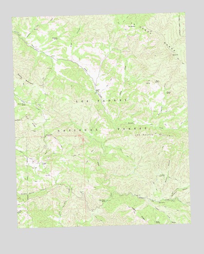
Los Machos Hills, CA USGS Topographic Map
Click on map above to begin viewing in our Map Viewer.

This topographic map contains these locations and features:
Feature Name Type Latitude Longitude GNIS ID View Map
Agua Escondida SpringSpringN35.1797°W120.2293°1670658View Map
Agua Escondido CampgroundLocaleN35.1789°W120.2285°269441View Map
Aliso CanyonValleyN35.2239°W120.2074°269488View Map
Avenales ObservationLocaleN35.1894°W120.2463°269612View Map
Avenales RanchLocaleN35.2055°W120.1913°269613View Map
Bluff SpringSpringN35.2096°W120.1462°269943View Map
Branch CreekStreamN35.1447°W120.1813°270005View Map
Cable Corral SpringSpringN35.1396°W120.1870°270124View Map
Double SpringsSpringN35.1268°W120.1515°270906View Map
Garica Potrero SpringSpringN35.1984°W120.2427°271269View Map
Joughin RanchLocaleN35.1628°W120.2315°271828View Map
Kennel CreekStreamN35.1828°W120.1779°271867View Map
Logan CreekStreamN35.1397°W120.1551°272161View Map
Logan RidgeRidgeN35.1269°W120.1579°272162View Map
Los Machos CreekStreamN35.1841°W120.1554°272224View Map
Los Machos HillsRangeN35.1755°W120.1513°272225View Map
Los PeladosSummitN35.2436°W120.1654°272229View Map
Machesna SpringSpringN35.2368°W120.2182°272298View Map
Machesna TrailTrailN35.2469°W120.2235°272299View Map
Paradise CampgroundLocaleN35.1541°W120.1440°272866View Map
Peartree SpringSpringN35.2027°W120.1413°272909View Map
Sheep CreekStreamN35.1853°W120.1790°273660View Map
Soto SpringSpringN35.1381°W120.1491°273808View Map
Thirtyfive CanyonValleyN35.1391°W120.1404°274107View Map
Wilcox CanyonValleyN35.1397°W120.1457°274493View Map

Note: Coordinates in the location and feature list above are referenced to NAD83 datum.


Copyright (C) 2008-2025 Ryan Niemi / Sunset Dynamics ... All Rights Reserved