TopoQuest Logo
Do you find TopoQuest useful?
Help keep TopoQuest running and adding new maps/features by donating!
Bitcoin:  19c7KJd3qBynnjoSw5npx9KScwjBe4ifkT
Litecoin:  LXs6TkuXGGXo1vDsWCkWVdjQX94eUKd6ui
Home View Maps Find Maps Find Places Resources & Links


Chimney Canyon, California Topographic Map

USGS Map Title: Chimney Canyon, CA
USGS Map MRC: 35120A2
DRG (GeoTIFF) Download: o35120a2.tif


Neighboring USGS Topographic Map Quads:


  Caldwell Mesa, CA  
35120B3
 

  Los Machos Hills, CA  
35120B2
 

  Branch Mountain, CA  
35120B1
 

  Huasna Peak, CA  
35120A3
 

  Chimney Canyon, CA  
35120A2
 

  Miranda Pine Mountain, CA  
35120A1
 

  Twitchell Dam, CA  
34120H3
 

  Tepusquet Canyon, CA  
34120H2
 

  Manzanita Mountain, CA  
34120H1


Map MRC Location:

N36°
W121°
N36°
W120°
H8 H7 H6 H5 H4 H3 H2 H1
G8 G7 G6 G5 G4 G3 G2 G1
F8 F7 F6 F5 F4 F3 F2 F1
E8 E7 E6 E5 E4 E3 E2 E1
D8 D7 D6 D5 D4 D3 D2 D1
C8 C7 C6 C5 C4 C3 C2 C1
B8 B7 B6 B5 B4 B3 B2 B1
A8 A7 A6 A5 A4 A3 A2 A1
N35°
W121°
N35°
W120°

Chimney Canyon, CA USGS 1:24K Topographic Map Preview:
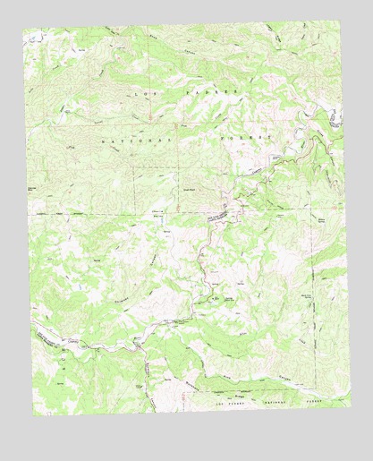
Chimney Canyon, CA USGS Topographic Map
Click on map above to begin viewing in our Map Viewer.

This topographic map contains these locations and features:
Feature Name Type Latitude Longitude GNIS ID View Map
Aliso CreekStreamN35.0322°W120.1877°269489View Map
Buck Cove SpringSpringN35.0360°W120.1402°270047View Map
Buckhorn CanyonValleyN35.0225°W120.2082°270064View Map
Charlie ValleyValleyN35.0602°W120.2008°270395View Map
Chimney CanyonValleyN35.0261°W120.2327°270423View Map
Clear CreekStreamN35.0972°W120.1254°270493View Map
Corral CreekStreamN35.0964°W120.2360°270603View Map
Fish CreekStreamN35.0941°W120.2404°271138View Map
GarcinLocaleN35.0566°W120.1560°1655265View Map
Glines CanyonValleyN35.0905°W120.1404°271316View Map
Glines RanchLocaleN35.0975°W120.2349°271317View Map
Horseshoe CanyonValleyN35.0030°W120.1321°271654View Map
Little Jollo CreekStreamN35.1214°W120.2124°272094View Map
Morris RanchLocaleN35.0086°W120.2077°1655266View Map
Permasse RanchLocaleN35.0808°W120.1538°272927View Map
Pine CanyonValleyN35.0291°W120.1949°272976View Map
Pine Canyon StationLocaleN35.0294°W120.1940°272978View Map
Rice RanchLocaleN35.0361°W120.1788°273275View Map
Shaw CanyonValleyN35.1250°W120.2071°273652View Map
Shell PeakSummitN35.0716°W120.1899°273669View Map
Sierra Madre Picnic AreaLocaleN35.0858°W120.1340°275487View Map
Twin Rocks TrailTrailN35.0964°W120.1696°274253View Map
Willow SpringSpringN35.0600°W120.1342°274525View Map
Willow Spring TrailTrailN35.0644°W120.1468°274533View Map

Note: Coordinates in the location and feature list above are referenced to NAD83 datum.


Copyright (C) 2008-2025 Ryan Niemi / Sunset Dynamics ... All Rights Reserved