TopoQuest Logo
Do you find TopoQuest useful?
Help keep TopoQuest running and adding new maps/features by donating!
Bitcoin:  19c7KJd3qBynnjoSw5npx9KScwjBe4ifkT
Litecoin:  LXs6TkuXGGXo1vDsWCkWVdjQX94eUKd6ui
Home View Maps Find Maps Find Places Resources & Links


Miser Creek, Montana Topographic Map

USGS Map Title: Miser Creek, MT
USGS Map MRC: 45111G1
DRG (GeoTIFF) Download: o45111g1.tif


Neighboring USGS Topographic Map Quads:


  Horseshoe Creek, MT  
45111H2
 

  Flathead Pass, MT  
45111H1
 

  Sacagawea Peak, MT  
45110H8
 

  Belgrade, MT  
45111G2
 

  Miser Creek, MT  
45111G1
 

  Saddle Peak, MT  
45110G8
 

  Bozeman Hot Springs, MT  
45111F2
 

  Bozeman, MT  
45111F1
 

  Kelly Creek, MT  
45110F8


Map MRC Location:

N46°
W112°
N46°
W111°
H8 H7 H6 H5 H4 H3 H2 H1
G8 G7 G6 G5 G4 G3 G2 G1
F8 F7 F6 F5 F4 F3 F2 F1
E8 E7 E6 E5 E4 E3 E2 E1
D8 D7 D6 D5 D4 D3 D2 D1
C8 C7 C6 C5 C4 C3 C2 C1
B8 B7 B6 B5 B4 B3 B2 B1
A8 A7 A6 A5 A4 A3 A2 A1
N45°
W112°
N45°
W111°

Miser Creek, MT USGS 1:24K Topographic Map Preview:
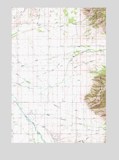
Miser Creek, MT USGS Topographic Map
Click on map above to begin viewing in our Map Viewer.

This topographic map contains these locations and features:
Feature Name Type Latitude Longitude GNIS ID View Map
01N03E10BB__01 WellWellN45.8591°W111.0947°812816View Map
01N05E02AAAC01 WellWellN45.8733°W111.0580°812961View Map
01N05E02BAAD01 WellWellN45.8735°W111.0727°812966View Map
01N05E03DA__01 WellWellN45.8666°W111.0791°812884View Map
01N05E04DD__01 WellWellN45.8630°W111.0997°812861View Map
01N05E04DD__02 WellWellN45.8630°W111.0997°812862View Map
01N05E04DDAD01 WellWellN45.8630°W111.0980°812860View Map
01N05E04DDAD02 WellWellN45.8627°W111.0983°812859View Map
01N05E05DA__01 WellWellN45.8666°W111.1205°812885View Map
01N05E08AD__01 WellWellN45.8555°W111.1205°812782View Map
01N05E09BB__01 WellWellN45.8591°W111.1152°812817View Map
01N05E10BA__01 WellWellN45.8591°W111.0894°812815View Map
01N05E11CB__01 WellWellN45.8519°W111.0738°812758View Map
01N05E11CB__02 WellWellN45.8519°W111.0738°812759View Map
01N05E13AD__01 WellWellN45.8408°W111.0377°812654View Map
01N05E14AB__01 WellWellN45.8444°W111.0636°812686View Map
01N05E14ACDD01 WellWellN45.8402°W111.0619°812648View Map
01N05E15CB__01 WellWellN45.8372°W111.0947°812612View Map
01N05E15CB__02 WellWellN45.8372°W111.0947°812613View Map
01N05E16BC__01 WellWellN45.8408°W111.1152°812655View Map
01N05E16DAAA01 WellWellN45.8383°W111.0986°812627View Map
01N05E20DBAA01 WellWellN45.8233°W111.1238°812474View Map
01N05E21BC__01 WellWellN45.8260°W111.1152°812505View Map
01N05E21BC__02 WellWellN45.8260°W111.1152°812506View Map
01N05E21BC__03 WellWellN45.8260°W111.1152°812507View Map
01N05E21BC__04 WellWellN45.8260°W111.1152°812508View Map
01N05E21CA__01 WellWellN45.8224°W111.1100°812463View Map
01N05E22AD__01 WellWellN45.8260°W111.0791°812504View Map
01N05E22CC__01 WellWellN45.8188°W111.0947°812419View Map
01N05E23CC__01 WellWellN45.8188°W111.0738°812418View Map
01N05E24AC__01 WellWellN45.8260°W111.0430°812503View Map
01N05E26CD__01 WellWellN45.8041°W111.0688°812204View Map
01N05E27CC__01 WellWellN45.8041°W111.0947°812205View Map
01N05E28DB__01 WellWellN45.8077°W111.1050°812251View Map
01N05E28DB__02 WellWellN45.8077°W111.1050°812252View Map
01N05E28DCAD01 WellWellN45.8047°W111.1033°812215View Map
01N05E32DD__01 WellWellN45.7894°W111.1205°812051View Map
01N05E34BD__01 WellWellN45.7966°W111.0894°812125View Map
01N05E34BD__02 WellWellN45.7966°W111.0894°812126View Map
01N05E34DB__01 WellWellN45.7930°W111.0844°812092View Map
01N05E34DDDC01 WellWellN45.7877°W111.0786°812035View Map
01N05E35AA__01 WellWellN45.8002°W111.0586°812161View Map
01N05E35AD__01 WellWellN45.7966°W111.0586°812124View Map
01N05E35ADBB01 WellWellN45.7977°W111.0586°812140View Map
01N05E35CA__01 WellWellN45.7930°W111.0688°812091View Map
01N05E36CD__01 WellWellN45.7894°W111.0480°812050View Map
01N06E07CC__01 SpringSpringN45.8458°W111.0322°812704View Map
01N06E17CDCB01 WellWellN45.8327°W111.0077°812568View Map
01N06E18CB__01 WellWellN45.8352°W111.0322°812594View Map
01N06E18CB__02 WellWellN45.8352°W111.0322°812595View Map
01N06E30AB__01 SpringSpringN45.8141°W111.0219°812331View Map
01N06E30BCBB01 WellWellN45.8133°W111.0338°812320View Map
01S05E01CB__01 WellWellN45.7783°W111.0591°811932View Map
01S05E02DC__01 WellWellN45.7747°W111.0694°811887View Map
01S05E03CB__01 WellWellN45.7783°W111.1005°811933View Map
01S05E03CD__01 WellWellN45.7747°W111.0952°811888View Map
01S05E04BD__01 WellWellN45.7819°W111.1158°811973View Map
01S05E04DB__01 WellWellN45.7783°W111.1108°811934View Map
01S05E04DC__01 WellWellN45.7747°W111.1108°811889View Map
01S05E04DC__02 WellWellN45.7747°W111.1108°811890View Map
01S05E09AC__01 WellWellN45.7674°W111.1108°811820View Map
01S05E09ACCC01 WellWellN45.7658°W111.1122°811799View Map
01S05E09BB__01 WellWellN45.7710°W111.1211°811855View Map
01S05E09DCCC01 WellWellN45.7602°W111.1158°811751View Map
01S05E10AC__01 WellWellN45.7674°W111.0902°811819View Map
01S05E10CC__01 WellWellN45.7602°W111.1005°811750View Map
01S05E11BC__01 WellWellN45.7674°W111.0799°811818View Map
01S05E11CB__01 WellWellN45.7638°W111.0799°811777View Map
01S05E12AD__01 WellWellN45.7674°W111.0438°811817View Map
01S05E12BCCC01 WellWellN45.7663°W111.0608°811803View Map
01S05E12BCCC02 WellWellN45.7663°W111.0608°811804View Map
01S05E12DB__01 WellWellN45.7638°W111.0488°811776View Map
01S05E13AA__01 WellWellN45.7566°W111.0438°811711View Map
01S05E14BD__01 WellWellN45.7530°W111.0747°811670View Map
01S05E15BA__01 WellWellN45.7566°W111.0952°811712View Map
01S05E15BCBA01 WellWellN45.7541°W111.1002°811690View Map
01S06E06ABCB01 WellWellN45.7849°W111.0299°812004View Map
01S06E18BBBB01 WellWellN45.7580°W111.0402°811737View Map
Bill Smith CreekStreamN45.8602°W111.0766°779912View Map
Bostwick CanyonValleyN45.7822°W111.0241°780241View Map
Bostwick CreekStreamN45.8049°W111.1202°780242View Map
Bueno Vista Acres Trailer CourtPopulated PlaceN45.8499°W111.0424°1738001View Map
BuschPopulated PlaceN45.8035°W111.0830°780666View Map
Busch (historical)LocaleN45.8035°W111.0830°1743884View Map
CamonaPopulated PlaceN45.7658°W111.0813°780834View Map
Camona (historical)LocaleN45.7658°W111.0813°1743883View Map
Corbly GulchValleyN45.8616°W111.0341°781666View Map
Courts Post Office (historical)Post OfficeN45.8708°W111.0841°1743732View Map
Decker School (historical)SchoolN45.7944°W111.0702°1743492View Map
East Gallatin Post Office (historical)Post OfficeN45.8222°W111.1230°1743786View Map
East Gallatin School (historical)SchoolN45.8208°W111.1244°1743494View Map
Flannery BridgeBridgeN45.7763°W111.1091°1737928View Map
Jones CreekStreamN45.8369°W111.0005°772887View Map
Limestone CanyonValleyN45.8610°W111.0502°786143View Map
Limestone CreekStreamN45.8602°W111.0769°786149View Map
Lutz McGuire DitchCanalN45.8194°W111.0661°806234View Map
Middle Cottonwood CreekStreamN45.7902°W111.1183°787221View Map
Miser CanyonValleyN45.8088°W111.0174°787493View Map
Miser CreekStreamN45.8055°W111.0613°787494View Map
North Cottonwood CreekStreamN45.8580°W111.0924°788075View Map
Penwellton (historical)LocaleN45.8160°W111.1247°1743847View Map
Reese Creek (historical)Populated PlaceN45.8638°W111.0841°1743842View Map
Schafer CreekStreamN45.7869°W111.0719°790111View Map
Sexton Post Office (historical)Post OfficeN45.8638°W111.0813°1743808View Map
Spain (historical)LocaleN45.7766°W111.1105°1743834View Map
Spain BridgeBridgeN45.7816°W111.1133°1737929View Map
Spring BranchStreamN45.8063°W111.0563°791194View Map
SpringhillLocaleN45.8260°W111.1166°791323View Map
SpringhillPopulated PlaceN45.8394°W111.0347°1743833View Map
Springhill CemeteryCemeteryN45.8405°W111.0080°791324View Map
Springhill ChurchChurchN45.8388°W111.0438°791325View Map
Springhill Fire - Central Valley Fire DisctrictBuildingN45.8351°W111.0430°2546608View Map
Springhill Post Office (historical)Post OfficeN45.8260°W111.1166°1743813View Map
Springhill SchoolSchoolN45.8391°W111.0352°791326View Map
Thomasville (historical)Populated PlaceN45.8299°W111.0424°1743827View Map
Walker (historical)Populated PlaceN45.7666°W111.0286°1743672View Map
Walker CemeteryCemeteryN45.7664°W111.0288°1743529View Map
Walker School (historical)SchoolN45.7666°W111.0286°1743491View Map
Walton CreekStreamN45.7516°W111.0319°792789View Map
Watts CanyonValleyN45.7688°W111.0016°793656View Map
Wisner (historical)LocaleN45.7769°W111.0822°1743667View Map
Wisner CrossingPopulated PlaceN45.7769°W111.0822°793443View Map

Note: Coordinates in the location and feature list above are referenced to NAD83 datum.


Copyright (C) 2008-2025 Ryan Niemi / Sunset Dynamics ... All Rights Reserved