TopoQuest Logo
Do you find TopoQuest useful?
Help keep TopoQuest running and adding new maps/features by donating!
Bitcoin:  19c7KJd3qBynnjoSw5npx9KScwjBe4ifkT
Litecoin:  LXs6TkuXGGXo1vDsWCkWVdjQX94eUKd6ui
Home View Maps Find Maps Find Places Resources & Links


Beaverhead Rock NE, Montana Topographic Map

USGS Map Title: Beaverhead Rock NE, MT
USGS Map MRC: 45112D3
DRG (GeoTIFF) Download: o45112d3.tif


Neighboring USGS Topographic Map Quads:


  Twin Bridges SW, MT  
45112E4
 

  Twin Bridges, MT  
45112E3
 

  Old Baldy Mountain, MT  
45112E2
 

  Beaverhead Rock, MT  
45112D4
 

  Beaverhead Rock NE, MT  
45112D3
 

  Sheridan, MT  
45112D2
 

  Beaverhead Rock SW, MT  
45112C4
 

  Beaverhead Rock SE, MT  
45112C3
 

  Laurin Canyon, MT  
45112C2


Map MRC Location:

N46°
W113°
N46°
W112°
H8 H7 H6 H5 H4 H3 H2 H1
G8 G7 G6 G5 G4 G3 G2 G1
F8 F7 F6 F5 F4 F3 F2 F1
E8 E7 E6 E5 E4 E3 E2 E1
D8 D7 D6 D5 D4 D3 D2 D1
C8 C7 C6 C5 C4 C3 C2 C1
B8 B7 B6 B5 B4 B3 B2 B1
A8 A7 A6 A5 A4 A3 A2 A1
N45°
W113°
N45°
W112°

Beaverhead Rock NE, MT USGS 1:24K Topographic Map Preview:
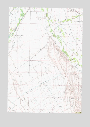
Beaverhead Rock NE, MT USGS Topographic Map
Click on map above to begin viewing in our Map Viewer.

This topographic map contains these locations and features:
Feature Name Type Latitude Longitude GNIS ID View Map
04S05W18CAAC01 WellWellN45.4863°W112.2694°809734View Map
04S06W16AAAA02 WellWellN45.4949°W112.3397°809781View Map
04S06W16DDDD02 WellWellN45.4810°W112.3400°809701View Map
04S06W26ABA_02 WellWellN45.4658°W112.3067°809631View Map
04S06W26ABB_02 WellWellN45.4658°W112.3067°809632View Map
04S06W27BAAA01 WellWellN45.4660°W112.3308°809634View Map
04S06W29AABA01 WellWellN45.4660°W112.3633°809635View Map
04S06W32ABB_02 WellWellN45.4510°W112.3692°809540View Map
04S06W32ABBA02 WellWellN45.4516°W112.3686°809547View Map
04S06W35BBBB01 WellWellN45.4508°W112.3183°809539View Map
05S05W05CCAA01 WellWellN45.4255°W112.2519°809420View Map
05S05W05CCCA01 WellWellN45.4241°W112.2542°809415View Map
05S06W03AAB_01 WellWellN45.4363°W112.3228°809479View Map
05S06W03BBB_01 WellWellN45.4360°W112.3397°809477View Map
05S06W04BDA_01 WellWellN45.4327°W112.3497°809454View Map
05S06W10BCCA01 WellWellN45.4163°W112.3375°809385View Map
05S06W12BBB01_ WellWellN45.4216°W112.2992°809404View Map
05S06W15ACB_01 WellWellN45.4044°W112.3294°809335View Map
05S06W17CAB_01 WellWellN45.3999°W112.3747°809308View Map
Beaverhead River BridgeBridgeN45.4735°W112.3642°1797678View Map
Castle RockMineN45.4658°W112.2564°803916View Map
Cottonwood Ranch (historical)LocaleN45.4749°W112.2967°1797532View Map
Duncan School (historical)SchoolN45.4583°W112.2503°1797530View Map
Indian CreekStreamN45.4680°W112.2767°785258View Map
Left Fork Leonard SloughStreamN45.4769°W112.2844°773285View Map
Leonard SloughStreamN45.4835°W112.3086°773304View Map
Mill CreekStreamN45.4658°W112.2914°787356View Map
Sarge Hall DitchCanalN45.4635°W112.3019°776224View Map
Silver Springs (historical)LocaleN45.4666°W112.3050°1797607View Map
Wet Georgia GulchValleyN45.4974°W112.2822°793147View Map
Wisconsin CreekStreamN45.4877°W112.3061°793431View Map

Note: Coordinates in the location and feature list above are referenced to NAD83 datum.


Copyright (C) 2008-2025 Ryan Niemi / Sunset Dynamics ... All Rights Reserved