TopoQuest Logo
Do you find TopoQuest useful?
Help keep TopoQuest running and adding new maps/features by donating!
Bitcoin:  19c7KJd3qBynnjoSw5npx9KScwjBe4ifkT
Litecoin:  LXs6TkuXGGXo1vDsWCkWVdjQX94eUKd6ui
Home View Maps Find Maps Find Places Resources & Links


Twin Bridges SW, Montana Topographic Map

USGS Map Title: Twin Bridges SW, MT
USGS Map MRC: 45112E4
DRG (GeoTIFF) Download: o45112e4.tif


Neighboring USGS Topographic Map Quads:


  Wickiup Creek, MT  
45112F5
 

  Table Mountain, MT  
45112F4
 

  Silver Star, MT  
45112F3
 

  Nez Perce Hollow, MT  
45112E5
 

  Twin Bridges SW, MT  
45112E4
 

  Twin Bridges, MT  
45112E3
 

  Block Mountain, MT  
45112D5
 

  Beaverhead Rock, MT  
45112D4
 

  Beaverhead Rock NE, MT  
45112D3


Map MRC Location:

N46°
W113°
N46°
W112°
H8 H7 H6 H5 H4 H3 H2 H1
G8 G7 G6 G5 G4 G3 G2 G1
F8 F7 F6 F5 F4 F3 F2 F1
E8 E7 E6 E5 E4 E3 E2 E1
D8 D7 D6 D5 D4 D3 D2 D1
C8 C7 C6 C5 C4 C3 C2 C1
B8 B7 B6 B5 B4 B3 B2 B1
A8 A7 A6 A5 A4 A3 A2 A1
N45°
W113°
N45°
W112°

Twin Bridges SW, MT USGS 1:24K Topographic Map Preview:
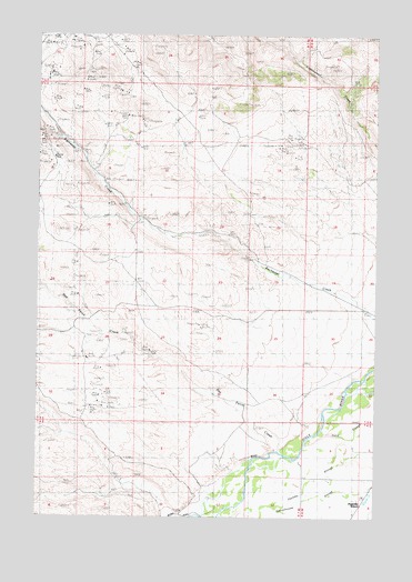
Twin Bridges SW, MT USGS Topographic Map
Click on map above to begin viewing in our Map Viewer.

This topographic map contains these locations and features:
Feature Name Type Latitude Longitude GNIS ID View Map
03S07W05DCDB01 SpringSpringN45.5988°W112.4917°810395View Map
Alaska MineMineN45.6244°W112.4736°804323View Map
Anything MineMineN45.6146°W112.4833°804312View Map
Crystal MineMineN45.5974°W112.4695°804320View Map
Eclipse MineMineN45.5930°W112.4947°771132View Map
Elizabeth MineMineN45.6191°W112.4675°804316View Map
Ellen Marshall MineMineN45.5410°W112.4820°804276View Map
End MineMineN45.6110°W112.4845°804321View Map
Full House MineMineN45.6169°W112.4656°804322View Map
Hermit MineMineN45.6160°W112.4925°804327View Map
Idler MineMineN45.6049°W112.4808°804326View Map
Monitor MineMineN45.6213°W112.4695°804311View Map
Muriers (historical)LocaleN45.5999°W112.4092°1797476View Map
NE Section 4 MineMineN45.6085°W112.4675°804307View Map
Never Fail MineMineN45.5285°W112.4808°804277View Map
Nez Perce CreekStreamN45.5177°W112.4117°774615View Map
NW Section 15 MineMineN45.5763°W112.4625°804325View Map
NW Section 26 MineMineN45.5508°W112.4425°804278View Map
NW Section 33 MineMineN45.5324°W112.4758°804279View Map
NW Section 5 MineMineN45.6085°W112.4961°804318View Map
Pageville Post Office (historical)Post OfficeN45.5033°W112.3808°1797472View Map
Pageville School (historical)SchoolN45.5030°W112.3800°775059View Map
Pennington Bridge Fishing Access SiteLocaleN45.5019°W112.4406°1744514View Map
Rock Spring RanchLocaleN45.5996°W112.4239°775862View Map
Sunbeam/ID Number 2 MineMineN45.6136°W112.4972°804306View Map
SW Section 3 MineMineN45.6027°W112.4625°804308View Map
SW Section 9 MineMineN45.5860°W112.4742°804310View Map

Note: Coordinates in the location and feature list above are referenced to NAD83 datum.


Copyright (C) 2008-2024 Ryan Niemi / Sunset Dynamics ... All Rights Reserved