TopoQuest Logo
Do you find TopoQuest useful?
Help keep TopoQuest running and adding new maps/features by donating!
Bitcoin:  19c7KJd3qBynnjoSw5npx9KScwjBe4ifkT
Litecoin:  LXs6TkuXGGXo1vDsWCkWVdjQX94eUKd6ui
Home View Maps Find Maps Find Places Resources & Links


Molt, Montana Topographic Map

USGS Map Title: Molt, MT
USGS Map MRC: 45108G8
DRG (GeoTIFF) Download: o45108g8.tif


Neighboring USGS Topographic Map Quads:


  Wheat Basin, MT  
45109H1
 

  Rock Spring, MT  
45108H8
 

  Comanche, MT  
45108H7
 

  Hunter Lake, MT  
45109G1
 

  Molt, MT  
45108G8
 

  Two Pine School, MT  
45108G7
 

  Horse Butte, MT  
45109F1
 

  Park City, MT  
45108F8
 

  Laurel, MT  
45108F7


Map MRC Location:

N46°
W109°
N46°
W108°
H8 H7 H6 H5 H4 H3 H2 H1
G8 G7 G6 G5 G4 G3 G2 G1
F8 F7 F6 F5 F4 F3 F2 F1
E8 E7 E6 E5 E4 E3 E2 E1
D8 D7 D6 D5 D4 D3 D2 D1
C8 C7 C6 C5 C4 C3 C2 C1
B8 B7 B6 B5 B4 B3 B2 B1
A8 A7 A6 A5 A4 A3 A2 A1
N45°
W109°
N45°
W108°

Molt, MT USGS 1:24K Topographic Map Preview:
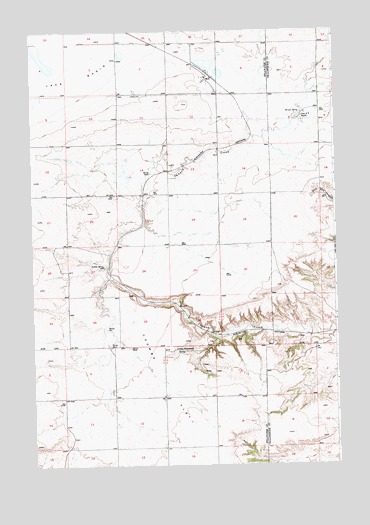
Molt, MT USGS Topographic Map
Click on map above to begin viewing in our Map Viewer.

This topographic map contains these locations and features:
Feature Name Type Latitude Longitude GNIS ID View Map
01N22E02BCBC01 WellWellN45.8666°W108.9640°812889View Map
01N22E02CDCA01 WellWellN45.8580°W108.9571°812797View Map
01N22E02CDCD01 WellWellN45.8574°W108.9574°812795View Map
01N22E10DCCD01 WellWellN45.8427°W108.9727°812667View Map
01N22E11CCCC01 WellWellN45.8427°W108.9663°812666View Map
01N22E14BCCC01 WellWellN45.8355°W108.9643°812599View Map
01N22E14CDAB01 WellWellN45.8311°W108.9560°812557View Map
01N22E15ABBB01 WellWellN45.8422°W108.9743°812663View Map
01N23E08ACCA01 WellWellN45.8508°W108.8896°812744View Map
01S22E12AAAA01 WellWellN45.7691°W108.9477°811832View Map
Coombs (historical)LocaleN45.8263°W108.9535°1726933View Map
Coombs FlatFlatN45.7733°W108.9474°770072View Map
Indian SpringSpringN45.8072°W108.9710°772700View Map
Lazy K T RanchLocaleN45.8508°W108.8890°773267View Map
Luckey HomesteadLocaleN45.7830°W108.9413°773755View Map
MoltPopulated PlaceN45.8613°W108.9279°774330View Map
Molt (historical)LocaleN45.8613°W108.9279°1726930View Map
Molt Post OfficePost OfficeN45.8615°W108.9280°1726886View Map
Molt SchoolSchoolN45.8615°W108.9297°2128255View Map
Molt Volunteer Fire DepartmentBuildingN45.8612°W108.9292°1726939View Map
Morgan SpringSpringN45.8511°W108.8897°774382View Map
Thurza Post Office (historical)Post OfficeN45.7977°W108.9660°1726983View Map

Note: Coordinates in the location and feature list above are referenced to NAD83 datum.


Copyright (C) 2008-2025 Ryan Niemi / Sunset Dynamics ... All Rights Reserved