TopoQuest Logo
Do you find TopoQuest useful?
Help keep TopoQuest running and adding new maps/features by donating!
Bitcoin:  19c7KJd3qBynnjoSw5npx9KScwjBe4ifkT
Litecoin:  LXs6TkuXGGXo1vDsWCkWVdjQX94eUKd6ui
Home View Maps Find Maps Find Places Resources & Links


Laurel, Montana Topographic Map

USGS Map Title: Laurel, MT
USGS Map MRC: 45108F7
DRG (GeoTIFF) Download: o45108f7.tif


Neighboring USGS Topographic Map Quads:


  Molt, MT  
45108G8
 

  Two Pine School, MT  
45108G7
 

  Rimrock, MT  
45108G6
 

  Park City, MT  
45108F8
 

  Laurel, MT  
45108F7
 

  Mossmain, MT  
45108F6
 

  Montaqua, MT  
45108E8
 

  Silesia, MT  
45108E7
 

  Mossmain SW, MT  
45108E6


Map MRC Location:

N46°
W109°
N46°
W108°
H8 H7 H6 H5 H4 H3 H2 H1
G8 G7 G6 G5 G4 G3 G2 G1
F8 F7 F6 F5 F4 F3 F2 F1
E8 E7 E6 E5 E4 E3 E2 E1
D8 D7 D6 D5 D4 D3 D2 D1
C8 C7 C6 C5 C4 C3 C2 C1
B8 B7 B6 B5 B4 B3 B2 B1
A8 A7 A6 A5 A4 A3 A2 A1
N45°
W109°
N45°
W108°

Laurel, MT USGS 1:24K Topographic Map Preview:
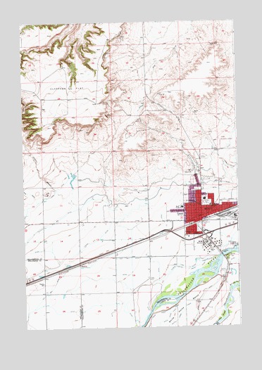
Laurel, MT USGS Topographic Map
Click on map above to begin viewing in our Map Viewer.

This topographic map contains these locations and features:
Feature Name Type Latitude Longitude GNIS ID View Map
02S23E10CDDA01 WellWellN45.6688°W108.8746°810975View Map
02S23E11ADDC01 WellWellN45.6758°W108.8454°811038View Map
02S23E11DDDC01 WellWellN45.6691°W108.8440°810977View Map
02S23E12ADDC01 WellWellN45.6766°W108.8238°811046View Map
02S23E13CCBC01 WellWellN45.6563°W108.8415°810865View Map
02S23E15DDDA01 WellWellN45.6555°W108.8643°810861View Map
02S23E15DDDB01 WellWellN45.6549°W108.8654°810845View Map
02S23E22DDAD01 WellWellN45.6416°W108.8640°810751View Map
02S23E24CCCC01 WellWellN45.6397°W108.8424°810735View Map
02S23E25DABD01 WellWellN45.6311°W108.8254°810684View Map
02S23E26CCCC01 WellWellN45.6252°W108.8632°810637View Map
02S23E26DDAC01 WellWellN45.6274°W108.8440°810660View Map
02S24E03CCCB01 WellWellN45.6836°W108.7607°811098View Map
02S24E04BCAA01 WellWellN45.6933°W108.7774°811186View Map
02S24E06DDCD01 WellWellN45.6836°W108.8051°811099View Map
02S24E07D___01 WellWellN45.6724°W108.8063°811010View Map
02S24E08BBBC01 WellWellN45.6813°W108.8015°811090View Map
02S24E08CCBC01 WellWellN45.6711°W108.8015°811005View Map
02S24E09BBCC01 WellWellN45.6797°W108.7813°811063View Map
02S24E15BBCC01 WellWellN45.6655°W108.7604°810948View Map
02S24E16CBDA01 WellWellN45.6588°W108.7768°810883View Map
02S24E16DDAD01 WellWellN45.6561°W108.7613°810862View Map
02S24E18BCBC01 WellWellN45.6636°W108.8213°810938View Map
02S24E18DDDB01 WellWellN45.6552°W108.8035°810859View Map
02S24E18DDDC01 WellWellN45.6547°W108.8038°810836View Map
02S24E19BBBC01 WellWellN45.6530°W108.8215°810830View Map
02S24E19DAAA01 WellWellN45.6455°W108.8026°810776View Map
02S24E20ABAD01 WellWellN45.6527°W108.7874°810828View Map
02S24E22CBBD01 WellWellN45.6449°W108.7593°810774View Map
02S24E28ACAB01 WellWellN45.6352°W108.7682°810715View Map
02S24E28ACDA01 WellWellN45.6327°W108.7668°810692View Map
02S24E29ACDD01 WellWellN45.6319°W108.7874°810688View Map
Big DitchCanalN45.6708°W108.8529°768777View Map
Bill Bartley TrailTrailN45.7322°W108.8304°768850View Map
Cenex Harvest State Fire BrigadeBuildingN45.6604°W108.7660°2546562View Map
City of LaurelCivilN45.6734°W108.7706°2411634View Map
Clappers FlatFlatN45.7249°W108.8560°769888View Map
Clarks Fork DitchCanalN45.6449°W108.7951°769907View Map
Cottonwood AirportAirportN45.6335°W108.8476°2650709View Map
Fly WM AirportAirportN45.6285°W108.8250°2717676View Map
Fred W Graff Elementary SchoolSchoolN45.6749°W108.7663°771086View Map
John Dunn TrailTrailN45.7377°W108.8185°772842View Map
KBSR-AM (Laurel)TowerN45.6530°W108.7532°806640View Map
LaurelPopulated PlaceN45.6691°W108.7715°773254View Map
Laurel Ambulance ServiceBuildingN45.6701°W108.7742°2637859View Map
Laurel CemeteryCemeteryN45.6944°W108.7699°773255View Map
Laurel City Police DepartmentBuildingN45.6700°W108.7743°2548908View Map
Laurel Municipal AirportAirportN45.7014°W108.7595°806464View Map
Laurel Post OfficePost OfficeN45.6752°W108.7720°2738313View Map
Laurel Volunteer Fire DepartmentBuildingN45.6700°W108.7741°2546623View Map
Red and King GulchValleyN45.6780°W108.8679°775613View Map
Saint Anthonys ChurchChurchN45.6761°W108.7754°776099View Map
Saint Johns ChurchChurchN45.6777°W108.7771°776108View Map
South Elementary SchoolSchoolN45.6630°W108.7763°776894View Map
SpurlingPopulated PlaceN45.6505°W108.8454°777097View Map
Thompson ParkParkN45.6761°W108.7685°777585View Map
Trewin School (historical)SchoolN45.6436°W108.8643°777754View Map
West Elementary SchoolSchoolN45.6741°W108.7824°778292View Map
Yellowstone National CemeteryCemeteryN45.6964°W108.7724°2775475View Map

Note: Coordinates in the location and feature list above are referenced to NAD83 datum.


Copyright (C) 2008-2024 Ryan Niemi / Sunset Dynamics ... All Rights Reserved