TopoQuest Logo
Do you find TopoQuest useful?
Help keep TopoQuest running and adding new maps/features by donating!
Bitcoin:  19c7KJd3qBynnjoSw5npx9KScwjBe4ifkT
Litecoin:  LXs6TkuXGGXo1vDsWCkWVdjQX94eUKd6ui
Home View Maps Find Maps Find Places Resources & Links


Monte Cristo, Washington Topographic Map

USGS Map Title: Monte Cristo, WA
USGS Map MRC: 47121H4
DRG (GeoTIFF) Download: o47121h4.tif


Neighboring USGS Topographic Map Quads:


  Silverton, WA  
48121A5
 

  Bedal, WA  
48121A4
 

  Sloan Peak, WA  
48121A3
 

  Mount Stickney, WA  
47121H5
 

  Monte Cristo, WA  
47121H4
 

  Blanca Lake, WA  
47121H3
 

  Index, WA  
47121G5
 

  Baring, WA  
47121G4
 

  Evergreen Mountain, WA  
47121G3


Map MRC Location:

N48°
W122°
N48°
W121°
H8 H7 H6 H5 H4 H3 H2 H1
G8 G7 G6 G5 G4 G3 G2 G1
F8 F7 F6 F5 F4 F3 F2 F1
E8 E7 E6 E5 E4 E3 E2 E1
D8 D7 D6 D5 D4 D3 D2 D1
C8 C7 C6 C5 C4 C3 C2 C1
B8 B7 B6 B5 B4 B3 B2 B1
A8 A7 A6 A5 A4 A3 A2 A1
N47°
W122°
N47°
W121°

Monte Cristo, WA USGS 1:24K Topographic Map Preview:
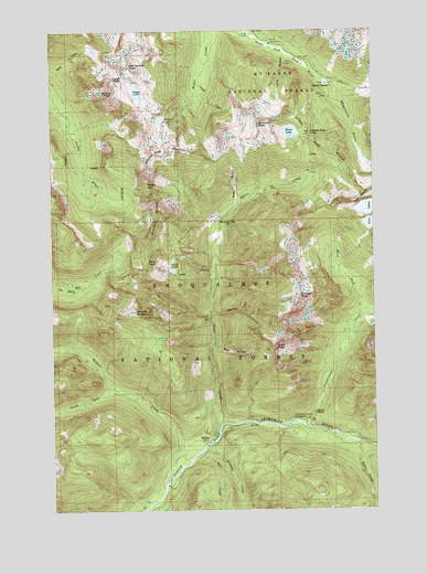
Monte Cristo, WA USGS Topographic Map
Click on map above to begin viewing in our Map Viewer.

This topographic map contains these locations and features:
Feature Name Type Latitude Longitude GNIS ID View Map
Bear CreekStreamN47.8923°W121.3829°1516252View Map
Big GulchValleyN47.9168°W121.4393°1516513View Map
Canyon CreekStreamN47.9876°W121.4440°1517343View Map
Crested ButtesSummitN47.9465°W121.4643°1518328View Map
Del Campo PeakSummitN47.9909°W121.4704°1530855View Map
Foggy LakeLakeN47.9840°W121.4673°1519673View Map
Foggy PassGapN47.9876°W121.4732°1519674View Map
GalenaPopulated PlaceN47.8923°W121.4434°1519869View Map
Glacier CreekStreamN47.9865°W121.3929°1519975View Map
Gothic PeakSummitN47.9837°W121.4768°1520170View Map
Gulch LakesLakeN47.9379°W121.4551°1520406View Map
Hard PassGapN47.9396°W121.4643°1520534View Map
Hops Hill CampgroundLocaleN47.9984°W121.4218°1528739View Map
Howard CreekStreamN47.8907°W121.4426°1520989View Map
Hubbart PeakSummitN47.9304°W121.4051°1521016View Map
Lake GulchValleyN47.9382°W121.4384°1533130View Map
Lost CreekStreamN47.8893°W121.4448°1522470View Map
Mineral ButteSummitN47.9265°W121.4690°1523206View Map
Mineral CityLocaleN47.9509°W121.4357°1523207View Map
Monte CristoPopulated PlaceN47.9857°W121.3940°1523329View Map
Monte Cristo CampgroundLocaleN47.9871°W121.3940°1529840View Map
North Crested ButteSummitN47.9540°W121.4612°1528621View Map
Poodle Dog PassGapN47.9726°W121.4007°1524569View Map
Quartz CreekStreamN47.9262°W121.4393°1524733View Map
Red GulchValleyN47.9543°W121.4304°1524933View Map
Salmon CreekStreamN47.8798°W121.4587°1525386View Map
Sauk River CampgroundLocaleN47.9921°W121.4079°1528815View Map
Scott PeakSummitN47.9171°W121.4151°1525518View Map
Seventysix GulchValleyN47.9846°W121.3912°1525595View Map
Sheep GapGapN47.9596°W121.4637°1525635View Map
Sheep Gap MountainSummitN47.9684°W121.4623°1525636View Map
Silver CreekStreamN47.8968°W121.4368°1525755View Map
Silver LakeLakeN47.9732°W121.4079°1525780View Map
Silvertip CampgroundLocaleN47.9959°W121.4154°1528740View Map
Silvertip CreekStreamN47.9957°W121.4165°1525801View Map
Silvertip PeakSummitN47.9754°W121.4204°1525803View Map
South Crested ButteSummitN47.9465°W121.4637°1528622View Map
South Fork Salmon CreekStreamN47.9054°W121.4757°1526239View Map
Sultan DivisionCivilN47.8917°W121.4908°1939627View Map
Sunday FallsFallsN47.9818°W121.3915°1528483View Map
Troublesome CreekStreamN47.8968°W121.4040°1527396View Map
Troublesome Creek CampgroundLocaleN47.8976°W121.4037°1527397View Map
Twin LakesLakeN47.9515°W121.3779°1527546View Map
Twin PeaksSummitN47.9557°W121.3809°1527552View Map
Weeden LakeLakeN47.9766°W121.4579°1527876View Map
West Fork Troublesome CreekStreamN47.9287°W121.3818°1527981View Map

Note: Coordinates in the location and feature list above are referenced to NAD83 datum.


Copyright (C) 2008-2024 Ryan Niemi / Sunset Dynamics ... All Rights Reserved