TopoQuest Logo
Do you find TopoQuest useful?
Help keep TopoQuest running and adding new maps/features by donating!
Bitcoin:  19c7KJd3qBynnjoSw5npx9KScwjBe4ifkT
Litecoin:  LXs6TkuXGGXo1vDsWCkWVdjQX94eUKd6ui
Home View Maps Find Maps Find Places Resources & Links


Bedal, Washington Topographic Map

USGS Map Title: Bedal, WA
USGS Map MRC: 48121A4
DRG (GeoTIFF) Download: o48121a4.tif


Neighboring USGS Topographic Map Quads:


  Helena Ridge, WA  
48121B5
 

  White Chuck Mountain, WA  
48121B4
 

  Mount Pugh, WA  
48121B3
 

  Silverton, WA  
48121A5
 

  Bedal, WA  
48121A4
 

  Sloan Peak, WA  
48121A3
 

  Mount Stickney, WA  
47121H5
 

  Monte Cristo, WA  
47121H4
 

  Blanca Lake, WA  
47121H3


Map MRC Location:

N49°
W122°
N49°
W121°
H8 H7 H6 H5 H4 H3 H2 H1
G8 G7 G6 G5 G4 G3 G2 G1
F8 F7 F6 F5 F4 F3 F2 F1
E8 E7 E6 E5 E4 E3 E2 E1
D8 D7 D6 D5 D4 D3 D2 D1
C8 C7 C6 C5 C4 C3 C2 C1
B8 B7 B6 B5 B4 B3 B2 B1
A8 A7 A6 A5 A4 A3 A2 A1
N48°
W122°
N48°
W121°

Bedal, WA USGS 1:24K Topographic Map Preview:
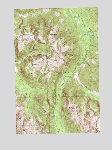
Bedal, WA USGS Topographic Map
Click on map above to begin viewing in our Map Viewer.

This topographic map contains these locations and features:
Feature Name Type Latitude Longitude GNIS ID View Map
Barlow PassGapN48.0265°W121.4440°1516141View Map
Barlow PointSummitN48.0365°W121.4437°1528481View Map
BedalPopulated PlaceN48.0987°W121.3959°1516360View Map
Bedal CampgroundLocaleN48.0965°W121.3868°1516361View Map
Bedal CreekStreamN48.0793°W121.3946°1516362View Map
Buck CreekStreamN48.0448°W121.4815°1517025View Map
Chocwich CampgroundLocaleN48.0732°W121.3987°1517739View Map
Chocwich CreekStreamN48.0743°W121.3982°1517740View Map
Elliott CreekStreamN48.0573°W121.4148°1519309View Map
Elliott Creek CampLocaleN48.0587°W121.4137°1519310View Map
Headlee PassGapN48.0071°W121.4976°1520644View Map
Ida LakeLakeN48.0150°W121.3763°1521132View Map
Lewis PeakSummitN48.0054°W121.4626°1522044View Map
Lost LakeLakeN48.0512°W121.4253°1522489View Map
Martin CreekStreamN48.1001°W121.3948°1522763View Map
Merry BrookStreamN48.0887°W121.3918°1523014View Map
Mill CampLocaleN48.0640°W121.4104°1523149View Map
Monte Cristo LakeLakeN48.0532°W121.4300°1523331View Map
Morning Star PeakSummitN48.0040°W121.4909°1523371View Map
Mount DickermanSummitN48.0687°W121.4704°1518764View Map
Mount ForgottenSummitN48.0987°W121.4446°1519695View Map
Myrtle LakeLakeN48.0535°W121.4260°1523543View Map
North Fork Falls CreekStreamN48.1154°W121.4834°1523775View Map
North Fork Guard StationLocaleN48.1004°W121.3854°1523791View Map
North Fork Sauk RiverStreamN48.0996°W121.3909°1523834View Map
OrientLocaleN48.0976°W121.3873°1530471View Map
Palmer CreekStreamN48.0451°W121.4829°1524152View Map
Pearsall CreekStreamN48.0401°W121.3979°1524286View Map
Pemmican LakeLakeN48.0973°W121.4822°1524316View Map
Shake CreekStreamN48.1209°W121.4573°1531123View Map
Sheep MountainSummitN48.0251°W121.4179°1525645View Map
Skull CreekStreamN48.1151°W121.4082°1525887View Map
South Fork CampLocaleN48.0721°W121.4007°1526168View Map
South Fork Falls CreekStreamN48.1154°W121.4834°1526191View Map
South Fork Sauk RiverStreamN48.0996°W121.3912°1526243View Map
South LakeLakeN48.0990°W121.4828°1526290View Map
Stillaguamish PeakSummitN48.0940°W121.4848°1526568View Map
Swift CreekStreamN48.1015°W121.3973°1526858View Map
Twin PeaksSummitN48.0723°W121.4412°1527553View Map
Twin Peaks CampLocaleN48.0693°W121.4054°1527555View Map
Tyee Pool CampLocaleN48.0673°W121.4084°1527586View Map
Weeden CreekStreamN48.0029°W121.4393°1527875View Map
White Deer CampLocaleN48.0565°W121.4198°1528058View Map

Note: Coordinates in the location and feature list above are referenced to NAD83 datum.


Copyright (C) 2008-2024 Ryan Niemi / Sunset Dynamics ... All Rights Reserved