TopoQuest Logo
Do you find TopoQuest useful?
Help keep TopoQuest running and adding new maps/features by donating!
Bitcoin:  19c7KJd3qBynnjoSw5npx9KScwjBe4ifkT
Litecoin:  LXs6TkuXGGXo1vDsWCkWVdjQX94eUKd6ui
Home View Maps Find Maps Find Places Resources & Links


Blanca Lake, Washington Topographic Map

USGS Map Title: Blanca Lake, WA
USGS Map MRC: 47121H3
DRG (GeoTIFF) Download: o47121h3.tif


Neighboring USGS Topographic Map Quads:


  Bedal, WA  
48121A4
 

  Sloan Peak, WA  
48121A3
 

  Glacier Peak West, WA  
48121A2
 

  Monte Cristo, WA  
47121H4
 

  Blanca Lake, WA  
47121H3
 

  Benchmark Mountain, WA  
47121H2
 

  Baring, WA  
47121G4
 

  Evergreen Mountain, WA  
47121G3
 

  Captain Point, WA  
47121G2


Map MRC Location:

N48°
W122°
N48°
W121°
H8 H7 H6 H5 H4 H3 H2 H1
G8 G7 G6 G5 G4 G3 G2 G1
F8 F7 F6 F5 F4 F3 F2 F1
E8 E7 E6 E5 E4 E3 E2 E1
D8 D7 D6 D5 D4 D3 D2 D1
C8 C7 C6 C5 C4 C3 C2 C1
B8 B7 B6 B5 B4 B3 B2 B1
A8 A7 A6 A5 A4 A3 A2 A1
N47°
W122°
N47°
W121°

Blanca Lake, WA USGS 1:24K Topographic Map Preview:
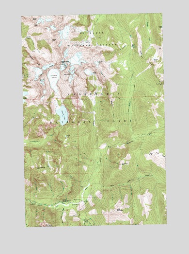
Blanca Lake, WA USGS Topographic Map
Click on map above to begin viewing in our Map Viewer.

This topographic map contains these locations and features:
Feature Name Type Latitude Longitude GNIS ID View Map
Bald Eagle MountainSummitN47.9573°W121.2512°1516067View Map
Blanca LakeLakeN47.9406°W121.3411°1516642View Map
Bowser LakeLakeN47.9727°W121.2597°1516891View Map
Cadet PeakSummitN47.9854°W121.3487°1517204View Map
Columbia GlacierGlacierN47.9625°W121.3485°1517975View Map
Columbia PeakSummitN47.9618°W121.3612°1517979View Map
Coney LakeLakeN47.9913°W121.2509°1518011View Map
Curry GapGapN47.9804°W121.2779°1518426View Map
Excelsior MountainSummitN47.9107°W121.2895°1519421View Map
Foggy PeakSummitN47.9979°W121.3659°1519676View Map
Frog MountainSummitN47.8837°W121.2951°1519826View Map
Garland Hot SpringsSpringN47.8893°W121.3429°1530312View Map
Garland Mineral SpringsLocaleN47.8890°W121.3429°1519903View Map
Glacier BasinBasinN47.9777°W121.3562°1528576View Map
Goblin CreekStreamN47.9184°W121.3079°1520068View Map
Goblin LakeLakeN47.9649°W121.3146°1520069View Map
Goblin MountainSummitN47.9637°W121.3040°1520070View Map
Ida PassGapN47.9951°W121.3621°1515701View Map
Jack PassGapN47.8787°W121.3234°1521294View Map
Kyes PeakSummitN47.9648°W121.3329°1521793View Map
Monte Cristo PeakSummitN47.9715°W121.3412°1523332View Map
Mystery Hill (not official)RidgeN47.9840°W121.3668°1529841View Map
Pride BasinBasinN47.9840°W121.3146°1524645View Map
Quartz CreekStreamN47.9257°W121.2793°1524731View Map
Quartz LakeLakeN47.9717°W121.3088°1524744View Map
San Juan CampgroundLocaleN47.8890°W121.3665°1525404View Map
San Juan CreekStreamN47.8873°W121.3407°1525405View Map
Storm RidgeRidgeN47.9429°W121.2976°1526601View Map
Troublesome MountainSummitN47.9096°W121.3648°1527398View Map
Virgin LakeLakeN47.9279°W121.3384°1527722View Map
West Cady CreekStreamN47.8993°W121.3190°1527918View Map
Wilmans PeaksSummitN47.9721°W121.3651°1528197View Map

Note: Coordinates in the location and feature list above are referenced to NAD83 datum.


Copyright (C) 2008-2024 Ryan Niemi / Sunset Dynamics ... All Rights Reserved