TopoQuest Logo
Do you find TopoQuest useful?
Help keep TopoQuest running and adding new maps/features by donating!
Bitcoin:  19c7KJd3qBynnjoSw5npx9KScwjBe4ifkT
Litecoin:  LXs6TkuXGGXo1vDsWCkWVdjQX94eUKd6ui
Home View Maps Find Maps Find Places Resources & Links


Monticello, Mississippi Topographic Map

USGS Map Title: Monticello, MS
USGS Map MRC: 31090E1
DRG (GeoTIFF) Download: o31090e1.tif


Neighboring USGS Topographic Map Quads:


  Oma, MS  
31090F2
 

  Monticello NE, MS  
31090F1
 

  New Hebron, MS  
31089F8
 

  Nola, MS  
31090E2
 

  Monticello, MS  
31090E1
 

  Prentiss West, MS  
31089E8
 

  Topeka, MS  
31090D2
 

  Tilton, MS  
31090D1
 

  Oak Vale, MS  
31089D8


Map MRC Location:

N32°
W91°
N32°
W90°
H8 H7 H6 H5 H4 H3 H2 H1
G8 G7 G6 G5 G4 G3 G2 G1
F8 F7 F6 F5 F4 F3 F2 F1
E8 E7 E6 E5 E4 E3 E2 E1
D8 D7 D6 D5 D4 D3 D2 D1
C8 C7 C6 C5 C4 C3 C2 C1
B8 B7 B6 B5 B4 B3 B2 B1
A8 A7 A6 A5 A4 A3 A2 A1
N31°
W91°
N31°
W90°

Monticello, MS USGS 1:24K Topographic Map Preview:
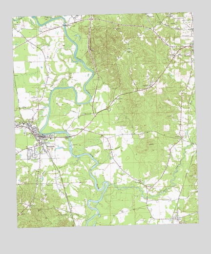
Monticello, MS USGS Topographic Map
Click on map above to begin viewing in our Map Viewer.

This topographic map contains these locations and features:
Feature Name Type Latitude Longitude GNIS ID View Map
ArmPopulated PlaceN31.5029°W90.0162°666367View Map
Arm Volunteer Fire DepartmentBuildingN31.5049°W90.0144°2667961View Map
Armstrong CemeteryCemeteryN31.6116°W90.0031°666374View Map
Bethel ChurchChurchN31.5129°W90.1159°666905View Map
Canaan ChurchChurchN31.5999°W90.0137°668011View Map
Church of ChristChurchN31.5607°W90.1220°687135View Map
Church of GodChurchN31.5254°W90.0395°668454View Map
Clay AirportAirportN31.5763°W90.1103°680318View Map
Commons Store (historical)LocaleN31.5018°W90.0437°687136View Map
Coopers CreekStreamN31.5032°W90.0776°668815View Map
Fair RiverStreamN31.6246°W90.1104°669863View Map
First Assembly of God ChurchChurchN31.6041°W90.0076°687137View Map
Fortenberry Pond DamDamN31.5502°W90.0051°680757View Map
Friendship ChurchChurchN31.6204°W90.1237°670222View Map
Halls CreekStreamN31.5410°W90.0826°670846View Map
Hardscrabble (historical)Populated PlaceN31.5610°W90.0523°687138View Map
Lawrence CountyCivilN31.5502°W90.1070°695762View Map
Lawrence County HospitalHospitalN31.5537°W90.0996°709268View Map
Lawrence County Sheriff's OfficeBuildingN31.5364°W90.1075°2754068View Map
McCullough Junior High SchoolSchoolN31.5618°W90.1193°673324View Map
MonticelloPopulated PlaceN31.5538°W90.1073°673748View Map
Monticello Baptist ChurchChurchN31.5521°W90.1031°687142View Map
Monticello Elementary SchoolSchoolN31.5552°W90.1090°709269View Map
Monticello Fire DepartmentBuildingN31.5537°W90.1027°2667841View Map
Monticello First Baptist ChurchChurchN31.5538°W90.1076°687143View Map
Monticello High SchoolSchoolN31.5463°W90.1162°709270View Map
Monticello Police DepartmentBuildingN31.5517°W90.1058°2754080View Map
Monticello Post OfficePost OfficeN31.5592°W90.1175°2768657View Map
Monticello United Methodist ChurchChurchN31.5527°W90.1070°687144View Map
Nim BranchStreamN31.5449°W90.0645°674924View Map
Oak Grove Missionary Baptist ChurchChurchN31.5252°W90.1043°675025View Map
Old Silver Creek ChurchChurchN31.5513°W90.0101°675256View Map
Pearl River Valley ChurchChurchN31.5666°W90.0770°675543View Map
Pin Oak ChurchChurchN31.5827°W90.0356°675786View Map
Pretty BranchStreamN31.6235°W90.0968°676329View Map
Riverside Baptist ChurchChurchN31.5641°W90.1126°687146View Map
Rocky Branch Baptist ChurchChurchN31.5599°W90.1148°687147View Map
Saint Paul ChurchChurchN31.6154°W90.0001°677184View Map
Saint Regis Paper Holding ReservoirDamN31.6118°W90.0851°680788View Map
Sheppards Store (historical)LocaleN31.5177°W90.0045°687148View Map
Silver CreekStreamN31.5238°W90.0620°677795View Map
Southgate Baptist ChurchChurchN31.5404°W90.1154°687149View Map
Supervisor District 5CivilN31.5081°W90.0131°711947View Map
Town of MonticelloCivilN31.5525°W90.1145°2406181View Map
Town of Silver CreekCivilN31.6048°W90.0023°2407341View Map
Wilson CemeteryCemeteryN31.6163°W90.1045°679757View Map

Note: Coordinates in the location and feature list above are referenced to NAD83 datum.


Copyright (C) 2008-2025 Ryan Niemi / Sunset Dynamics ... All Rights Reserved