TopoQuest Logo
Do you find TopoQuest useful?
Help keep TopoQuest running and adding new maps/features by donating!
Bitcoin:  19c7KJd3qBynnjoSw5npx9KScwjBe4ifkT
Litecoin:  LXs6TkuXGGXo1vDsWCkWVdjQX94eUKd6ui
Home View Maps Find Maps Find Places Resources & Links


Montour, Iowa Topographic Map

USGS Map Title: Montour, IA
USGS Map MRC: 41092H6
DRG (GeoTIFF) Download: o41092h6.tif


Neighboring USGS Topographic Map Quads:


  Le Grand, IA  
42092A7
 

  Garwin, IA  
42092A6
 

  Gladbrook SE, IA  
42092A5
 

  Gilman, IA  
41092H7
 

  Montour, IA  
41092H6
 

  Tama, IA  
41092H5
 

  Newburg, IA  
41092G7
 

  Grinnell North, IA  
41092G6
 

  Sheridan, IA  
41092G5


Map MRC Location:

N42°
W93°
N42°
W92°
H8 H7 H6 H5 H4 H3 H2 H1
G8 G7 G6 G5 G4 G3 G2 G1
F8 F7 F6 F5 F4 F3 F2 F1
E8 E7 E6 E5 E4 E3 E2 E1
D8 D7 D6 D5 D4 D3 D2 D1
C8 C7 C6 C5 C4 C3 C2 C1
B8 B7 B6 B5 B4 B3 B2 B1
A8 A7 A6 A5 A4 A3 A2 A1
N41°
W93°
N41°
W92°

Montour, IA USGS 1:24K Topographic Map Preview:
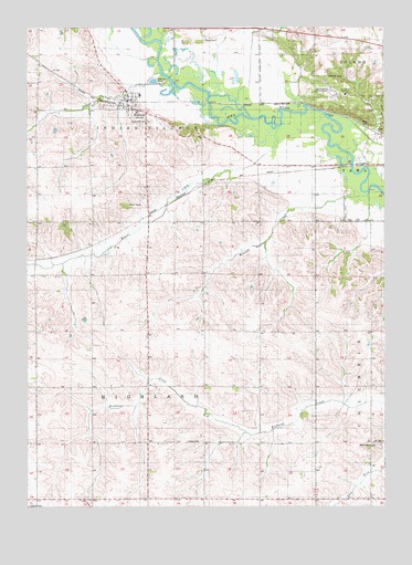
Montour, IA USGS Topographic Map
Click on map above to begin viewing in our Map Viewer.

This topographic map contains these locations and features:
Feature Name Type Latitude Longitude GNIS ID View Map
Bennett CreekStreamN41.9572°W92.6305°454514View Map
Butlerville CemeteryCemeteryN41.9970°W92.7300°1983306View Map
City of MontourCivilN41.9803°W92.7150°2395387View Map
Grave of Chief Push-E-To-Qua Historical MarkerParkN41.9730°W92.6257°1983324View Map
Indian CreekStreamN41.9878°W92.7027°457794View Map
Korns CemeteryCemeteryN41.8919°W92.6944°458140View Map
Living Faith United Methodist ChurchChurchN41.9814°W92.7149°1983236View Map
Maple Grove CemeteryCemeteryN41.8912°W92.6278°458772View Map
Maple Hill CemeteryCemeteryN41.9755°W92.7071°458782View Map
McIntosh CemeteryCemeteryN41.9869°W92.6455°458919View Map
Meskwaki Settlement School - Elementary SchoolSchoolN41.9920°W92.6467°2719858View Map
Meskwaki Settlement School - Middle / High SchoolSchoolN41.9926°W92.6479°2720070View Map
Mesquakie Indian Burial GroundsCemeteryN41.9730°W92.6257°459010View Map
Mesquakie Indian SettlementPopulated PlaceN41.9822°W92.6427°464653View Map
MontourLocaleN41.9805°W92.7121°1983232View Map
MontourPopulated PlaceN41.9814°W92.7149°459196View Map
Montour Elementary SchoolSchoolN41.9825°W92.7105°1983233View Map
Montour First RespondersBuildingN41.9812°W92.7153°2599847View Map
Montour Post OfficePost OfficeN41.9814°W92.7149°1983237View Map
PotterPopulated PlaceN41.9600°W92.6752°464182View Map
Potter (historical)LocaleN41.9600°W92.6752°1983158View Map
Potter Post Office (historical)Post OfficeN41.9600°W92.6752°1983157View Map
Raven CreekStreamN41.9742°W92.6619°460536View Map
Rouse CemeteryCemeteryN41.9968°W92.6876°460833View Map
Sac and Fox Day SchoolSchoolN41.9825°W92.6385°460880View Map
Sac and Fox/Meskwaki SettlementCivilN41.9797°W92.6495°463420View Map
Saint John ChurchChurchN41.8917°W92.6285°461000View Map
Site of Former Indiantown Historical MarkerParkN41.9600°W92.7280°1983341View Map
Township of HighlandCivilN41.9058°W92.7076°468039View Map
Township of Indian VillageCivilN41.9923°W92.7076°468072View Map
West CemeteryCemeteryN41.9750°W92.6307°462832View Map

Note: Coordinates in the location and feature list above are referenced to NAD83 datum.


Copyright (C) 2008-2025 Ryan Niemi / Sunset Dynamics ... All Rights Reserved