TopoQuest Logo
Do you find TopoQuest useful?
Help keep TopoQuest running and adding new maps/features by donating!
Bitcoin:  19c7KJd3qBynnjoSw5npx9KScwjBe4ifkT
Litecoin:  LXs6TkuXGGXo1vDsWCkWVdjQX94eUKd6ui
Home View Maps Find Maps Find Places Resources & Links


Montpelier, Idaho Topographic Map

USGS Map Title: Montpelier, ID
USGS Map MRC: 42111C3
DRG (GeoTIFF) Download: o42111c3.tif


Neighboring USGS Topographic Map Quads:


  Nounan, ID  
42111D4
 

  Georgetown, ID  
42111D3
 

  Meade Peak, ID  
42111D2
 

  Ovid, ID  
42111C4
 

  Montpelier, ID  
42111C3
 

  Montpelier Canyon, ID  
42111C2
 

  Paris, ID  
42111B4
 

  Dingle, ID  
42111B3
 

  Pegram, ID  
42111B2


Map MRC Location:

N43°
W112°
N43°
W111°
H8 H7 H6 H5 H4 H3 H2 H1
G8 G7 G6 G5 G4 G3 G2 G1
F8 F7 F6 F5 F4 F3 F2 F1
E8 E7 E6 E5 E4 E3 E2 E1
D8 D7 D6 D5 D4 D3 D2 D1
C8 C7 C6 C5 C4 C3 C2 C1
B8 B7 B6 B5 B4 B3 B2 B1
A8 A7 A6 A5 A4 A3 A2 A1
N42°
W112°
N42°
W111°

Montpelier, ID USGS 1:24K Topographic Map Preview:
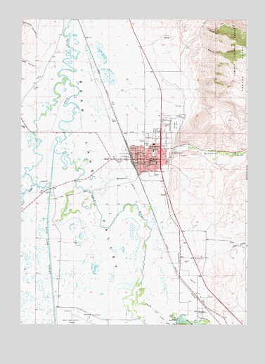
Montpelier, ID USGS Topographic Map
Click on map above to begin viewing in our Map Viewer.

This topographic map contains these locations and features:
Feature Name Type Latitude Longitude GNIS ID View Map
A J Winters Elementary SchoolSchoolN42.3213°W111.3021°401340View Map
Bagley HollowValleyN42.3552°W111.2841°376846View Map
Bear HollowValleyN42.2810°W111.2585°377165View Map
Bear Lake CountyCivilN42.2848°W111.3297°395090View Map
Bear Lake County AmbulanceBuildingN42.3161°W111.3002°2642793View Map
Bear Lake High SchoolSchoolN42.3280°W111.2971°401417View Map
Bear Lake Memorial HospitalHospitalN42.3162°W111.3001°2721859View Map
Bear Lake Middle SchoolSchoolN42.3171°W111.3035°401418View Map
Bear Lake Volunteer Fire Protection District Station 14BuildingN42.3355°W111.2973°2619175View Map
City of MontpelierCivilN42.3260°W111.2988°2411150View Map
Dingle Swamp Wildlife Habitat AreaReserveN42.2838°W111.3577°401565View Map
Joes GapGapN42.3708°W111.2702°393902View Map
Kent La Roco CanalCanalN42.2524°W111.2952°384172View Map
KVSI-AM (Montpelier)TowerN42.3149°W111.3113°401737View Map
Landmark LetterLocaleN42.3196°W111.2910°384411View Map
MontpelierPopulated PlaceN42.3221°W111.2977°396914View Map
Montpelier CanyonValleyN42.3224°W111.2896°387104View Map
Montpelier CreekStreamN42.3044°W111.3349°399009View Map
Montpelier Fire DepartmentBuildingN42.3224°W111.3064°2618972View Map
Montpelier Police DepartmentBuildingN42.3180°W111.3020°2722406View Map
Montpelier Post OfficePost OfficeN42.3191°W111.3071°2781756View Map
Montpelier Shopping CenterLocaleN42.3171°W111.2983°394781View Map
Montpelier Wildlife Management AreaReserveN42.3385°W111.2521°401626View Map
Ovid CreekStreamN42.3069°W111.3669°388043View Map
Rainbow DamDamN42.2502°W111.2885°389040View Map
Red Pine HollowValleyN42.3663°W111.3647°389222View Map
Sheep HollowValleyN42.3546°W111.3641°390234View Map
Stewart DamDamN42.2524°W111.2885°391451View Map
Stock ParkParkN42.3233°W111.2969°391472View Map
WardboroPopulated PlaceN42.2558°W111.2771°392830View Map

Note: Coordinates in the location and feature list above are referenced to NAD83 datum.


Copyright (C) 2008-2024 Ryan Niemi / Sunset Dynamics ... All Rights Reserved